Tuscarora Township in Indian River in Cheboygan County, Michigan — The American Midwest (Great Lakes)
The Cross in the Woods
Photographed by Joel Seewald, October 9, 2025
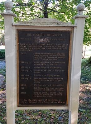
1. The Cross in the Woods Marker
1946, June 26, First Mass offered at newly established Indian River parish.
Inspired by Blessed Kateri Tekakwitha's practice of placing crosses throughout the woods, Fr. Charles Brophy suggests a large wooden cross as the center-piece for an outdoor shrine.
1947-52 Thirteen acre site obtained and Long House Chapel designed by Alden Dow and Shrines dedicated to St. Theresa, St. Anthony and St. Peregrine were built.
1954, Aug. 5, Calvary Cross made of one redwood tree erected, height 55', width 22'.
1956, July 1, Outdoor temporary altar dedicated.
1956, Aug. 15, Stations of the Cross and Holy Stairs blessed.
1957, June 7, Madonna of the Highway erected.
1959, Aug. 16, Seven ton bronze corpus designed by Marsall Fredericks, world's largest crucifix.
1961-62 Gift Shop, rectory and church addition.
1964 Doll Museum of Nuns began, granite altar, communion rail and sanctuary installed.
1983-89 Complete renovation of outdoor Mass facility and grounds, and erection of the Resurrection statue.
For the maintenance of the Shrine, we rely on the good will offerings of our Visitors
Topics. This
this page online
Location. 45° 23.873′ N, 84° 37.887′ W. Marker is in Indian River, Michigan, in Cheboygan County. It is in Tuscarora Township. It can be reached from M-68 west of South Straits Highway. Marker is at Cross in the Woods Catholic Shrine of Indian River. Touch for map. Marker is at or near this postal address: 7078 M-68, Indian River MI 49749, United States of America. Touch for directions.

Regionally, this marker is in Northern Michigan Lower Peninsula, on the Straits of Mackinac, and in one of the Lake Huron Shore counties. It is also in the American Midwest. Globally, it is in North America, in the Great North Woods, on the Great Lakes, in the Western Hemisphere, in the Western World, and in the Anglosphere. Historically, it finds itself in what was once the Northwest Territory.
Other nearby markers. At least 8 other markers are within 10 miles of this marker, measured as the crow flies: Inland Waterway (approx. 0.4 miles away); What is this thing? (approx. 5.2 miles away); Burn-Out: A People Displaced, But Not Destroyed
Photographed by Joel Seewald, October 9, 2025
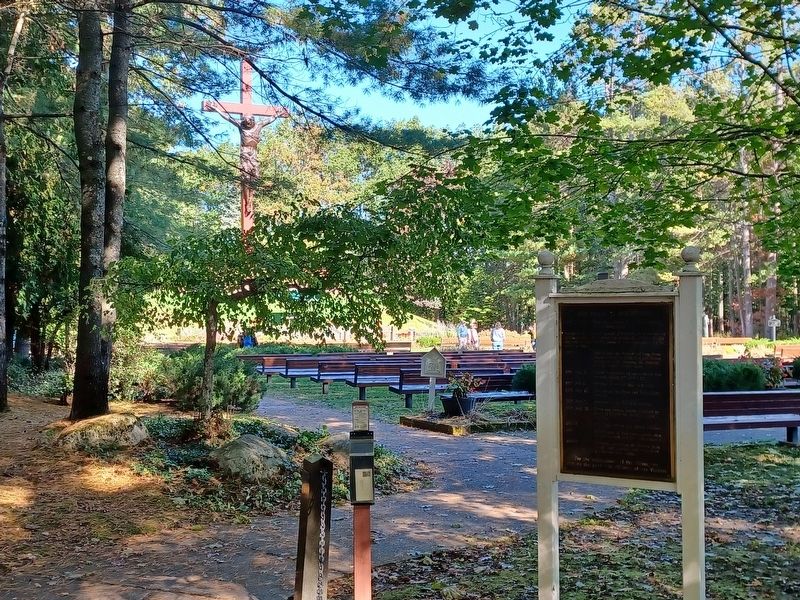
2. The Cross in the Woods and Marker
Also see . . . The Beginning. More about the history of the Cross in the Woods Catholic Shrine of Indian River on their website. (Submitted on November 5, 2025, by Joel Seewald of Madison Heights, Michigan.)
Credits. This page was last revised on November 5, 2025. It was originally submitted on November 5, 2025, by Joel Seewald of Madison Heights, Michigan. This page has been viewed 76 times since then and 37 times this year. Photos: 1, 2. submitted on November 5, 2025, by Joel Seewald of Madison Heights, Michigan.
