Burgwindheim in Bamberg, Bavaria, Germany — Central Europe
Ehem. Amtschloss des Klosters Ebrach
⎯⎯⎯
Former Official Castle of Ebrach Monastery
| — | Kulturhistorischer Rundweg Burgwindheim | — |
Photographed by Andrew Ruppenstein, September 2, 2025
1. Ehem. Amtschloss des Klosters Ebrach / Former Official Castle of Ebrach Monastery Marker

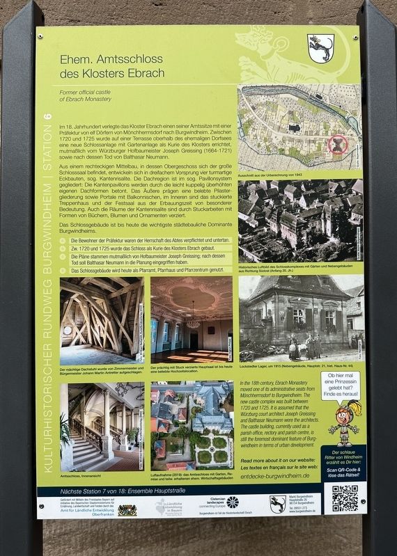
Im 18. Jahrhundert verlegte das Kloster Ebrach einen seiner Amtssitze mit einer Präfektur von elf Dörfern von Mönchherrnsdorf nach Burgwindheim. Zwischen 1720 und 1725 wurde auf einer Terrasse oberhalb des ehemaligen Dorfsees eine neue Schlossanlage mit Gartenanlage als Kurie des Klosters errichtet, mutmaßlich vom Würzburger Hofbaumeister Joseph Greissing (1664-1721) sowie nach dessen Tod von Balthasar Neumann.
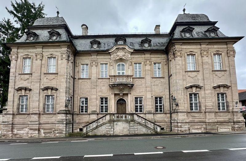
Aus einem rechteckigen Mittelbau, in dessen Obergeschoss sich der große Schlosssaal befindet, entwickeln sich in dreifachem Vorsprung vier turmartige Eckbauten, sog. Kantenrisalite. Die Dachregion ist im sog. Pavillonsystem gegliedert: Die Kantenpavillons werden durch die leicht kuppelig überhöhten eigenen Dachformen betont. Das Äußere prägen eine belebte Pilastergliederung sowie Portale mit Balkonnischen, im Inneren sind das stuckierte Treppenhaus und der Festsaal aus der Erbauungszeit von besonderer Bedeutung. Auch die Räume der Kantenrisalite sind durch Stuckarbeiten mit Formen von Büchern, Blumen und Ornamenten verziert.
Das Schlossgebäude ist
this page online
Die Bewohner der Präfektur waren der Herrschaft des Abtes verpflichtet und untertan.
Zw. 1720 und 1725 wurde das Schloss als Kurie des Klosters Ebrach gebaut.
Die Pläne stammen mutmaßlich von Hofbaumeister Joseph Greissing; nach dessen Tod soll Balthasar Neumann in die Planung eingegriffen haben.
Das Schlossgebäude wird heute als Pfarramt, Pfarrhaus und Pfarrzentrum genutzt.
Former official castle of Ebrach Monastery
In the 18th century, Ebrach Abbey moved one of its administrative centers, along with a prefecture of eleven villages, from Mönchherrnsdorf to Burgwindheim. Between 1720 and 1725, a new castle complex with gardens was built on a terrace above the former village lake as a curia of the abbey, presumably by the Würzburg court architect Joseph Greissing (1664-1721) and, after his death, by Balthasar Neumann.
From a rectangular central section, the upper floor of which houses the great hall, four tower-like corner structures, known as corner pavilions, project outwards in three stages. The roof area is structured according
Photographed by Andrew Ruppenstein, September 2, 2025
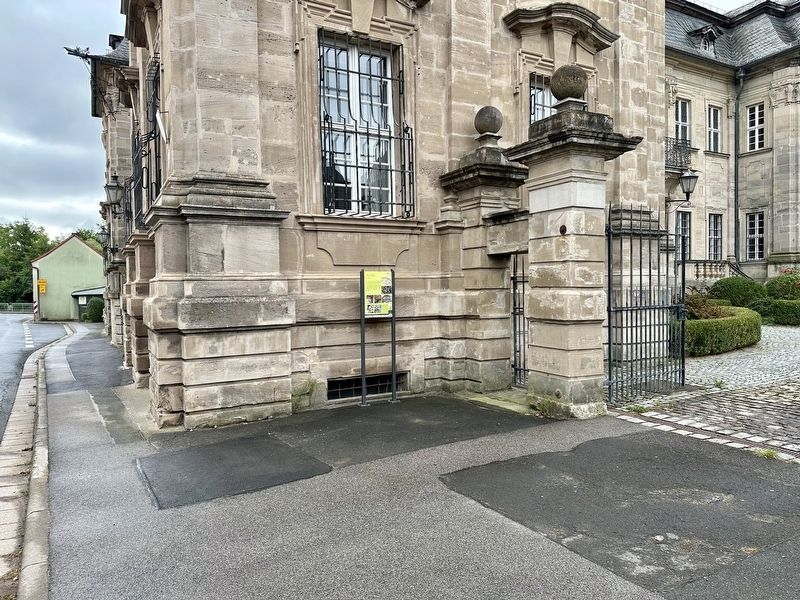
2. Former Official Castle of Ebrach Monastery Marker - wide view
The marker is visible here on the eastern corner of the building.
To this day, the castle remains the most important architectural landmark of Burgwindheim.
The inhabitants of the prefecture were subject to the abbot's authority.
Between 1720 and 1725, the castle was built as a curia of Ebrach Abbey.
The plans are presumably by court architect Joseph Greissing; after his death, Balthasar Neumann is said to have intervened in the planning.
The castle building is now used as a parish office, rectory, and parish center.
(Marker Number 6.)
Topics. This historical marker is listed in these topic lists: Architecture • Government & Politics • Religion & Religious Structures. A significant historical year for this entry is 1720.
Location. 49° 49.629′ N, 10° 35.828′ E.
Photographed by Andrew Ruppenstein, September 2, 2025
3. Former Official Castle of Ebrach Monastery

Regionally, this marker is in German Franconia. Globally, it is in Europe, the European Union, Atlantic Europe, Central Europe, the Schengen Area, Western Europe, and the Western World. Historically, it finds itself in what was once the Holy Roman Empire and also the former West Germany.
Other nearby markers. At least 8 other markers are within walking distance of this marker: Ensemble Hauptstraße / Main Street Ensemble (within shouting distance of this marker); Kath. Pfarrkiche St. Jakobus / Catholic Parish Church of St. Jakobus (about 90 meters away, measured in a direct line); Ehem. Gasthof Zum Hirschen / Former Inn “Zum Hirschen” (about 120 meters away); Pfarrkirche St. Jakobus / St. James Parish Church (about 150 meters away); Nonnenhof (about 180 meters away); Posthalterei / Posting Inn (about 180 meters away); Ebrachisches Richterhaus / Ebrach Magistrate’s House (about 180 meters away); Obertorbrücke / Bridge “Obertorbrücke” (approx. 0.3 kilometers away). Touch for a list and map of all markers in Burgwindheim.
Also see . . . Former official Castle of Ebrach Monastery (Markt Burgwindheim). The QR code on the marker leads to this page, which is part of the set of pages describing the historical tour of Burgwindheim. Excerpt:
In the 18th century, Ebrach Monastery moved one of its administrative seats from Mönchherrnsdorf to Burgwindheim. Eleven villages belonged to this administrative area. Their inhabitants were bound to the abbot's rule as their hereditary lord by an oath of loyalty and obedience. For reasons of representation as well as space, a new castle complex with gardens was built between 1720 and 1725 as the administrative seat of the monastery. A property register states: "As the old house was too small, a new castle was built there from scratch of solid and well-smoothed ashlar, with everything necessary for agriculture as well as other things, and in such wonderful art and practicality that it attracts the eyes of passers-by full of admiration."(Submitted on November 7, 2025.)
Credits. This page was last revised on November 7, 2025. It was originally submitted on November 7, 2025, by Andrew Ruppenstein of Lamorinda, California. This page has been viewed 52 times since then and 18 times this year. Photos: 1, 2, 3. submitted on November 7, 2025, by Andrew Ruppenstein of Lamorinda, California.
