Milton in Halton Region, Ontario — Central Canada (North America)
Trafalgar Neighbourhood
Photographed by Tim Boyd, November 2, 2025
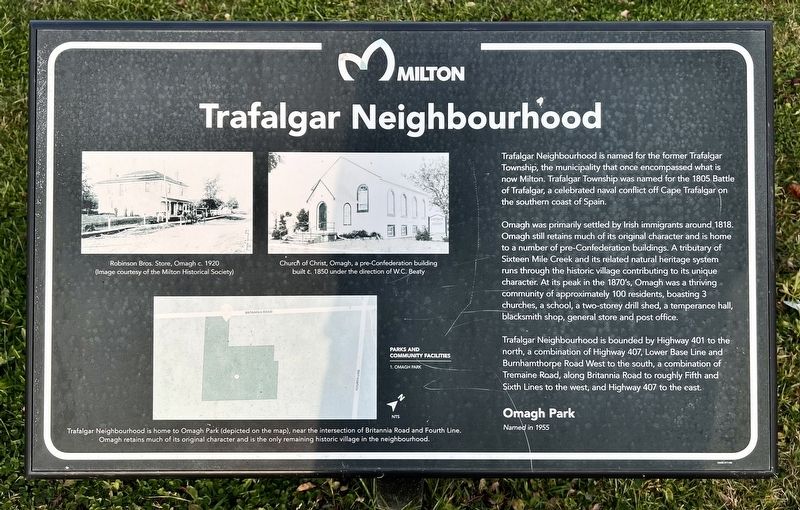
1. Trafalgar Neighbourhood Marker
Trafalgar Neighbourhood is named for the former Trafalgar Township, the municipality that once encompassed what is now Milton. Trafalgar Township was named for the 1805 Battle of Trafalgar, a celebrated naval conflict off Cape Trafalgar on the southern coast of Spain.
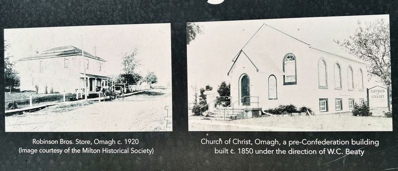
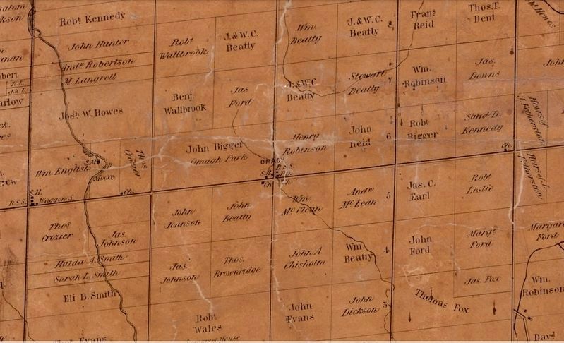
Omagh was primarily settled by Irish immigrants around 1818. Omagh still retains much of its original character and is home to a number of pre-Confederation buildings. A tributary of Sixteen Mile Creek and its related natural heritage system runs through the historic village contributing to its unique character. At its peak in the 1870's, Omagh was a thriving community of approximately 100 residents, boasting 3 churches, a school, a two-storey drill shed, a temperance hall, blacksmith shop, general store and post office.
Trafalgar Neighbourhood is bounded by Highway 401 to the north, a combination of Highway 407, Lower Base Line and Burnhamthorpe Road West to the south, a combination of Tremaine Road, along Britannia Road to roughly Fifth and Sixth Lines to the west, and Highway 407 to the east.
Erected by Town of Milton.
Topics. This historical
this page online
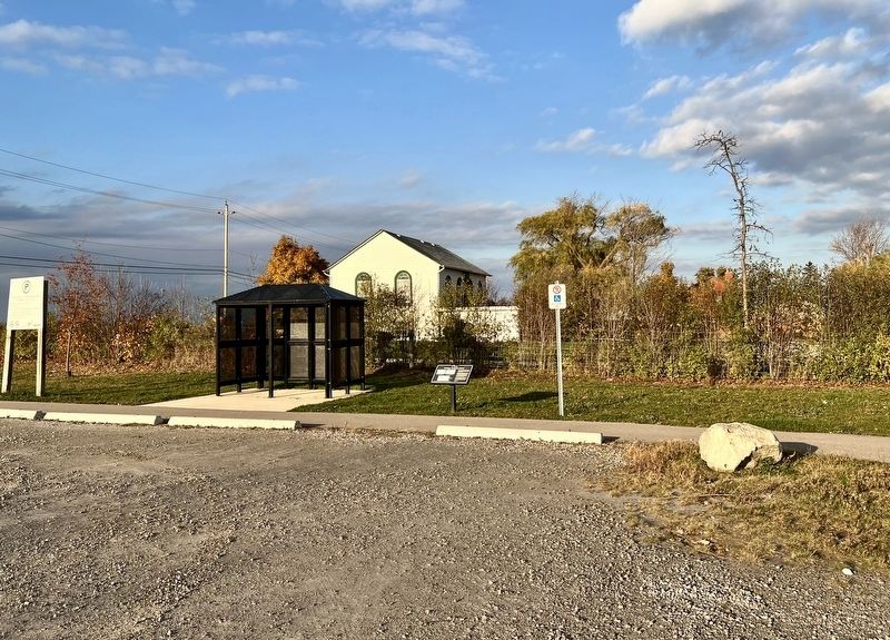
Location. 43° 30.265′ N, 79° 48.889′ W. Marker is in Milton, Ontario, in Halton Region. It is on Old Britannia Road 0.2 kilometers west of Fourth Line, on the right when traveling east. The marker is in Omagh Park. Touch for map. Marker is at or near this postal address: 9830 Britannia Rd, Milton ON L9E 0E5, Canada. Touch for directions.

Regionally, this marker is in Greater Toronto, specifically on the Golden Horseshoe, in the Hamilton-Halton-Brant Area, and specifically in the Toronto Metropolitan Area. It is also in Central Canada. Globally, it is in North America, on the Great Lakes, in the Western Hemisphere, in the Western World, and in the Anglosphere. Historically, it finds itself in what was once a British colony, the Viceroyalty of New France, the Haudenosaunee (Iroquois) Confederacy, and Rupert’s Land.
Other nearby markers. At least 8 other markers are within 6 kilometers of this marker, measured as the crow flies: The Omagh School Bell (a few steps from this marker); Former Milton Town Hall (approx.
Photographed by Tim Boyd, November 2, 2025
2. Trafalgar Neighbourhood Marker
Photographed by Tim Boyd, November 2, 2025
3. Trafalgar Neighbourhood marker photos and captions detail
Photographed by Tim Boyd, November 2, 2025
4. Omagh, Trafalgar Township, in 1859
Credits. This page was last revised on November 8, 2025. It was originally submitted on November 8, 2025, by Tim Boyd of Hamilton, Ontario. This page has been viewed 45 times since then and 27 times this year. Photos: 1, 2, 3, 4. submitted on November 8, 2025, by Tim Boyd of Hamilton, Ontario. • Andrew Ruppenstein was the editor who published this page.
