
Near Rulo in Richardson County, Nebraska — The American Midwest (Upper Plains)
Atchison & Nebraska Railroad
Photographed by Jason Voigt, October 27, 2025
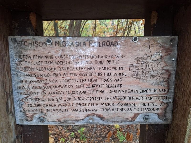
1. Atchison & Nebraska Railroad Marker
The few remaining concrete posts and barbed wire are the last reminder of the fence built by the Atchison-Nebraska Railroad. The first railroad in Richardson Co. ran at the base of this hill where the highway is now located. The first track was laid in Atchison, Kansas on Sept. 22, 1870. It reached this point on January 10, 1871 and the final destination in Lincoln, Nebr., a distance of 106. 5 mi., on August 27, 1872. The Missouri River ran parallel to the track making erosion a major problem. The line was abandoned in 1933. It was 144 mi. from Atchison to Lincoln.
Topics. This historical marker is listed in this topic list: Railroads & Streetcars. A significant historical date for this entry is January 10, 1871.
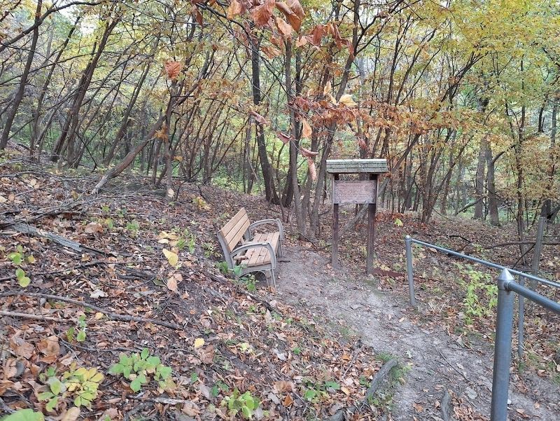
Location. 40° 0.018′ N, 95° 19.94′ W. Marker is near Rulo, Nebraska, in Richardson County. It can be reached from 703 Trail. Marker is off a hiking trail that leads to the 40th Parallel Marker, which is 100 feet high from the starting point. 703 Trail continues as Kansas State Route 7. Touch for map. Marker is at or near this postal address: 703 Trail, Rulo NE 68431, United States of America. Touch for directions.

Regionally,
this page online
Other nearby markers. At least 8 other markers are within 3 miles of this marker, measured as the crow flies: Our System of Land Surveys (within shouting distance of this marker in Kansas); The Cast Iron Monument (within shouting distance of this marker in Kansas); Kansas & Nebraska: From Wilderness to Statehood (within shouting distance of this marker in Kansas); Point of Beginning, Public Land Surveys of the Sixth Principal Meridian (about 300 feet away, measured in a direct line); Wilbur Chapman (approx. 2½ miles away in Kansas); July 10, 1804 (approx. 2½ miles away in Kansas); Glacial Hills Scenic Byway (approx. 2½ miles away in Kansas); The Lewis and Clark Expedition (approx. 2½ miles away in Kansas).
Regarding Atchison & Nebraska Railroad. How to access the marker:
Park at the Nebraska Historical Marker (at
Photographed by Jason Voigt, October 27, 2025
2. Atchison & Nebraska Railroad Marker
Also see . . . Atchison and Nebraska Railroad on Wikipedia. (Submitted on November 8, 2025, by Jason Voigt of Glen Carbon, Illinois.)
Credits. This page was last revised on November 8, 2025. It was originally submitted on November 8, 2025, by Jason Voigt of Glen Carbon, Illinois. This page has been viewed 70 times since then and 38 times this year. Photos: 1, 2. submitted on November 8, 2025, by Jason Voigt of Glen Carbon, Illinois.
