Anoka in Anoka County, Minnesota — The American Midwest (Upper Plains)
Anoka-Champlin Mississippi River Bridge
Circa 1929

Photographed by McGhiever, June 30, 2024
1. Anoka-Champlin Mississippi River Bridge Marker
Before this bridge was built, crossing the Mississippi River meant using either ice bridges or a ferry boat. The first ferry crossed the river at this point in the fall of 1855.
The first bridge to span the river between Anoka and Champlin opened in 1884 and served horse and wagon traffic. It was a swing bridge constructed of iron with a wood deck and rested on Kasota stone and granite piers. By the 1920s, automobiles were replacing horses, and the bridge could not handle the load.
The Minneapolis Bridge Company received the contract to build a new bridge in 1928. Horace E. Horton, a well-known bridge builder from Rochester, was the designer. Horton's bridge was a continuous arch bridge of reinforced concrete with eight spans and two approach spans. The open spandrel construction had twin concrete arches for each span. The estimated cost was $500,000.
By the 1940s, arched bridges were deemed to expensive to build and prestressed girders took their place. The Anoka-Champlin Mississippi River Bridge was placed on the National Register for both its historical and engineering significance.
A resurfacing project
this page online
Originally built to accomodate [sic] horses and pedestrians, the original swing bridge, made of iron, a wood deck, and granite piers, could not handle the weight of cars and trucks.
The arched bridge, built from reinforced concrete, replaced the original swing bridge and accomodated [sic] modern-day transportation. The bridge was restored in 1998.
Anoka-Champlin Mississippi River Bridge Timeline
• 1855 First ferry crossed the river at this point
• 1884 First bridge span over the Mississippi River between Anoka and Champlin
• 1920 Automobiles replaced horses
• 1928 Minneapolis Bridge Company received contract to build new bridge
• 1971 Resurfacing project replaced the bridge deck
• 1980 Bridge placed on the National Register of Historic Places
• 1988 Discussion began concerning the repair, replacement, and reconstruction of the bridge
• 1991 Temporary four-lane bridge was built
• 1998 Rebuilt bridge was rededicated and opened for traffic
Erected by City
Photographed by McGhiever
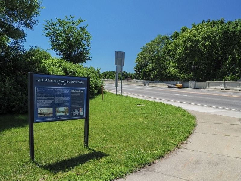
2. Anoka-Champlin Mississippi River Bridge Marker at the north end of the bridge
Topics. This historical marker is listed in this topic list: Bridges & Viaducts. A significant historical year for this entry is 1929.
Location. 45° 11.59′ N, 93° 23.638′ W. Marker is in Anoka, Minnesota, in Anoka County. It is on Ferry Street (U.S. 169), on the right when traveling north. The marker is at the north end of the bridge, on a sidewalk between Ferry Street and Ferry Road. Touch for map. Marker is at or near this postal address: 1500 S Ferry Road, Anoka MN 55303, United States of America. Touch for directions.

Regionally, this marker is in the Twin Cities Metropolitan Area. It is also in the American Midwest, in the Corn Belt, and in the Great River Road Region. Globally, it is in North America, the Western Hemisphere, the Western World, and the Anglosphere. Historically, it finds itself in what was once Rupert’s Land and also the territory of the Mississippian Culture.
Other nearby markers. At least 8 other markers are within walking distance of this marker: Kline Sanitarium (within shouting distance of this marker); Bridging the Mississippi (about 700 feet away, measured in a direct line); Where Land and Water Meet (about 800 feet away); Getting Here (about 800 feet away); Who Lived Here / Neighborhood Names / Building a Community (approx. 0.2 miles away); The Point (approx. 0.2 miles away); Two Rivers Historical Park (approx. 0.2 miles away); Anoka Becomes a Suburb (approx. 0.2 miles away). Touch for a list and map of all markers in Anoka.
Credits. This page was last revised on November 15, 2025. It was originally submitted on November 8, 2025, by McGhiever of Minneapolis, Minnesota. This page has been viewed 64 times since then and 30 times this year. Photos: 1. submitted on November 8, 2025, by McGhiever of Minneapolis, Minnesota. 2. submitted on November 9, 2025, by McGhiever of Minneapolis, Minnesota.
