Big Lake in Holt County, Missouri — The American Midwest (Upper Plains)
The Lewis and Clark Expedition Across Missouri
Photographed by Jason Voigt, October 27, 2025
1. The Lewis and Clark Expedition Across Missouri Marker
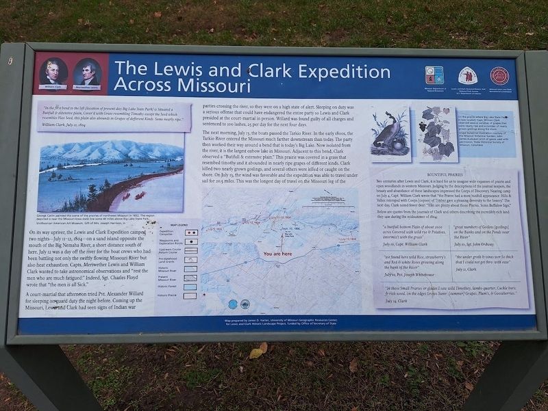
'In the first bend to the left [location of present-day Big Lake State Park is Situated a Butifull & extensive plain, Cover'd with Grass resembling Timothy except the Seed which resembles Flax Seed, this plain also abounds in Grapes of different Kinds. Some nearly Ripe."
William Clark, July 12, 1804
On its way upriver, the Lewis and Clark Expedition camped two nights - July 11-12, 1804 - on a sand island opposite the mouth of the Big Nemaha River, a short distance south of here. July 12 was a day off the river for the boat crews who had been battling not only the swiftly flowing Missouri River but also heat exhaustion. Capts. Meriwether Lewis and William Clark wanted to take astronomical observations and "rest the men who are much fatigued." Indeed, Sgt. Charles Floyd wrote that "the men is all Sick."
A court-martial that afternoon tried Pvt. Alexander Willard for sleeping on guard duty the night before. Coming up the Missouri, Lewis and Clark had seen signs of Indian war parties crossing the river, so they were on a high state of alert. Sleeping on duty was a serious offense that could have endangered the entire
this page online
The next morning, July 13, the boats passed the Tarkio River. In the early 1800s, the Tarkio River entered the Missouri much farther downstream than today. The party then worked their way around a bend that is today's Big Lake. Now isolated form the river, it is the largest oxbow lake in Missouri. Adjacent to this bend, Clark observed a "Butifull & extensive plain." This prairie was covered in a grass that resembled timothy and it abounded in nearly ripe grapes of different kinds. Clark killed two nearly grown goslings, and several others were killed or caught on the shore. On July 13, the wind was favorable and the expedition was able to travel under sail for 20.5 miles. This was the longest day of travel on the Missouri leg of the (marker text was cut off)
Bountiful Prairies
Two centuries after Lewis and Clark, it is hard for us to imagine wide expanses of prairie and open woodlands in western Missouri. Judging by the descriptions of the journal keepers, the
Photographed by Jason Voigt, October 27, 2025
2. The Lewis and Clark Expedition Across Missouri Marker
Marker is on the left
Below are quotes from the journals of Clark and others describing the incredibly rich land they saw during the midsummer of 1804:
-"a butifull bottom Plain of about 2000 acres Covered with wild rye & Potatoes, intermix[t with the grass" - July 10, Capt. William Clark
-"we found here wild Rice, strawberry's and Red & white Roses growing along the bank of the River" - July 10, Pvt. Joseph Whitehouse
-"great numbers of Goslins [goslings] on the Banks and on the Ponds near the River" - July 10, Sgt. John Ordway
-"the under groth & vines wer So thick that I could not get thro: with ease" - July 11, Clark
-"In those Small Praries or glades I saw wild Timothey, lambs-quarter, Cuckle burs; & rich weed. On the edges Grows Sumr. [summer] Grapes, Plum's, & Gooseberries" - July 14, Clark
Erected by Missouri

Photographed by Jason Voigt, October 27, 2025
3. The Lewis and Clark Expedition Across Missouri Marker
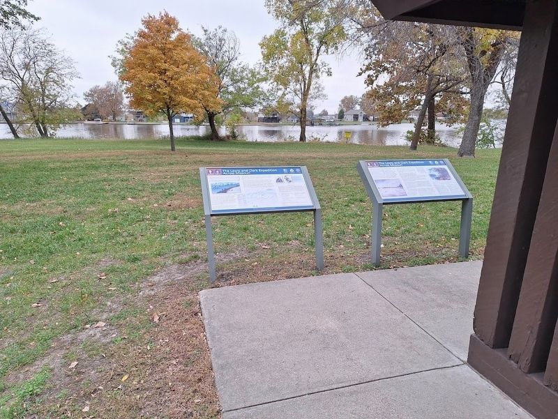
Marker is behind a picnic shelter at Big Lake State Park.
Topics and series. This historical marker is listed in this topic list: Exploration. In addition, it is included in the Lewis & Clark Expedition series list. A significant historical date for this entry is July 12, 1804.
Location. 40° 5.042′ N, 95° 20.598′ W. Marker is in Big Lake, Missouri, in Holt County. It can be reached from State Park Road west of Lake Shore Drive (Missouri Route 111). Marker is located behind a picnic shelter at Big Lake State Park. Touch for map. Marker is at or near this postal address: 200 Lake Shore Dr, Craig MO 64437, United States of America. Touch for directions.

Regionally, this marker is in North Missouri. It is also in the American Midwest, in the Lewis & Clark Corridor, and in the Corn Belt. Globally, it is in North America, the Western Hemisphere, the Western World, and the Anglosphere. Historically, it finds itself in what was once the territory of the Mississippian Culture, the Louisiana Purchase, and the Antebellum South.
Other nearby markers. At least 8 other markers are within 6 miles of this marker, measured as the crow flies: A different marker also named The Lewis and Clark Expedition Across Missouri (here, next to this marker); The Missouri River (approx. 4.3 miles away); Lewis and Clark (approx. 4.9 miles away in Nebraska); a different marker also named Missouri River (approx. 4.9 miles away in Nebraska); Lewis and Clark Campsite (approx. 4.9 miles away in Nebraska); Atchison & Nebraska Railroad (approx. 5.8 miles away in Nebraska); Point of Beginning, Public Land Surveys of the Sixth Principal Meridian (approx. 5.8 miles away in Nebraska); Our System of Land Surveys (approx. 5.9 miles away in Kansas).
Also see . . . Lewis & Clark National Historic Trail (National Park Service). (Submitted on November 9, 2025, by Jason Voigt of Glen Carbon, Illinois.)
Credits. This page was last revised on November 9, 2025. It was originally submitted on November 9, 2025, by Jason Voigt of Glen Carbon, Illinois. This page has been viewed 96 times since then and 54 times this year. Photos: 1, 2, 3. submitted on November 9, 2025, by Jason Voigt of Glen Carbon, Illinois.
