Big Lake in Holt County, Missouri — The American Midwest (Upper Plains)
The Lewis and Clark Expedition Across Missouri
Photographed by Jason Voigt, October 27, 2025
1. The Lewis and Clark Expedition Across Missouri Marker
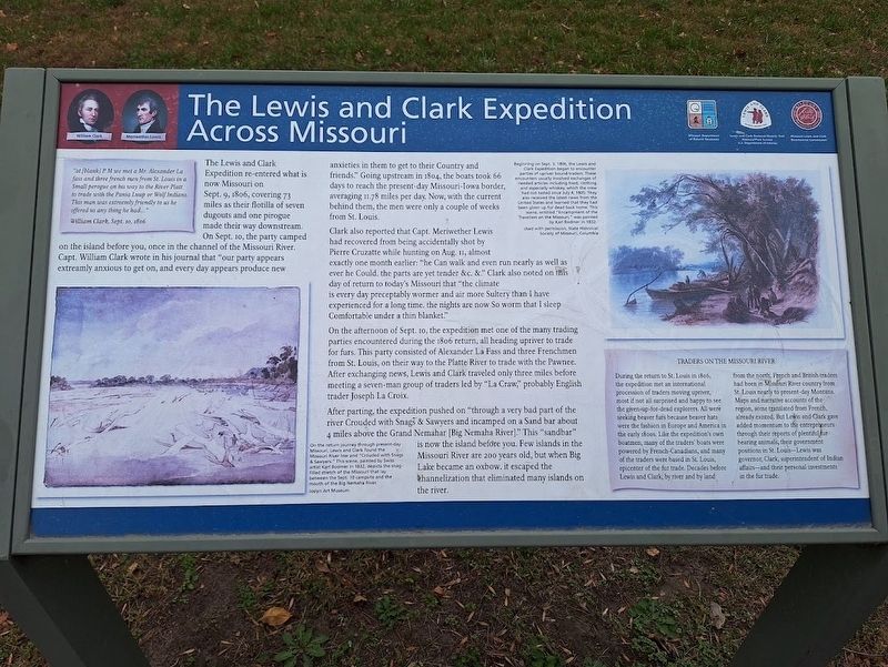
"at [blank] P M we met a Mr. Alexander La fass and three french men from St. Louis in a Small perogue on his way to the River Platt to trade with the Pania Luup or Wolf Indians. This man was extreemly friendly to us he offered us any thing he had…"
William Clark, Sept. 10, 1806
The Lewis and Clark Expedition re-entered what is now Missouri on Sept. 9, 1806, covering 73 miles as their flotilla of seven dugouts and one pirogue made their way downstream. On Sept. 10, the party camped on the island before you, once in the channel of the Missouri River. Capt. William Clark wrote in his journal that "our party appears extreamly anxious to get on, and every day appears produce new anxieties in them to get to their Country and friends." Going upstream in 1804, the boats took 66 days to reach the present-day Missouri-Iowa border, averaging 11.78 miles per day. Now, with the current behind them, the men were only a couple of weeks from St. Louis.
Clark also reported that Capt. Meriwether Lewis had recovered from being accidentally shot by Pierre Cruzatte while hunting on Aug. 11, almost exactly one month earlier: he Can
this page online
On the afternoon of Sept. 10, the expedition met one of the many trading parties encountered during the 1806 return, all heading upriver to trade for furs. This party consisted of Alexander La Fass and three Frenchmen from St. Louis, on their way to the Platte River to trade with the Pawnee. After exchanging news, Lewis and Clark traveled only three miles before meeting a seven-man group of traders led by "La Craw," probably English trader Joseph La Croix.
After parting, the expedition pushed on "through a very bad part of the river Crouded with Snags & Sawyers and incamped on a Sand bar about 4 miles above the Grand Nehamar [Big Nemaha River]." This "sandbar" is now the island before you. Few islands in the Missouri River are 200 years old, but when Big Lake became an oxbow. It escaped the channelization that

Photographed by Jason Voigt, October 27, 2025
2. The Lewis and Clark Expedition Across Missouri Marker
Marker is on the right. The left marker talks about their arrival coming from the East in 1804
Traders on the Missouri River
During the return to St. Louis in 1806, the expedition met an international procession of traders moving upriver, most if not all surprised and happy to see the given-up-for-dead explorers. All were seeking beaver furs because beaver hats were the fashion in Europe and America in the early 1800s. Like the expedition's own boatmen, many of the traders' boats were powered by French-Canadians, and many of the traders were based in St. Louis, epicenter of the fur trade. Decades before Lewis and Clark, by river and by land from the north, French and British traders had been in Missouri River country from St. Louis nearly to present-day Montana. Maps and narrative accounts of the region, some translated from French, already existed. But Lewis and Clark gave added momentum to the entrepreneurs through their reports of plentiful fur-bearing animals, their government positions in St. Louis - Lewis was governor, Clark, superintendent of Indian affairs - and their personal investments in the fur trade.
Erected by Missouri Department of Natural Resources; National Park
Photographed by Jason Voigt, October 27, 2025
3. The Lewis and Clark Expedition Across Missouri Marker
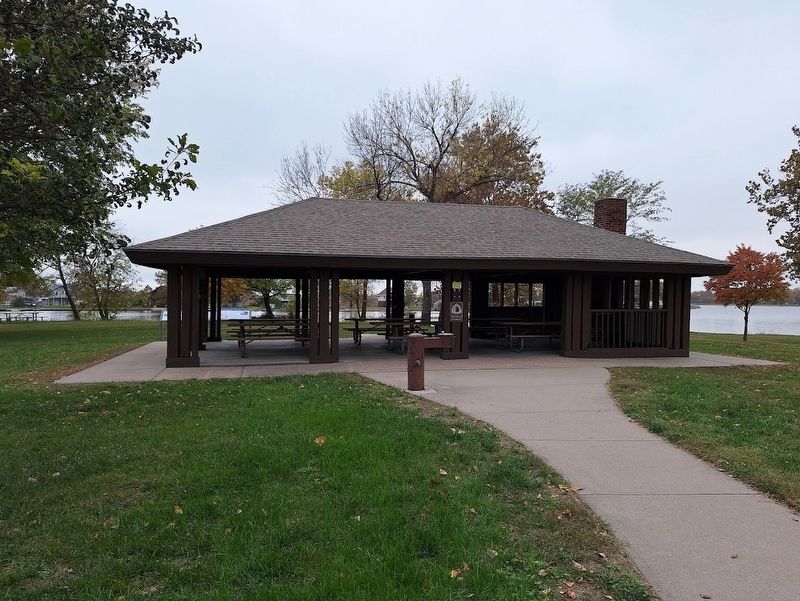
Marker is behind a picnic shelter at Big Lake State Park.
Topics and series. This historical marker is listed in this topic list: Exploration. In addition, it is included in the Lewis & Clark Expedition series list. A significant historical date for this entry is September 10, 1806.
Location. 40° 5.043′ N, 95° 20.598′ W. Marker is in Big Lake, Missouri, in Holt County. It can be reached from State Park Road west of Lake Shore Drive (Missouri Route 111). Marker is located behind a picnic shelter at Big Lake State Park. Touch for map. Marker is at or near this postal address: 200 Lake Shore Dr, Craig MO 64437, United States of America. Touch for directions.

Regionally, this marker is in North Missouri. It is also in the American Midwest, in the Lewis & Clark Corridor, and in the Corn Belt. Globally, it is in North America, the Western Hemisphere, the Western World, and the Anglosphere. Historically, it finds itself in what was once the territory of the Mississippian Culture, the Louisiana Purchase, and the Antebellum South.
Other nearby markers. At least 8 other markers are within 6 miles of this marker, measured as the crow flies: A different marker also named The Lewis and Clark Expedition Across Missouri (here, next to this marker); The Missouri River (approx. 4.3 miles away); Lewis and Clark (approx. 4.9 miles away in Nebraska); a different marker also named Missouri River (approx. 4.9 miles away in Nebraska); Lewis and Clark Campsite (approx. 4.9 miles away in Nebraska); Atchison & Nebraska Railroad (approx. 5.8 miles away in Nebraska); Point of Beginning, Public Land Surveys of the Sixth Principal Meridian (approx. 5.8 miles away in Nebraska); Our System of Land Surveys (approx. 5.9 miles away in Kansas).
Also see . . . Lewis & Clark National Historic Trail (National Park Service). (Submitted on November 9, 2025, by Jason Voigt of Glen Carbon, Illinois.)
Credits. This page was last revised on November 9, 2025. It was originally submitted on November 9, 2025, by Jason Voigt of Glen Carbon, Illinois. This page has been viewed 87 times since then and 44 times this year. Photos: 1, 2, 3. submitted on November 9, 2025, by Jason Voigt of Glen Carbon, Illinois.
