Rialto in San Bernardino County, California — The American West (Pacific Coastal)
Rialto Adobe
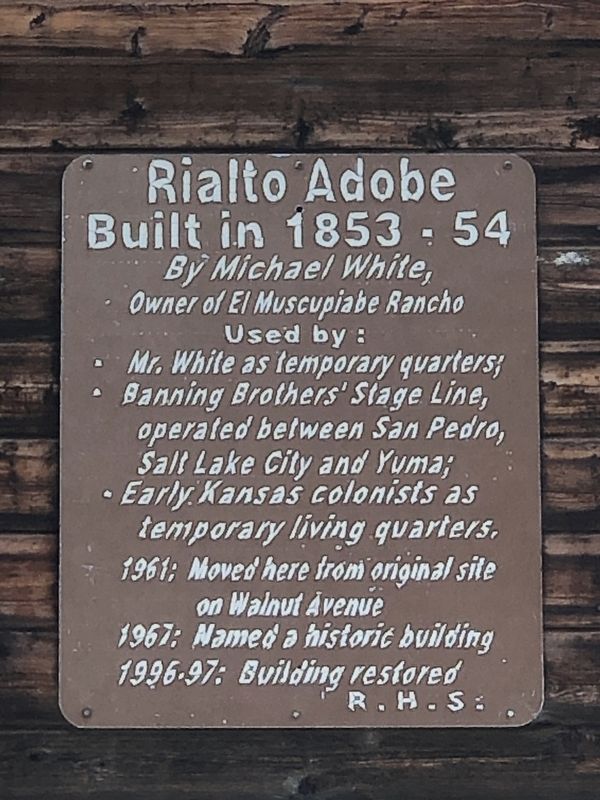
Built in 1853-54
Photographed by Duane and Tracy Marsteller, September 29, 2025
1. Rialto Adobe Marker
Used by:
• Mr. White as temporary quarters;
• Banning Brothers' Stage Line, operated between San Pedro, Salt Lake City and Yuma;
• Early Kansas colonists as temporary living quarters.
1961: Moved here from original site on Walnut Avenue
1967: Named a historic building
1996-97: Building restored
Erected by Rialto Historical Society.
Topics. This historical marker is listed in this topic list: Notable Buildings. A significant historical year for this entry is 1853.
Location. 34° 6.184′ N, 117° 22.611′ W. Marker is in Rialto, California, in San Bernardino County. It can be reached from North Millard Avenue south of West McKinley Street. Marker is located in Bud Bender Park. It is accessible from Millard Avenue only by foot. Millard Avenue is a dead-end residential street with extremely limited parking. Touch for map. Marker is at or near this postal address: 211 N Millard Ave, Rialto CA 92376, United States of America. Touch for directions.

Regionally, this marker is in Greater Los Angeles, in the Inland Empire, in the Peninsular Ranges, and specifically in
this page online
Other nearby markers. At least 8 other markers are within 4 miles of this marker, measured as the crow flies: First Christian Church of Rialto (approx. 0.4 miles away); The Bridge To Progress (approx. 0.4 miles away); Viticulture and the Muscat Grape (approx. 1.1 miles away); The Era of Citrus & Fruit Colonies (approx. 1.4 miles away); Mitla Café (approx. 3.6 miles away); War Memorial (approx. 3.7 miles away); Colton Vietnam War Memorial (approx. 3.8 miles away); Fontana Farms Company (approx. 3.8 miles away). Touch for a list and map of all markers in Rialto.
Another marker is no longer nearby. La Plaza Park, San Bernardino, California (was approx. 3.7 miles away but has been confirmed missing).
Regarding Rialto Adobe. It is not to be confused with the Michael White Adobe (also known as Casa de Miguel Blanco) in
Photographed by Duane and Tracy Marsteller, September 29, 2025
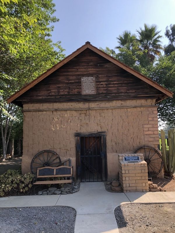
2. Rialto Adobe Marker
Marker is above the door.
Also see . . . Adobe structure is the oldest standing building in Rialto. Built in 1853 by former seaman Michael White (also known as Michael Blanco), the adobe stands as a relatively tiny package of history. (Bob Sokolsky, San Bernardino Sun, Jan. 21, 2002; reposted by Rialto Historical Society) (Submitted on November 12, 2025, by Duane and Tracy Marsteller of Murfreesboro, Tennessee.)

Photographed by Duane and Tracy Marsteller, September 29, 2025
3. Rialto Adobe
Credits. This page was last revised on November 12, 2025. It was originally submitted on November 12, 2025, by Duane and Tracy Marsteller of Murfreesboro, Tennessee. This page has been viewed 160 times since then and 116 times this year. Photos: 1, 2, 3. submitted on November 12, 2025, by Duane and Tracy Marsteller of Murfreesboro, Tennessee.
