Near Hickory in Burke County, North Carolina — The American South (South Atlantic)
Grumman OV-1D Mohawk

Photographed by Mark Parker, November 14, 2025
1. Grumman OV-1D Mohawk Marker
Role Light attack and observation aircraft
National origin United States of America
Manufacturer Grumman
First flight 14 April 1959
Introduction October 1959
Retired September 1996 (USA), 2015 (Argentina)
Primary users United States, Argentine Army Aviation
Produced 1959-1970
Number built 380 (all variants)
The Grumman OV-ID Mohawk is an armed military observation and attack aircraft that was designed for battlefield surveillance and light strike capabilities. It has a twin turboprop configuration, and carries two crew members in side-by-side seating.
The Mohawk was intended to operate from short, unimproved runways in support of United States Army maneuver forces. The radar imaging capability of the Mohawk was to improve a significant advance in both peace and war. The Side-Looking Airborne Radar could look through foliage and map terrain, presenting the observer with a film image of the earth below in only minutes after the area was scanned. In military operations, the image was split in two parts, one showing fixed terrain features, the other spotting moving targets.
The last of the Mohawk versions
this page online
General characteristics
Crew: 2
Length: 41 ft 0 in (12.50 m)
Wingspan: 48 ft 0 in (14.63 m)
Height: 12 ft 8 in (3.86 m)
Wing area: 360 ft (33m³)
Empty weight: 12,054 lb (5,468 kg)
Max. takeoff weight: 18,109 lb (8,214 kg) (SLAR mission)
Powerplant: 2 x Lycoming T53-L-701 turboprops, 1,400 shp (1,000 kW) each
Performance
Maximum speed: 305 mph (491 km/h, 265 kn) (IR mission)
Cruise speed: 207 mph (333 km/h, 180 kn) (econ. cruise)
Range: 944 mi (1,519 km, 820 nmi) with external tanks (SLAR mission)
Rate of climb: 3,466 ft/min (17.61 m/s) (SLAR mission)
Take-off to 50 ft (15 m): 1,175 ft (358 m)
Landing run from 50 ft: (15 m): 1,060 ft (320 m)
Armament: 2.75 FFAR (Folding Fin Aerial Rocket) pods, Mk 80 series bombs, Zuni rockets, Mk 40 grenade launcher, 50 cal. and 30 mm gun pods.
Erected by Hickory

Photographed by Mark Parker, November 14, 2025
2. Grumman OV-1D Mohawk and Marker
Topics. This historical marker is listed in these topic lists: Air & Space • Military. A significant historical date for this entry is April 14, 1959.
Location. 35° 44.509′ N, 81° 23.369′ W. Marker is near Hickory, North Carolina, in Burke County. It can be reached from 9th Avenue Drive Northwest 0.6 miles south of 24th Street Northwest, on the left when traveling west. The marker and aircraft display are part of the Hickory Aviation Museum located at Hickory Regional Airport. Touch for map. Marker is at or near this postal address: 3101 9th Ave Dr NW, Hickory NC 28601, United States of America. Touch for directions.

Regionally, this marker is in North Carolina’s Mountains. It is also in the American South, specifically in the Upper South, in Appalachia, and specifically in Southern Appalachia. Globally, it is in North America, the Western Hemisphere, the Western World, and the Anglosphere. Historically, it finds itself in what was once the territory of the Mississippian Culture, one of the original Thirteen Colonies, one of the Confederate States of America, and the Antebellum South.
Other nearby markers. At

Photographed by Mark Parker, November 14, 2025
3. 15th Military Intelligence Battalion rocket attached to Grumman OV-1D Mohawk aircraft
Photographed by Mark Parker, November 14, 2025
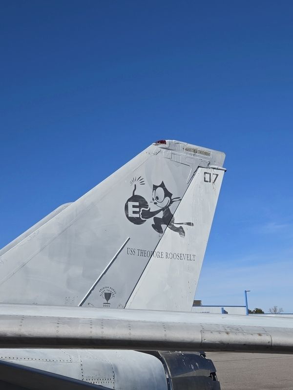
4. Grumman OV-1D Mohawk tail with the USS Teddy Roosevelt insignia
Credits. This page was last revised on November 15, 2025. It was originally submitted on November 14, 2025, by Mark Parker of Hickory, North Carolina. This page has been viewed 85 times since then and 56 times this year. Photos: 1, 2, 3, 4. submitted on November 14, 2025, by Mark Parker of Hickory, North Carolina. • Bernard Fisher was the editor who published this page.
