Millersville in Anne Arundel County, Maryland — The American Northeast (Mid-Atlantic)
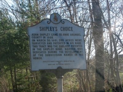
Shipley’s Choice
On March 30, 1681, 200 acres were surveyed and patented in his name. This tract was the earliest patented in the Shipley name. Marker was dedicated during the development of the subdivision named in his honor.
Erected by Shipley's Choice Community Association, Inc., and Maryland Historical Society.
Topics. This historical marker is listed in this topic list: Colonial Era. A significant historical month for this entry is March 1877.
Location. 39° 5.681′ N, 76° 37.247′ W. Marker is in Millersville, Maryland, in Anne Arundel County. Marker is on Benfield Boulevard, 0.1 miles east of Veterans Highway, on the right when traveling east. Touch for map. Marker is in this post office area: Millersville MD 21108, United States of America. Touch for directions.
Other nearby markers. At least 8 other markers are within 3 miles of this marker, measured as the crow flies. Governor William Stone (approx. 0.4 miles away); a different marker also named Shipley’s Choice (approx. 0.9 miles away); Widow Ramsey’s Tavern (approx. 1.1 miles away); a different marker also named Shipley's Choice (approx. 1.1 miles away); The Kinder Farmhouse (approx. 2 miles away); Kinder Farm Ice House (approx. 2 miles away); Sawmill (approx. 2.1 miles away); Tobacco Barn (approx. 2.1 miles away). Touch for a list and map of all markers in Millersville.
More about this marker. Two similar Shipley’s Choice markers (but with slightly different text) are located on Veterans Highway about 1 mile south of Benfield Boulevard.
Credits. This page was last revised on June 16, 2016. It was originally submitted on October 9, 2007, by F. Robby of Baltimore, Maryland. This page has been viewed 4,090 times since then and 146 times this year. Photo 1. submitted on October 9, 2007, by F. Robby of Baltimore, Maryland. • J. J. Prats was the editor who published this page.
Editor’s want-list for this marker. A wide shot of the marker and its surroundings. • Can you help?
