Emerson in Emerson – Franklin Municipality, Manitoba — Canada’s Prairie Region (North America)
Pembina - Emerson Area
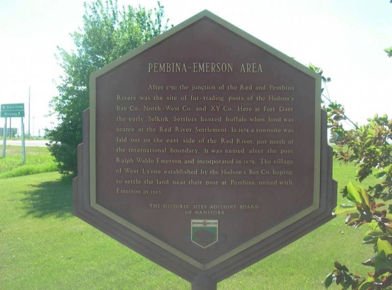
Photographed by Jimmy Emerson, Sept 2023
1. Pembina - Emerson Area Marker
Erected by The Historic Sites Advisory Board of Manitoba.
Topics. This historical marker is listed in these topic lists: Industry & Commerce • Settlements & Settlers. A significant historical year for this entry is 1879.
Location. 49° 0.306′ N, 97° 14.036′ W. Marker is in Emerson, Manitoba, in Emerson – Franklin Municipality. It is on Dallas Avenue, on the left when traveling east. Touch for map. Marker is at or near this postal address: 373 Dallas Avenue, Emerson MB R0A 0L0, Canada. Touch for directions.

Regionally, this marker
this page online
Other nearby markers. At least 8 other markers are within 18 kilometers of this marker, measured as the crow flies: Emerson Court House and Town Hall (approx. 1.5 kilometers away); Dumoulin Church (approx. 2 kilometers away in the U.S.); Fort Dufferin (approx. 3.6 kilometers away); Walter Welford (approx. 3.9 kilometers away in the U.S.); Votes For Women (approx. 3.9 kilometers away in the U.S.); Pembina State Park (approx. 4.4 kilometers away in the U.S.); First Railway in Western Canada / Le Premier Chemin de Fer de L'Ouest du Canada (approx. 16.3 kilometers away); The Fish (approx. 16.3 kilometers away). Touch for a list and map of all markers in Emerson.
Another marker is no longer nearby. The March West / La Marche Vers L'ouest (was approx. 3.6 kilometers away but has been permanently removed).
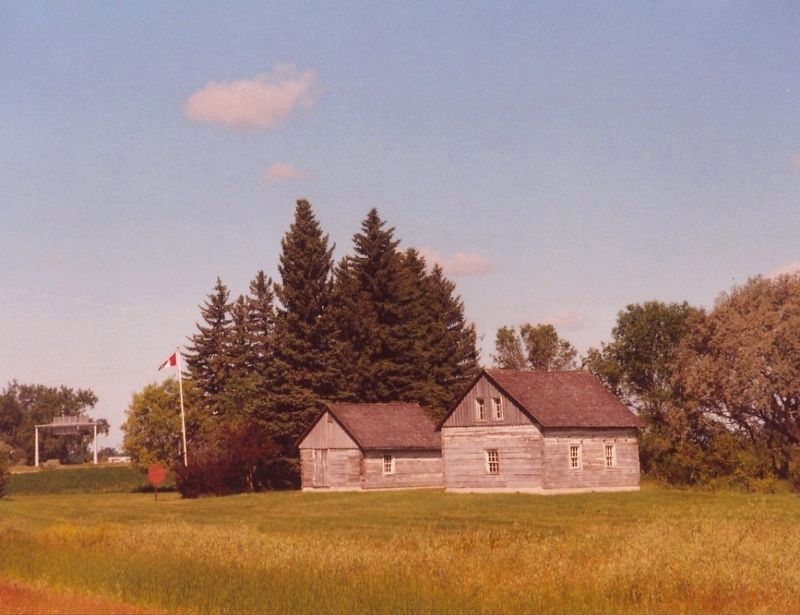
Photographed by Jimmy Emerson, June 2005
2. First Jail and Customs Building in Western Canada
The Pembina - Emerson Area marker is to the left of the log buildings and is still in the same location as of 2023.
Credits. This page was last revised on November 19, 2025. It was originally submitted on November 18, 2025, by Jimmy Emerson of Dalton, Georgia. This page has been viewed 57 times since then and 31 times this year. Photos: 1, 2. submitted on November 18, 2025, by Jimmy Emerson of Dalton, Georgia. • Andrew Ruppenstein was the editor who published this page.
