Mangum in Greer County, Oklahoma — The American South (West South Central)
Thomas Arthur Sheriff
⎯⎯⎯
George Washington Overton

Photographed by James Hulse, October 28, 2025
1. Thomas Arthur Sheriff / George Washington Overton Marker
Son of John A. Sheriff and Melinda Burt, born June 9, 1871, Dawson, Co. Georgia farmer - Deacon - On State Board of Southern Baptist Convention & State Orphans Home for many years - 33rd Degree Mason - first Go Agent of Harmon Co. Took active interest in building schools, churches and other projects so badly needed during pioneer days of Old Greer and Harmon Counties. Married Charlotte Blasingame 1890 in Ga. They and their family came to southern area of Old Greer (Louis-Bethel community) - 1899 Lottie died 1904, buried Louis Cemetery. Married Florence Davis Arthur. Sheriff passed away June 20, 1937 Belen, New Mexico. Buried Lolis Cemetery.
Reverse Side
George Washington Overton
George Washington Overton, born Dec. 16, 1875 in Marietta, Georgia, came to Old Greer Co. in 1898. He was a deputy sheriff in Old Greer Co., O.T. then moved to the Vinson area after working as a cow-hand on the Tittle Ranch. He married Julia Mae Worthen, becoming farmer, rancher and father to Eunice, Verna, Velma, W.H. (Bud), Ed, Forrest, and Russell. Strains of his prime hereford cattle have been carried on by his sons.
A humanitarian, he loved his fellowman. He helped many people during the depression of the 1930's while serving as county commissioner, reaping gratitude that extends to the present day. He was a member of the Vinson Masonic Lodge. He was truly a man for his time making life happier for those around him. He died July 1, 1938.
Erected by Old Greer County Museum & Hall of Fame Inc.
Topics. This historical marker is listed in this topic list: Settlements & Settlers. A significant historical date for this entry is June 9, 1871.
Location. 34° 52.408′ N, 99° 30.427′ W. Marker is in Mangum, Oklahoma, in Greer County. It is at the intersection of West Jefferson Street and S Commerce Alley, on the left when traveling west on West Jefferson Street. The marker is located east of the Old Greer County Museum. Touch for map. Marker is at or near this postal address: 222 W Jefferson St, Mangum OK 73554, United States of America. Touch for directions.

Regionally, this marker is in the Kiowa Tribe, in the Comanche Nation, and in Southwest Oklahoma—Great Plains Country. It is also in the American South, specifically on the prairies, and on the Southern Plains. Globally, it is in North America,
this page online
Other nearby markers. At least 8 other markers are within walking distance of this marker: Caledonia Armstrong Trench / Marion Ernest Copelin (here, next to this marker); William Jones Petty / Charles Brown Overbey Sr. (here, next to this marker); Daniel Mackay Trench / Fredie Lee Crowley (here, next to this marker); Alice Florence Sheriff / Andrew M. Stewart (here, next to this marker); Lella I. (Drake) Pierson / Ervin R. Pierson (here, next to this marker); Edith Florence Kromer / Jewel Smoot Hood (here, next to this marker); James Franklin Kromer / Francis Marion Martin (here, next to this marker); William (Bill) Houston Pierson / Nancy Elizabeth Pierson (here, next to this marker). Touch for a list and map of all markers in Mangum.
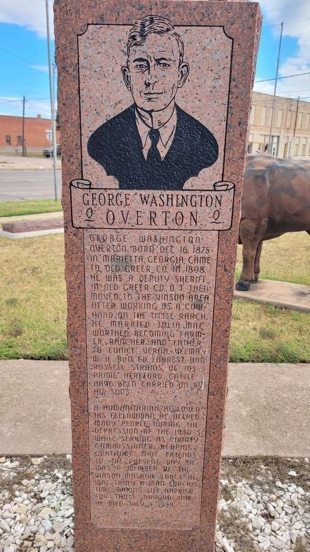
Photographed by James Hulse, October 28, 2025
2. Thomas Arthur Sheriff / George Washington Overton Marker - Reverse Side
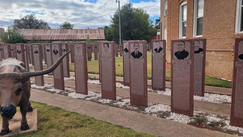
Photographed by James Hulse, October 28, 2025
3. The marker is the third front marker from the right side
Credits. This page was last revised on November 20, 2025. It was originally submitted on November 19, 2025, by James Hulse of Medina, Texas. This page has been viewed 50 times since then and 18 times this year. Photos: 1, 2, 3. submitted on November 20, 2025, by James Hulse of Medina, Texas.
