
Nixon in Gonzales County, Texas — The American South (West South Central)
Nixon
Photographed by Mansfieldphoto.com, November 15, 2025
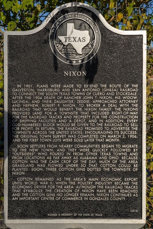
1. Nixon Marker
Soon settlers from nearby communities began to migrate to the new town, and they were quickly followed by "outsiders" who poured in from other Texas towns and from locations as far away as Alabama and Ohio. Because cotton was the cash crop of the day, much of the area grassland was plowed under so that cotton could be planted. Soon, three cotton gins dotted the townsite of Nixon.
Cotton remained as the area's main economic export until World War II, when the poultry industry became the economic driver for the area. Although the railroad tracks that symbolize the creation of Nixon have been removed and the cotton gins no longer remain, Nixon continues as an important center of commerce in Gonzales County.
Erected 2010 by Texas Historical Commission. (Marker Number 16601.)
Topics. This historical marker is listed in these topic lists: Industry & Commerce • Railroads & Streetcars • Settlements & Settlers. A significant historical date for this entry is March 2, 1906.
Location. 29° 16.091′ N,
this page online

Regionally, this marker is in the Hill Country. It is also in the American South. Globally, it is in North America, a Gulf of Mexico state, the Western Hemisphere, the Western World, and the Anglosphere. Historically, it finds itself in what was once New Spain, the Republic of Texas, one of the Confederate States of America, and the Antebellum South.
Other nearby markers. At least 8 other markers are within 6 miles of this marker, measured as the crow flies: Southern Pacific Railroad Promotes Nixon Townsite (here, next to this marker); The First Cotton Gins in Nixon (here, next to this marker); Nixon Depot and Cattle Pens (here, next to this marker); Nixon Ice and Water Company and Poultry Processing Plants (here, next to this marker); The John T. Nixon Ranch (here, next to this marker); First Baptist Church of Nixon (approx. ¼ mile away); Rancho (approx. 1.9 miles away); Site of Old Town of Union Valley (approx. 5.9 miles away). Touch for a list and map of all markers in Nixon.
Credits. This page was last revised on November 24, 2025. It was originally submitted on November 24, 2025, by James Hulse of Medina, Texas. This page has been viewed 74 times since then and 37 times this year. Photo 1. submitted on November 24, 2025, by James Hulse of Medina, Texas.
Editor’s want-list for this marker. A wide view photo of the marker and the surrounding area together in context. • Can you help?
