Marker Logo
THE HISTORICAL
MARKER DATABASE
“Bite-Size Bits of Local, National, and Global History”
Elora in Centre Wellington in Wellington County, Ontario — Central Canada (North America)
 

Mill Street on the Grand
 
 
Mill Street on the Grand Marker image. Click for full size.
Photographed by Tim Boyd, November 24, 2025
1. Mill Street on the Grand Marker
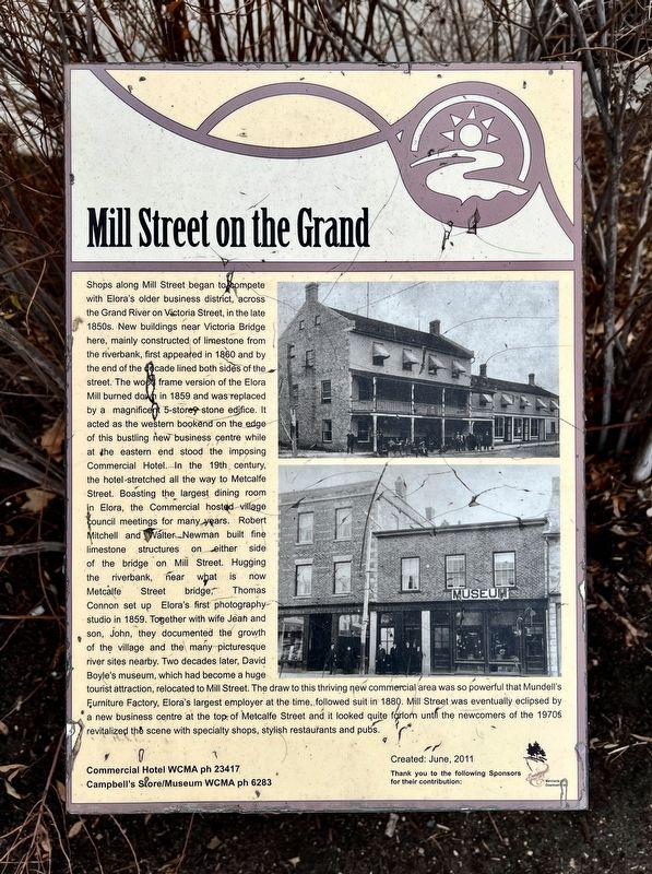
Inscription. Shops along Mill Street began to compete with Elora's older business district, across the Grand River on Victoria Street, in the late 1850s. New buildings near Victoria Bridge here, mainly constructed of limestone from the riverbank, first appeared in 1860 and by the end of the decade lined both sides of the street. The wood frame version of the Elora Mill burned down in 1859 and was replaced by a magnificent 5-story stone edifice. It acted as the western bookend on the edge of this bustling new business centre while at the eastern end stood the imposing Commercial Hotel. In the 19th century, the hotel stretched all the way to Metcalfe Street. Boasting the largest dining room in Elora, the Commercial hosted village council meetings for many years. Robert Mitchell and Walter Newman built fine limestone structures on either side of the bridge on Mill Street. Hugging the riverbank, near what is now Metcalfe Street bridge, Thomas Connon set up Elora's first photography studio in 1859. Together with wife Jean and son John, they documented the growth of the village and the many picturesque river sites nearby. Two decades later,
Paid Advertisement
Click or scan to see
this page online
David Boyle's museum, which had become a huge tourist attraction, relocated to Mill Street. The draw to this thriving new commercial area was so powerful that Mundell's Furniture Factory, Elora's largest employer at the time, followed suit in 1880. Mill Street was eventually eclipsed by a new business centre at the top, of Metcalfe Street and it looked quite forlorn until the newcomers of the 1970s revitalized the scene with specialty shops, stylish restaurants and pubs.
 
Erected 2011.
 
Topics. This historical marker is listed in this topic list: Industry & Commerce. A significant historical year for this entry is 1860.
 
Location. 43° 40.857′ N, 80° 25.778′ W. Marker is in Centre Wellington, Ontario, in Wellington County. It is in Elora. It is at the intersection of Mill Street West and Metcalfe Street, on the right when traveling east on Mill Street West. Touch for map. Marker is at or near this postal address: 10 Mill Street W, Centre Wellington ON N0B 1S0, Canada. Touch for directions.

Regionally, this marker is in the Huron-Perth-Waterloo-Wellington Area and in Southwestern Ontario. It is also in Central Canada. Globally,
Mill Street on the Grand Marker image. Click for full size.
Photographed by Tim Boyd, November 24, 2025
2. Mill Street on the Grand Marker
Centre of photo
it is in North America, the Western Hemisphere, the Western World, and the Anglosphere. Historically, it finds itself in what was once a British colony, the Viceroyalty of New France, the Haudenosaunee (Iroquois) Confederacy, and Rupert’s Land.

Other nearby markers. At least 8 other markers are within walking distance of this marker: Victoria Street Walking Bridge (within shouting distance of this marker); Former Victoria Street Bridge (within shouting distance of this marker); Crossing the Grand (about 90 meters away, measured in a direct line); Lower Metcalfe Street (about 120 meters away); Elora Drill Shed / Le Manθge Militaire D’Elora (about 120 meters away); Charles Clarke 1826-1909 (about 180 meters away); Lower Geddes Street (about 180 meters away); Upper Metcalfe Street (about 210 meters away). Touch for a list and map of all markers in Centre Wellington.
 
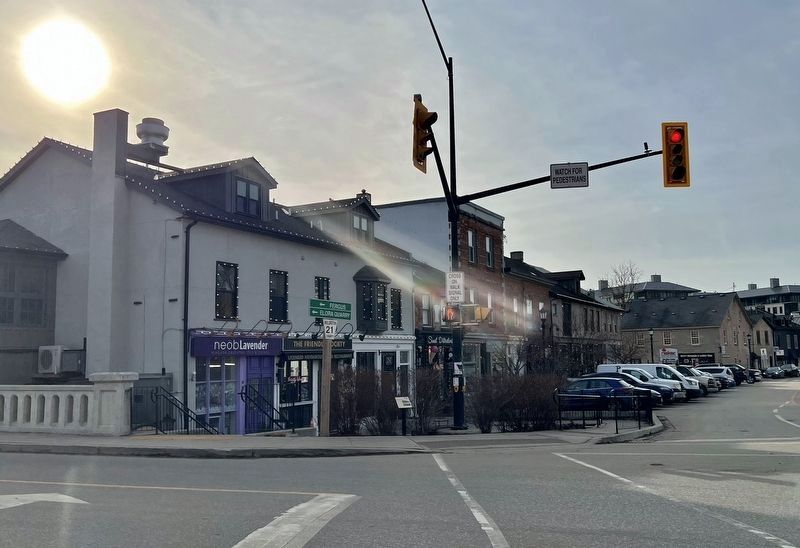
Mill Street in 2025 image. Click for full size.
Photographed by Tim Boyd, November 24, 2025
3. Mill Street in 2025
 
 
Credits. This page was last revised on November 28, 2025. It was originally submitted on November 26, 2025, by Tim Boyd of Hamilton, Ontario. This page has been viewed 45 times since then and 12 times this year. Photos:   1, 2, 3. submitted on November 26, 2025, by Tim Boyd of Hamilton, Ontario. • Andrew Ruppenstein was the editor who published this page.

m=289211

CeraNet Cloud Computing sponsors the Historical Marker Database.
This website earns income from purchases you make after using our links to Amazon.com. We appreciate your support.
Paid Advertisement
Aug. 3, 2026