Tennga in Polk County, Tennessee — The American South (East South Central)
Tennessee
⎯⎯⎯
Georgia
Photographed by Tim Fillmon, October 27, 2025
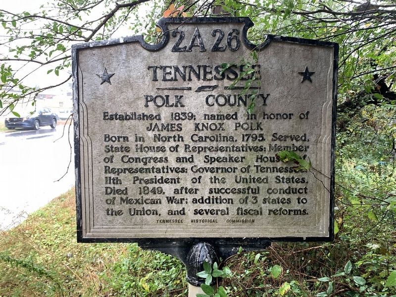
1. Tennessee side of marker
Tennessee
Polk County
Established 1839; named in honor of
James Knox Polk
Born in North Carolina. 1795. Served, State House of Representatives: Member of Congress and Speaker House of Representatives: Governor of Tennessee 11th President of the United States. Died 1849, after successful conduct of Mexican War; addition of 3 states to the Union, and several fiscal reforms.
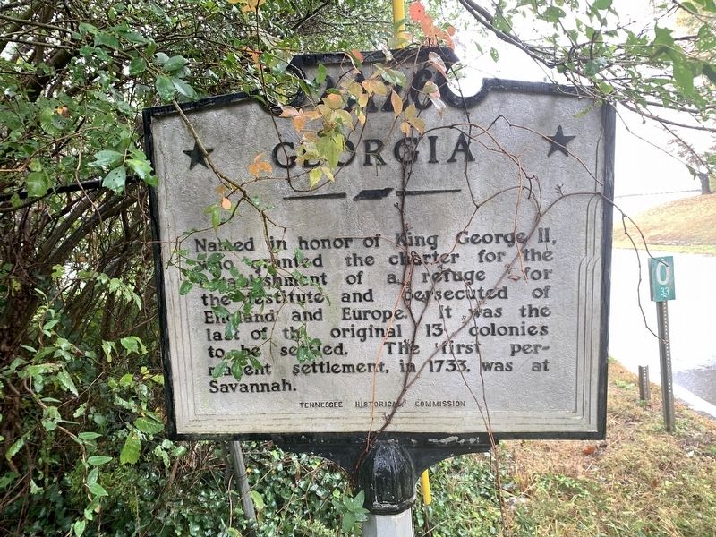
Georgia
Named in honor of King Georgia II, who granted the charter for the establishment of a refuge for the destitute and persecuted of England and Europe. It was the last of the original 13 colonies to be settled. The first permanent settlement, in 1733, was at Savannah.
Erected by Tennessee Historical Commission. (Marker Number 2A 26.)
Topics. This historical marker is listed in this topic list: Political Subdivisions. A significant historical year for this entry is 1839.
Location. 34° 59.283′ N, 84° 44.306′ W. Marker is in Tennga, Tennessee, in Polk County. It is on U.S. 411 0.1 miles south of Liberty Church Road, on the right when traveling north. As of 10/25 the marker is hard to see in the bushes along the roadway. Touch for map.
this page online

Regionally, this marker is in East Tennessee. It is also in the American South, specifically in the Upper South, in Appalachia, and specifically in Southern Appalachia. Globally, it is in North America, the Western Hemisphere, the Western World, and the Anglosphere. Historically, it finds itself in what was once the original Cherokee Nation, the territory of the Mississippian Culture, one of the Confederate States of America, and the Antebellum South.
Other nearby markers. At least 8 other markers are within 12 miles of this marker, measured as the crow flies: Old Federal Road (approx. half a mile away in Georgia); Marr’s Fort (approx. 4.7 miles away); Ocoee Dam #1 (approx. 8.9 miles away); Ocoee No. 1 (approx. 9 miles away); a different marker also named Ocoee No. 1 (approx. 9 miles away); Civil War "No Man's Land" (approx. 10.4 miles away); Red Clay Council Ground (approx. 10.8 miles away); a different marker also named Old Federal Road (approx. 11.8 miles away in Georgia).
Other markers
Photographed by Tim Fillmon, October 27, 2025
2. Georgia side of marker
Photographed by Tim Fillmon, October 27, 2025
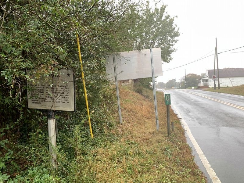
3. Tennessee / Georgia Marker
Credits. This page was last revised on November 26, 2025. It was originally submitted on November 26, 2025, by Tim Fillmon of Webster, Florida. This page has been viewed 86 times since then and 40 times this year. Photos: 1, 2, 3. submitted on November 26, 2025, by Tim Fillmon of Webster, Florida.
