Arvada in Jefferson County, Colorado — The American Mountains (Southwest)
Placer Mining
Gold from Gravel
Photographed by Cosmos Mariner, August 14, 2022
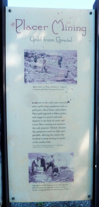
1. Placer Mining Marker
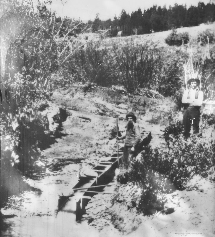
Gold miners in the early years recovered placer gold using equipment such as gold pans, sluice boxes, and rockers. Placer gold appeared as flakes, grains, and nuggets in gravel and sand deposits in the beds of creeks and rivers. Placer mining was suited to the early pioneers' lifestyle, because the equipment used was light and portable, allowing the miners the freedom to keep moving in search of the mother lode.
Source: Historic Trail Map of the Denver 1° x 2° Quadrangle, by Glen R. Scott, U.S. Geological Survey
Topics. This historical marker is listed in these topic lists: Exploration • Industry & Commerce.
Location. 39° 47.88′ N, 105° 3.389′ W. Marker is in Arvada, Colorado, in Jefferson County. It can be reached from West 56th Avenue just south of Ralston Road, on the right when traveling east. The marker is on the south side of an interpretive kiosk in Gold Strike Park. Touch for map. Marker is at or near this postal address: 5500 West 56th Avenue, Arvada CO 80002, United States of America. Touch for directions.

Regionally, this marker is in the Front Range. It is also in the American Mountain West. Globally, it is in North America, the Rocky Mountains, the Western Hemisphere, the Western World, and the Anglosphere. Historically, it finds itself in what was once the Louisiana Purchase.
Other nearby markers. At least 8 other markers are within 2 miles of this marker, measured as the crow flies: The Cherokee Trail (here, next to this marker); Gold Fever (here, next to this marker); Ralston's Gold Discovery (here, next to this marker); Gold Was Discovered (approx. ¾ mile away); McIlvoy House (approx. 1.2 miles away); Arvada's Trolleys (approx. 1.2 miles away); Arvada's First Park (approx. 1.2 miles away); Roads and Trains (approx. 1.2 miles
this page online
Related markers. Click here for a list of markers that are related to this marker.
Also see . . . Placer Mining (Wikipedia).
Excerpt: Placer mining is the mining of stream bed deposits for minerals. Placer mining is frequently used for precious metal deposits (particularly gold) and gemstones, both of which are often found in deposits of sand and gravel in modern or ancient stream beds, or occasionally glacial deposits. The metal or gemstones, having been moved by stream flow from an original source such as a vein, are typically only a minuscule portion of the total deposit. Since gems and heavy metals like gold are considerably denser than sand, they tend to accumulate at the base of placer deposits.(Submitted on November 29, 2025, by Cosmos Mariner of Cape Canaveral, Florida.)
In North America, placer mining was famous in the context of several gold rushes, particularly the California Gold Rush and the Colorado Gold Rush, the Fraser Canyon Gold Rush and the Klondike Gold Rush.
Denver Public Library Western History Department
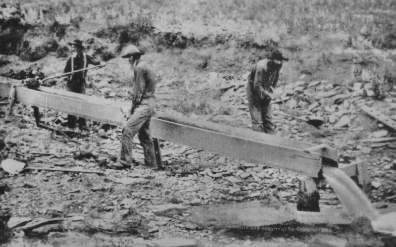
2. Marker detail: Sluice Box
These miners are using a sluicebox or “long tom” to separate gold flakes from gravel and sand.
Denver Public Library Western History Department
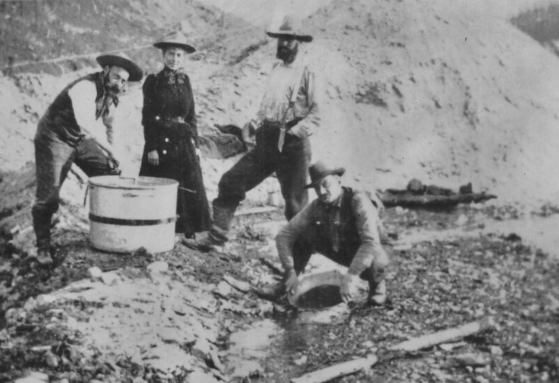
3. Marker detail: A Woman amongst Placer Miners
Although few and far between, women did make the difficult journey west with their families. A dozen females accompanied the Lewis Ralston party of 1850.
Photographed by Cosmos Mariner, August 14, 2022
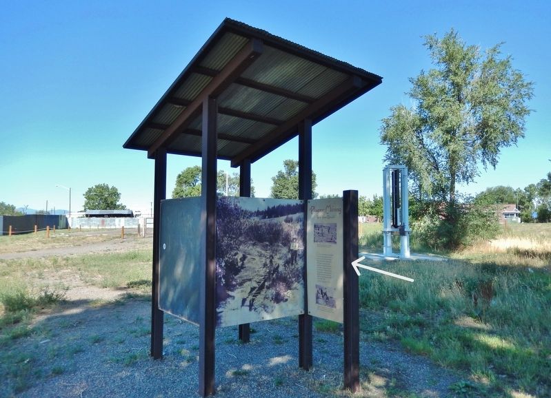
4. Placer Mining Marker
The marker [right] is on the south side of this interpretive kiosk in Gold Strike Park.
Colorado Historical Society
5. Placer Mining
This photo of placer miners operating a sluice box is adjacent to the historical marker in the interpretive kiosk.
Credits. This page was last revised on November 29, 2025. It was originally submitted on November 29, 2025, by Cosmos Mariner of Cape Canaveral, Florida. This page has been viewed 72 times since then and 31 times this year. Photos: 1, 2, 3, 4, 5. submitted on November 29, 2025, by Cosmos Mariner of Cape Canaveral, Florida.
