Marker Logo
THE HISTORICAL
MARKER DATABASE
“Bite-Size Bits of Local, National, and Global History”
Elora in Centre Wellington in Wellington County, Ontario — Central Canada (North America)
 

Upper Geddes Street
 
 
Upper Geddes Street Marker image. Click for full size.
Photographed by Tim Boyd, November 24, 2025
1. Upper Geddes Street Marker
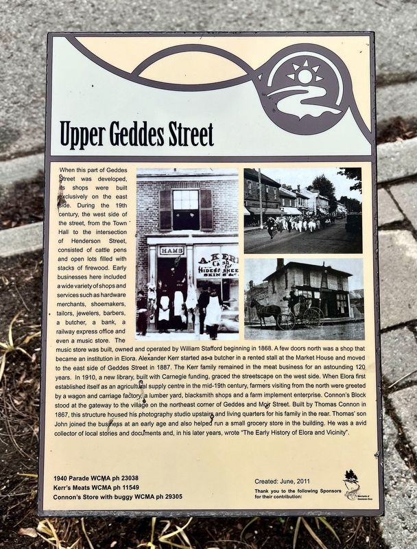
Inscription. When this part of Geddes Street was developed, its shops were built exclusively on the east side. During the 19th century, the west side of the street, from the Town Hall to the intersection of Henderson Street, consisted of cattle pens and open lots filled with stacks of firewood. Early businesses here included a wide variety of shops and services such as hardware merchants, shoemakers, tailors, jewellers, barbers, a butcher, a bank, a railway express office and even a music store. The music store was built, owned and operated by William Stafford beginning in 1868. A few doors north was a shop that became an institution in Elora. Alexander Kerr started as a butcher in a rented stall at the Market House and moved to the east side of Geddes Street in 1887. The Kerr family remained in the meat business for an astounding 120 years. In 1910, a new library, built with Carnegie funding, graced the streetscape on the west side. When Elora first established itsef as an agricultural supply centre in the mid-19th century, farmers visiting from the north were greeted by a wagon and carriage factory, a lumber yard, blacksmith shops
Paid Advertisement
Click or scan to see
this page online
and a farm implement enterprise. Connon's Block stood at the gateway to the village on the northeast corner of Geddes and Mojr Street. Built by Thomas Connon in 1867, this structure housed his photography studio upstairs and living quarters for his family in the rear. Thomas’ son John joined the business at an early age and also helped run a small grocery store in the building. He was a avid collector of local stories and documents and, in his later years, wrote "The Early History of Elora and Vicinity".
 
Erected 2011 by Merchants of Downtown Elora.
 
Topics. This historical marker is listed in these topic lists: Industry & CommerceSettlements & Settlers. A significant historical year for this entry is 1868.
 
Location. 43° 41.033′ N, 80° 25.861′ W. Marker is in Centre Wellington, Ontario, in Wellington County. It is in Elora. It is at the intersection of Geddes Street and Henderson Street, on the right on Geddes Street. Touch for map. Marker is at or near this postal address: 157 Geddes Street, Centre Wellington ON N0B 1S0, Canada. Touch for directions.

Regionally, this marker is in the Huron-Perth-Waterloo-Wellington
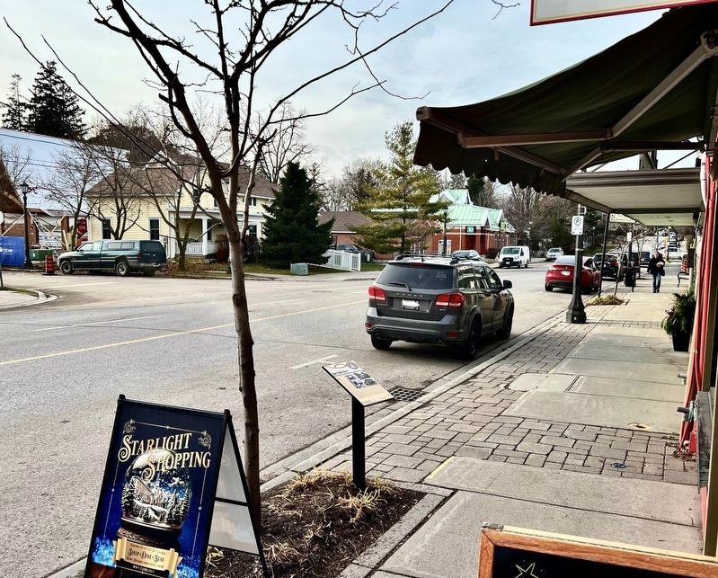
Upper Geddes Street Marker image. Click for full size.
Photographed by Tim Boyd, November 24, 2025
2. Upper Geddes Street Marker
Area and in Southwestern Ontario. It is also in Central Canada. Globally, it is in North America, the Western Hemisphere, the Western World, and the Anglosphere. Historically, it finds itself in what was once a British colony, the Viceroyalty of New France, the Haudenosaunee (Iroquois) Confederacy, and Rupert’s Land.

Other nearby markers. At least 8 other markers are within walking distance of this marker: The Village Drinking Fountain (within shouting distance of this marker); The Village Centre (within shouting distance of this marker); The Founder of Elora (within shouting distance of this marker); Elora Cenotaph (within shouting distance of this marker); Liquor Store (about 120 meters away, measured in a direct line); Upper Metcalfe Street (about 150 meters away); Lower Geddes Street (about 180 meters away); Charles Clarke 1826-1909 (about 210 meters away). Touch for a list and map of all markers in Centre Wellington.
 
Upper Geddes Street and marker, 2025 image. Click for full size.
Photographed by Tim Boyd, November 24, 2025
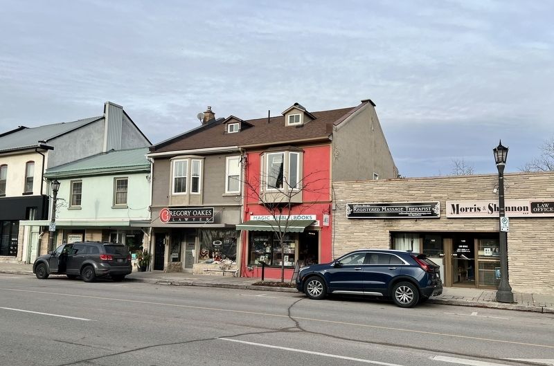
3. Upper Geddes Street and marker, 2025
Marker is at the centre of the photo, in front of the red building
 
 
Credits. This page was last revised on December 21, 2025. It was originally submitted on November 29, 2025, by Tim Boyd of Hamilton, Ontario. This page has been viewed 33 times since then and 10 times this year. Photos:   1, 2, 3. submitted on November 29, 2025, by Tim Boyd of Hamilton, Ontario. • Andrew Ruppenstein was the editor who published this page.

m=289364

CeraNet Cloud Computing sponsors the Historical Marker Database.
This website earns income from purchases you make after using our links to Amazon.com. We appreciate your support.
Paid Advertisement
Aug. 4, 2026