Marker Logo
THE HISTORICAL
MARKER DATABASE
“Bite-Size Bits of Local, National, and Global History”
Elora in Centre Wellington in Wellington County, Ontario — Central Canada (North America)
 

Upper Metcalfe Street
 
 
Upper Metcalfe Street Marker image. Click for full size.
Photographed by Tim Boyd, November 24, 2025
1. Upper Metcalfe Street Marker
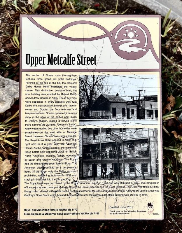
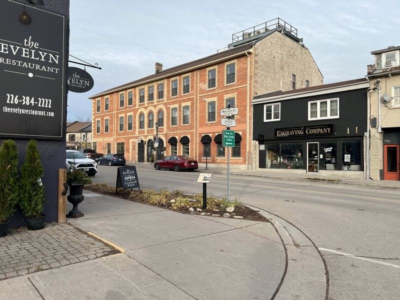
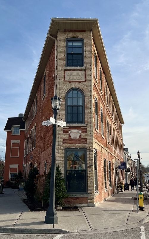
Inscription. This section of Elora's main thoroughfare features three grand old hotel buildings. Perched at the top of the hill, the eloquent Dalby House Hotel overlooks the village centre. This distinctive, two-tone brick flat iron building was erected by Robert Dalby and Andrew Gordon in 1865. These two men were opposites in every possible way, with Dalby the conservative brewer and tavern-owner and Gordon the fiery reformer and temperance man. Gordon operated a harness shop at the peak of the edifice and, much to Dalby's chagrin, placed a carved stone there naming the building “Gordon's Block”. A few years earlier, two other hostelries were established on the west side of Metcalfe Street, between Church and James Streets. The Royal Arms Hotel opened in 1859 and, right next to it a year later, the American House. As the names suggest, the owners of these hotels held opposing views on British North American loyalties. When operated by Sarah and Andrew Kauffman, The Royal had the finest dining room fare in Elora. The American often operated as a temperance hotel. Of the three, only the Dalby survived prohibition, reopening its tavern
Paid Advertisement
Click or scan to see
this page online
in 1934 and staying in business into the 21st-century. The Royal Hotel was purchased by the Royal Canadian Legion in 1938 and was enlarged in 1969. Two newspaper offices were located on upper Metcalfe Street, the Elora Observer and the Elora Express. The Observer office building though much altered, still stands on the northeast corner of Metcalfe and Church Streets. A few doors-up the street was Godfrey's Shoe Store which housed the post office until the current post office building was erected in 1911.
 
Erected 2011.
 
Topics. This historical marker is listed in this topic list: Industry & Commerce. A significant historical year for this entry is 1865.
 
Location. 43° 40.963′ N, 80° 25.82′ W. Marker is in Centre Wellington, Ontario, in Wellington County. It is in Elora. It is at the intersection of Metcalfe Street and James Street, on the right when traveling south on Metcalfe Street. Touch for map. Marker is at or near this postal address: 130 Metcalfe Street, Centre Wellington ON N0B 1S0, Canada. Touch for directions.

Regionally, this marker is in the Huron-Perth-Waterloo-Wellington Area and in Southwestern Ontario. It
Upper Metcalfe Street Marker image. Click for full size.
Photographed by Tim Boyd, November 24, 2025
2. Upper Metcalfe Street Marker
Facing northeast
is also in Central Canada. Globally, it is in North America, the Western Hemisphere, the Western World, and the Anglosphere. Historically, it finds itself in what was once a British colony, the Viceroyalty of New France, the Haudenosaunee (Iroquois) Confederacy, and Rupert’s Land.

Other nearby markers. At least 8 other markers are within walking distance of this marker: Liquor Store (a few steps from this marker); Elora Cenotaph (within shouting distance of this marker); Lower Metcalfe Street (within shouting distance of this marker); The Founder of Elora (within shouting distance of this marker); Lower Geddes Street (within shouting distance of this marker); The Village Centre (within shouting distance of this marker); Charles Clarke 1826-1909 (about 90 meters away, measured in a direct line); The Village Drinking Fountain (about 120 meters away). Touch for a list and map of all markers in Centre Wellington.
 
Gordon’s Blocking 2025 image. Click for full size.
Photographed by Tim Boyd, November 24, 2025
3. Gordon’s Blocking 2025
(Upper) Metcalfe Street in 2025 image. Click for full size.
Photographed by Tim Boyd, November 24, 2025
4. (Upper) Metcalfe Street in 2025
 
 
Credits. This page was last revised on November 30, 2025. It was originally submitted on November 29, 2025, by Tim Boyd of Hamilton, Ontario. This page has been viewed 34 times since then and 13 times this year. Photos:   1, 2, 3, 4. submitted on November 29, 2025, by Tim Boyd of Hamilton, Ontario. • Andrew Ruppenstein was the editor who published this page.

m=289390

CeraNet Cloud Computing sponsors the Historical Marker Database.
This website earns income from purchases you make after using our links to Amazon.com. We appreciate your support.
Paid Advertisement
Aug. 4, 2026