Near Roll in Yuma County, Arizona — The American Mountains (Southwest)
In Memory of Harold and Ethelind Woodhouse
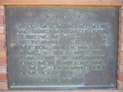
Photographed by Bill Kirchner, March 13, 2010
1. In Memory of Harold and Ethelind Woodhouse Marker
Erected 1955 by Wellton-Mohawk Valley Kiwanis Club.
Topics. This historical marker is listed in this topic list: Settlements & Settlers. A significant historical date for this entry is May 1, 1952.
Location. 32° 45.098′ N, 113° 58.374′ W. Marker is near Roll, Arizona, in Yuma County. It is on East County 5th Street near South Avenue 39 East, on the right when traveling east. Touch for map. Marker is in this post office area: Roll AZ 85347, United States of America. Touch for directions.

Regionally, this marker is in Arizona’s Colorado River Valley, in the Sonoran Desert, and in the Yuma Area. It is also in the American Borderlands and in the Southwest. Globally, it is in North America, the Western Hemisphere, the Western World, and the Anglosphere. Historically, it finds itself in what was once New Spain and also the Gadsden Purchase.
this page online
Other nearby markers. At least 2 other markers are within 4 miles of this marker, measured as the crow flies: Antelope Hill Campsite (approx. 3.6 miles away); a different marker also named Antelope Hill Campsite (approx. 3.6 miles away).
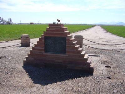
Photographed by Bill Kirchner, March 13, 2010
2. In Memory of Harold and Ethelind Woodhouse Marker
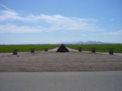
Photographed by Bill Kirchner, March 13, 2010
3. In Memory of Harold and Ethelind Woodhouse Marker
Credits. This page was last revised on November 2, 2019. It was originally submitted on March 22, 2010, by Bill Kirchner of Tucson, Arizona. This page has been viewed 1,019 times since then and 30 times this year. Photos: 1, 2, 3. submitted on March 22, 2010, by Bill Kirchner of Tucson, Arizona. • Syd Whittle was the editor who published this page.
