
Downtown in St. John's in CensusDiv 1 - Avalon Peninsula-St. John's, Newfoundland and Labrador — The Atlantic Provinces (North America)
Fort William
⎯⎯⎯
Le Fort William
Photographed by Jimmy Emerson, July 2024
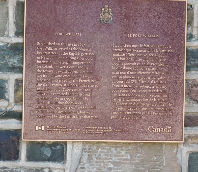
1. Fort William Le Fort William Marker

Established on this site in 1697, Fort William served as the original headquarters of the English garrison in Newfoundland during a period of intense Anglo-French competition for colonial power. Commanding the town's seaward approaches but not its landward ones, the fort was repeatedly attacked by the French in the 18th century. It successfully resisted an assault led by Subercase in 1705 only to be captured and destroyed by Saint-Ovide in 1709. Rebuilt by the British during the War of the Austrian Succession (1740-1748), it fell to the French again in 1762, but was recaptured by the British later that year.
Établi ici en 1697, le fort William fut le premier quartier général de la garnison anglaise à Terre-Neuve, servant au plus fort de la lutte anglo-française pour le pouvoir colonial Protégeant la ville d'une approche maritime, mais non d'une offensive terrestre, il essuya plusieurs attaques françaises au cours du XVIII siècle. Il résista à l'assaut mené par Subercase en 1705 pour ensuite être conquis et détruit par Saint-Ovide en 1709. Reconstruit par
this page online
Erected by Historic Sites and Monuments Board of Canada.
Topics and series. This historical marker is listed in this topic list: Forts and Castles. In addition, it is included in the Canada, Historic Sites and Monuments Board series list. A significant historical year for this entry is 1697.
Location. 47° 34.24′ N, 52° 42.027′ W. Marker is in St. John's, Newfoundland and Labrador, in CensusDiv 1 - Avalon Peninsula-St. John's. It is in Downtown. It is at the intersection of Cavendish Square and Duckworth Street, on the right when traveling north on Cavendish Square. Marker is located on the stone retaining wall. Touch for map. Marker is at or near this postal address: 2 Cavendish Square, St John's NL A1C 3K2, Canada. Touch for directions.

Regionally, this marker is on Newfoundland and Labrador’s Avalon Peninsula. It is also in Atlantic Canada. Globally, it is in the North Atlantic Region, North America, the Western Hemisphere, the
©2005 Parks Canada Agency / Agence Parcs Canada, M. Dawe (terms of use pc.gc.ca/termes-terms#p05), 2005
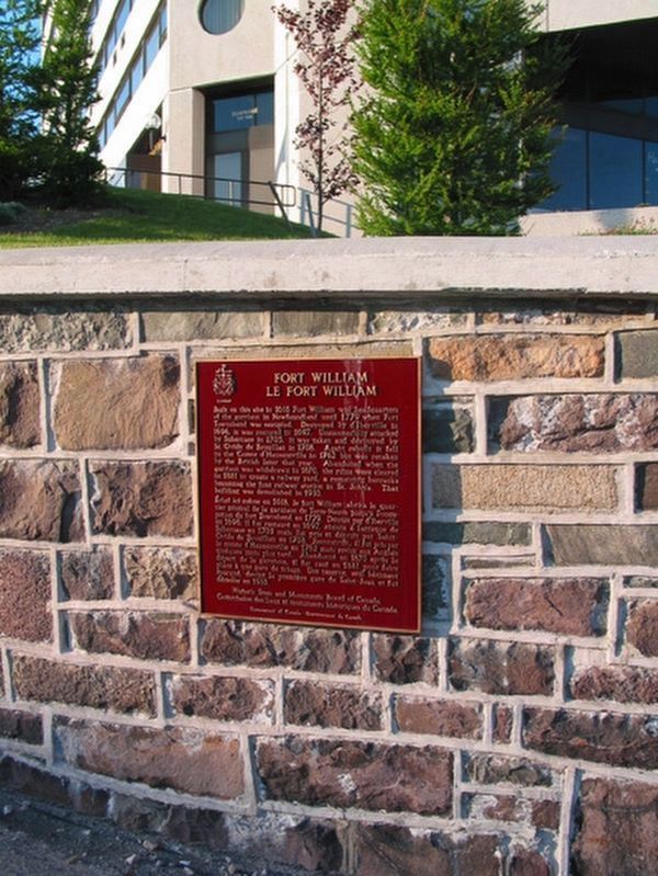
2. General view
Photo faces north-east. Marker is on a stone retaining wall, beside the road's sidewalk. (photo available at Parks Canada website pc.gc.ca)
Other nearby markers. At least 8 other markers are within walking distance of this marker: 28 Cochrane Street (about 240 meters away, measured in a direct line); Bannerman House (approx. 0.3 kilometers away); Government House / Résidence Du Lieutenant-Gouverneur (approx. 0.4 kilometers away); Sir Humphrey Gilbert (approx. 0.4 kilometers away); Anderson House (approx. 0.4 kilometers away); a different marker also named Anderson House (approx. 0.4 kilometers away); The Newfoundland National War Memorial (approx. 0.4 kilometers away); 32 Queen's Road (approx. 0.7 kilometers away). Touch for a list and map of all markers in St. John's.
Also see . . . Fort William, Newfoundland (Wikipedia). Excerpt:
Fort William was a fort in St. John's built in 1698 to protect English interests on Newfoundland, primarily against French opposition. It was the original headquarters of the British garrison in Newfoundland.…(Submitted on December 17, 2025.)
The Fort was demolished in 1881 to make room for a railway yard, the barracks being used as the station. This was demolished in 1910 and urban development now occupies the site.
Fort William was designated a National Historic Site of Canada in 1952. As there are no visible remains, the site is marked by a Historic Sites and Monuments Board plaque located on a retaining wall at the corner of Cavendish Square and Duckworth Street in downtown St. John’s
Credits. This page was last revised on July 26, 2026. It was originally submitted on December 8, 2025, by Jimmy Emerson of Dalton, Georgia. This page has been viewed 81 times since then and 50 times this year. Photos: 1. submitted on December 8, 2025, by Jimmy Emerson of Dalton, Georgia. 2. submitted on July 26, 2026, by Kevin Westell of St. Catharines, Ontario. • Andrew Ruppenstein was the editor who published this page.
