
Tryon in Borden-Carleton in Prince County, Prince Edward Island — The Atlantic Provinces (North America)
Tryon United Church
⎯⎯⎯
L'Église Unie de Tryon
Photographed by Jimmy Emerson, July 2022
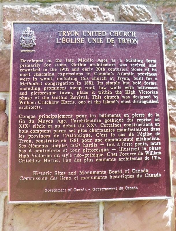
1. Tryon United Church Marker

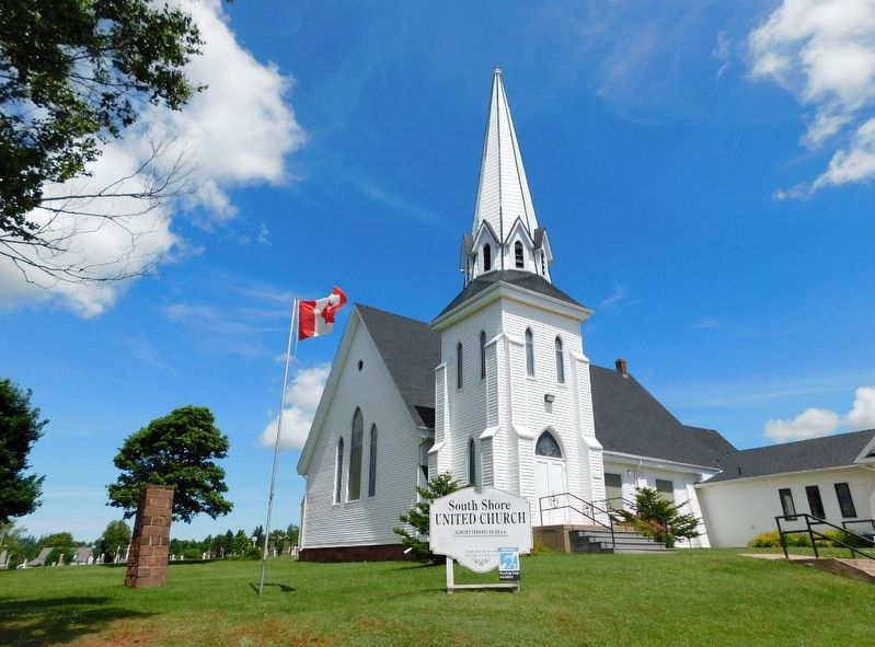
Developed in the late Middle Ages as a building form primarily for stone, Gothic architecture was revived and reworked in the 19th and early 20th centuries. Some of its most charming expressions in Canada's Atlantic provinces were in wood, including this church at Tryon, built for a Methodist congregation in 1881. Its simple but bold forms, including prominent steep roof, low walls with buttresses and picturesque tower, place it within the High Victorian phase of the Gothic Revival. This church was designed by William Critchlow Harris, one of the Island's most distinguished architects.
Conçue principalement pour les bâtiments en pierre de la fin du Moyen Âge, l'architecture gothique fut reprise an XIXe siècle et au début du XXe. Certaines constructions en bois comptent parmi ses plus charmantes manifestations dans les provinces de l'Atlantique. C'est le cas de l'église de Tryon, construite en 1881 pour une communauté méthodiste. Ses éléments simples mais hardis toit à forte pente, murs bas à contreforts et tour pittoresque illustrent la phase High
this page online
Erected by Historic Sites and Monuments Board of Canada.
Topics and series. This historical marker is listed in these topic lists: Architecture • Religion & Religious Structures. In addition, it is included in the Canada, Historic Sites and Monuments Board series list. A significant historical year for this entry is 1881.
Location. 46° 14.307′ N, 63° 32.604′ W. Marker is in Borden-Carleton, Prince Edward Island, in Prince County. It is in Tryon. It is on Prince Edward Island 10 (Prince Edward Island Route 10), on the right when traveling east. Touch for map. Marker is at or near this postal address: 85 PE-10, Borden-Carleton PE C0B 1A0, Canada. Touch for directions.

Regionally, this marker is in North Cape Coastal P. E. I. It is also in the Maritimes and in Atlantic Canada. Globally, it is in the North Atlantic Region, North America, the Western Hemisphere, the Western World, and the Anglosphere. Historically, it finds itself in what was once a British colony, the Viceroyalty of New France,
Photographed by Jimmy Emerson, July 2022
2. Tryon United Church
The marker is on the stone base by the flag pole.
Other nearby markers. At least 8 other markers are within 24 kilometers of this marker, measured as the crow flies: Agriculture in Kinkora / L’agriculture à Kinkora (approx. 10.4 kilometers away); Kinkora (approx. 10.4 kilometers away); Granite Mill Stone (approx. 10.4 kilometers away); This Granite Rock (approx. 10.4 kilometers away); James Colledge Pope (approx. 18.7 kilometers away); The Efficiency of Mixed Farming (approx. 23.2 kilometers away); Potato Farming Between the Tree Stumps (approx. 23.3 kilometers away); A Woman's Work is Never Done (approx. 23.3 kilometers away).
Credits. This page was last revised on December 20, 2025. It was originally submitted on December 9, 2025, by Jimmy Emerson of Dalton, Georgia. This page has been viewed 55 times since then and 29 times this year. Photos: 1, 2. submitted on December 9, 2025, by Jimmy Emerson of Dalton, Georgia. • Andrew Ruppenstein was the editor who published this page.
