
Winnipeg Beach, Manitoba — Canada’s Prairie Region (North America)
Postage Stamp Province
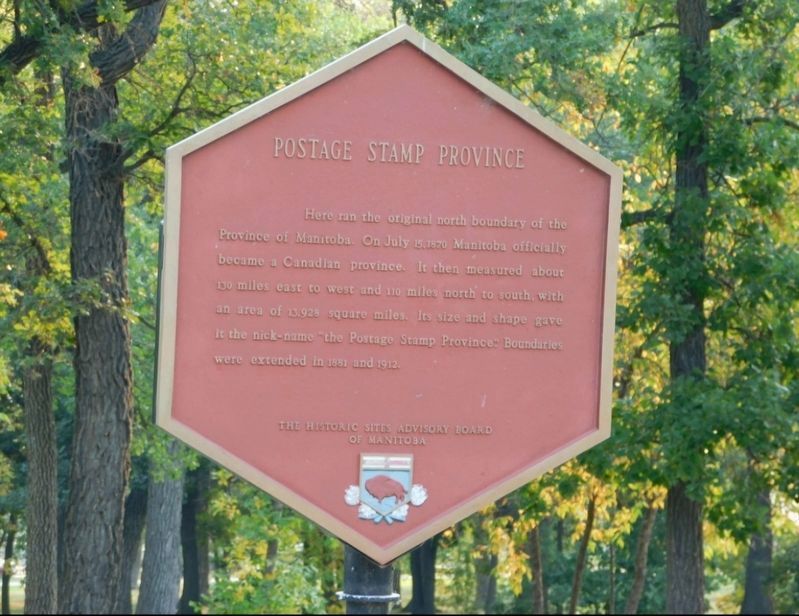
Photographed by Jimmy Emerson, Sept 2023
1. Postage Stamp Province Marker
Erected by Historic Sites Advisory Board of Manitoba.
Topics. This historical marker is listed in this topic list: Political Subdivisions. A significant historical year for this entry is 1870.
Location. 50° 30.402′ N, 96° 58.13′ W. Marker is in Winnipeg Beach, Manitoba. It is at the intersection of Prospect Street and Park Avenue, on the right when traveling north on Prospect Street. Touch for map. Marker is at or near this postal address: 26 Prospect Street, Winnipeg Beach MB R1A 2X7, Canada. Touch for directions.

Regionally, this marker is in Manitoba’s Interlake Region. It is also in the Prairies. Globally, it is in North America, the Western Hemisphere, the Western World, and the Anglosphere. Historically, it finds itself in what was
this page online
Other nearby markers. At least one other marker is within 14 kilometers of this marker, measured as the crow flies: New Iceland (approx. 13.7 kilometers away).
Also see . . . Manitoba's Borders (Turtle Mountain - Souris Plains Heritage Foundation). Excerpt:
Manitoba was the 5th province to be added to the Dominion of Canada… The Manitoba Act was passed in the spring of 1870 and brought the new province of Manitoba into the Dominion of Canada.(Submitted on December 16, 2025.)
The original size of the province was only one-eighteenth its present size. It was referred to as the “postage stamp” province due to its square shape. The following decade saw thousands of settlers moving into the province and past Manitoba into the North West Territories. In 1881 Manitoba’s borders were enlarged in order to control the pattern of incoming settlement. Land mostly to the north and west was added to the province, quintupling its size. The Manitoba-Ontario border took a further 74 years to be determined. The town of Rat Portage (now Kenora), especially, was caught in the middle of an inter-provincial dispute over who was in control.
The present boundaries of Manitoba were set in 1912. The northern limit of the province runs along the 60th degree latitude and the northeastern part of the province was enlarged to border Hudson’s Bay.
Credits. This page was last revised on December 16, 2025. It was originally submitted on December 9, 2025, by Jimmy Emerson of Dalton, Georgia. This page has been viewed 102 times since then and 68 times this year. Photo 1. submitted on December 9, 2025, by Jimmy Emerson of Dalton, Georgia. • Andrew Ruppenstein was the editor who published this page.
Editor’s want-list for this marker. photo of the marker within its surroundings • Can you help?
