Groveton in Coos County, New Hampshire — The American Northeast (New England)
Gateway to the Great North Woods
Photographed by Craig Doda, June 3, 2019
1. Gateway to the Great North Woods Marker
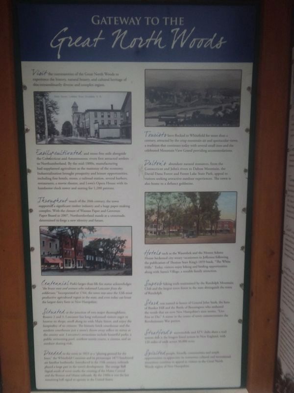
Visit the communities of the Great North Woods to experience the history, natural beauty, and cultural heritage of this extraordinarily diverse and complex region.
Easily-cultivated and stone-free soils alongside the Connecticut and Ammonoosac rivers first attracted settlers to Northumberland. By the mid-1800s, manufacturing had supplanted agriculture as the mainstay of the economy. Industrialization brought prosperity and leisure opportunities, inducing fine hotels, stores, a railroad station, several barbers, restaurants, a movie theatre, and Lowe's Opera House with its handsome clock tower and seating for 1,200 patrons.
Throughout much of the 20th century, the town supported a significant timber industry and a huge paper making complex. With the closure of Wausau Paper and Groveton Paper Board in 2007, Northumberland stands at a crossroads, determined to forge & new identity and future.
Centennial Park's larger-than-life fox statue acknowledges "the brave men and women who redeemed Lancaster from the wilderness." Incorporated in 1764, the town was once one of the 12 most productive agricultural regions in
this page online
Situated at the junction of two major thoroughfares, Routes 2 and 3, Lancaster has long welcomed visitors eager to brows its shops, stroll along its wide Main Street, and enjoy the hospitality of its citizens. The historic brick courthouse and the modern courthouse just a stone's throw away reflect its status as the county seat. Lancaster's attractions include beautiful parks a public swimming pool, outdoor tennis courts, a cinema, and an outdoor skating rink.
Deeded as the town in 1833 as a "playing ground for the boys." the Whitefield Common and in picturesqueness 1875 bandstand are familiar landmarks. Introduced in the 19th century, railroads played a large part in the towns development. The orange Ball Signal north of town marks the crossing of the Maine Central and the Boston and Maine railroads. By the 1960s in was the last remaining rail signal in aperate in the United States.
Tourists have flocked to Whitefield for more than a century, attracted by the crisp mountain air and spectacular views, a tradition that continues today with several small
Photographed by Craig Doda, June 3, 2019
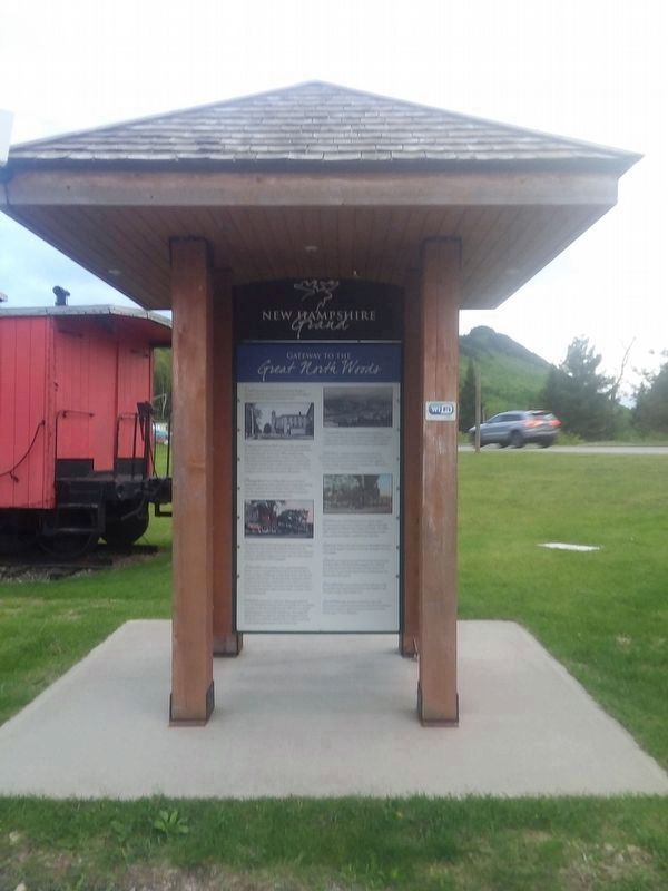
2. Gateway to the Great North Woods Marker
Dalton's abundant natural resources, from the Connecticut and John's rivers to Dalton Mountain, the David Dana Forest and Forest Lake State Park, appeal to visitors seeking attractive outdoor experiences. The town is also home to a defunct goldmine.
Hotels such as the Waumbek and the Mount Adams House beckoned city-weary vacationers to Jefferson following the publication of Thomas Starr King's 1859 book, "The White Hills.” Today, visitors enjoy hiking and birding opportunities along with Santa's Village, a notable family attraction.
Superb hiking trails maintained by the Randolph Mountain Club and the largest town forest in the state distinguish the town of Randolph.
Stark was named in honor of General John Stark, the hero of Bunker Hill and the Battle of Bennington who authored the words that are now New Hampshire's state motto, "Live Free or Die.” A statue in the center of town commemorates the Revolutionary War patriot.
Stratfords snowmobile and ATV clubs share a trail system that is the longest lineal system in New England, with 120 miles of trails
Photographed by Craig Doda, June 3, 2019
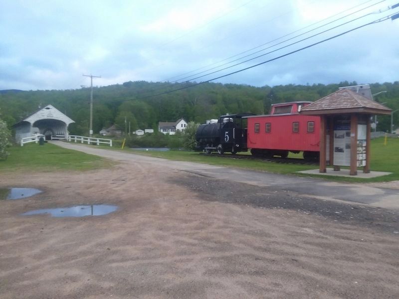
3. Groveton Covered Bridge Park
Spirited people, friendly communities and ample opportunities to appreciate its numerous cultural and recreational attractions continue to appeal to visitors to the Great North Woods region of New Hampshire.
Topics. This historical marker is listed in this topic list: Notable Places. A significant historical year for this entry is 2007.
Location. 44° 35.75′ N, 71° 30.687′ W. Marker is in Groveton, New Hampshire, in Coos County. It is on Main Street (U.S. 3) just south of Mechanic Street, on the right when traveling north. The marker stands in Groveton Covered Bridge Park. Touch for map. Marker is at or near this postal address: 3 West St, Groveton NH 03582, United States of America. Touch for directions.

Regionally, this marker is in New Hampshire’s White Mountains. It is also in the American Northeast and in New England. Globally, it is in North America, the Great North Woods, the Western Hemisphere, the Western World, and the Anglosphere. Historically, it finds itself in what was once one of the original Thirteen Colonies.
Other nearby markers. At least 8 other markers are within 8 miles of this marker, measured as the crow flies: Connecticut River to Umbagog Lake (within shouting distance of this marker); The Benton Cottage (approx. 3.2 miles away in Vermont); Honor Roll (approx. 3.2 miles away in Vermont); Essex County Court House (approx. 3.2 miles away in Vermont); Historic Guildhall, Vermont (approx. 3.2 miles away in Vermont); Camp Stark (approx. 6.3 miles away); Wilder-Holton House (approx. 7.6 miles away); Lancaster N. H.: Stories of People and Places (approx. 7.6 miles away).
Credits. This page was last revised on December 10, 2025. It was originally submitted on December 14, 2020, by Craig Doda of Napoleon, Ohio. This page has been viewed 461 times since then and 46 times this year. Last updated on December 10, 2025, by Adam Blodgett of Groveton, New Hampshire. Photos: 1. submitted on December 14, 2020, by Craig Doda of Napoleon, Ohio. 2. submitted on December 15, 2020, by Craig Doda of Napoleon, Ohio. 3. submitted on December 14, 2020, by Craig Doda of Napoleon, Ohio. • Devry Becker Jones was the editor who published this page.
