Minturn in Eagle County, Colorado — The American Mountains (Southwest)
The Minturn Turn-Table
Photographed by Cosmos Mariner, July 27, 2025
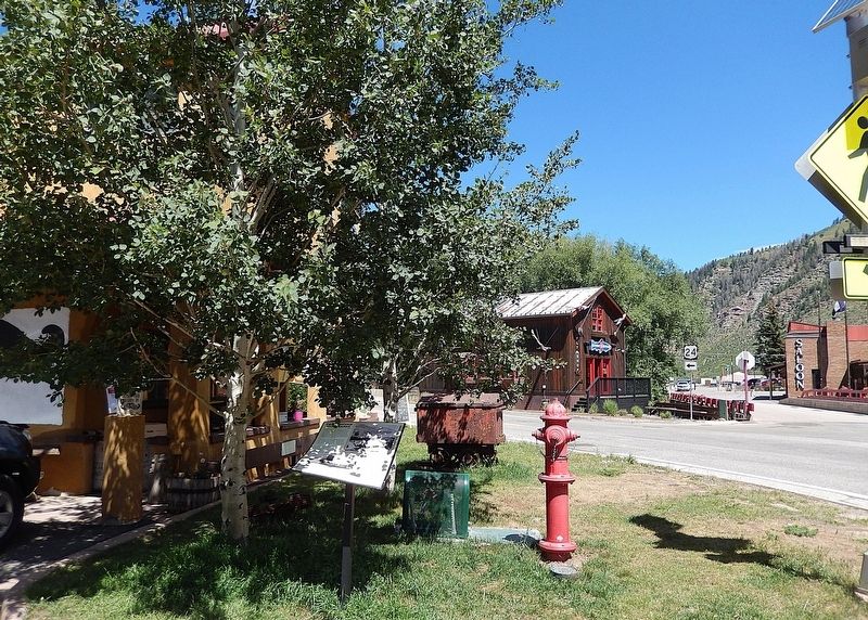
1. The Minturn Turn-Table Marker
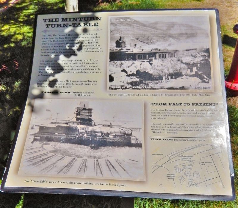
”In 1886, the Denver & Rio Grand Railroad hurried tracks down the Eagle River, to end at Aspen’s rich silver ores. The Rio Grand established a station, and in June 1887, it was designated Minturn, in honor of Robert H. Minturn of New York, a Director of the Denver and Rio Grande Railway. He was a financier who helped gather the funds needed for the railroad expansion. The town was not formally incorporated until 1904.
The railroad was a ‘never-sleep’ industry. It ran 7 days a week, 365 days a year. The turntable took locomotives from yard tracks and turned them to stalls in the roundhouse. Workers known as hostlers operated the controls. The roundhouse had 10 stalls and was the biggest structure in Minturn.
Use of the tracks through Minturn and across Tennessee Pass were discontinued in 1997 because the trains were rerouted to the Moffat Tunnel.”
—Passage from ‘Minturn, A Memoir’ by Bill Burnett
“From Past to Present”
The ‘Minturn Entrance’ design theme honors the town’s mining and railroad history while embracing the future and modern technology. Steel, wood and ‘I-beam light poles’ represent materials used by these industries.
this page online
The modern turn-table pattern of the patio reflects the historic turn-table used by the railroad. The mining industry is reflected by the fence with mining carts and parametric modeled rails and “The Adit” 3D restrooms.
Topics. This historical marker is listed in these topic lists: Architecture • Industry & Commerce • Railroads & Streetcars. A significant historical year for this entry is 1886.
Location. 39° 35.339′ N, 106° 25.885′ W. Marker is in Minturn, Colorado, in Eagle County. It is at the intersection of Main Street (U.S. 24) and Eagle River Street, on the left when traveling north on Main Street. Touch for map. Marker is at or near this postal address: 101 Main Street, Minturn CO 81645, United States of America. Touch for directions.

Regionally, this marker is in the Colorado High Rockies. It is also in the American Mountain West. Globally, it is in North America, the Rocky Mountains, the Western Hemisphere, the Western World, and the Anglosphere.
Other nearby markers. At least 8 other markers are within 12 miles of this marker, measured as the crow flies: Welcome to Historic Minturn (within shouting distance
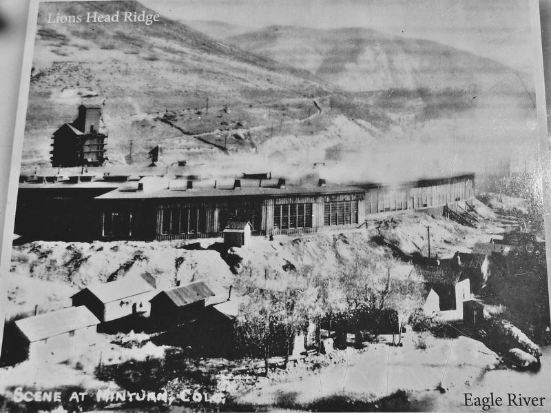
2. Marker detail: Minturn Turn-Table Railroad Building
Looking south towards downtown, 100 block, Main Street.
Also see . . . Minturn, Colorado (Wikipedia).
Excerpt: The town is named for Robert Bowne Minturn, Jr., who was vice president of the Denver and Rio Grande Western Railroad that founded the town. Minturn's oldest families settled at the confluence of Gore Creek and the Eagle River in the late 1800s. Some created homesteads and farmed the land, while others mined silver in the mountains high above town. With the arrival of the Denver & Rio Grande Railroad in 1887, Minturn quickly developed into a booming crossroads for transportation and industry. By the turn of the century, a growing population(Submitted on December 12, 2025, by Cosmos Mariner of Cape Canaveral, Florida.)of mining and railroad workers and their families raised the demand for business and services in town. In response, Minturn was incorporated on November 15, 1904. Minturn has adapted to several major changes in the local economy over the decades, including the development of Vail and Beaver Creek ski resorts, the closing of the Gilman mine, and the idling of rail lines through Minturn.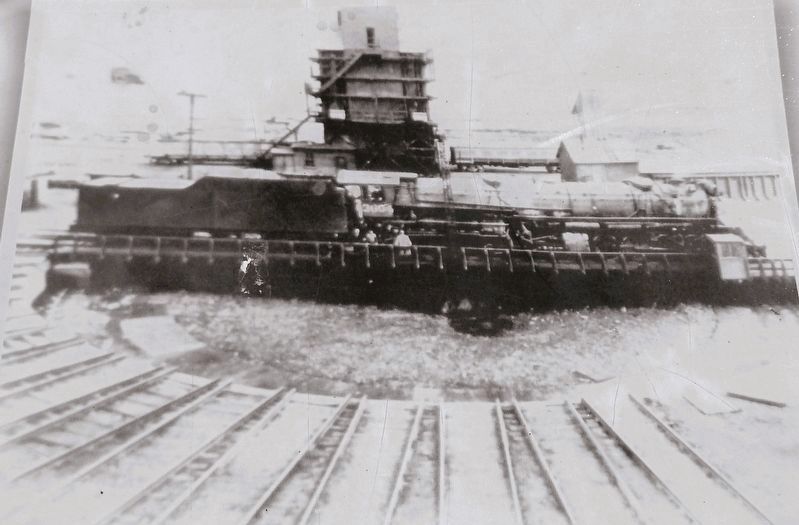 3. Marker detail: The “Turn-Table”
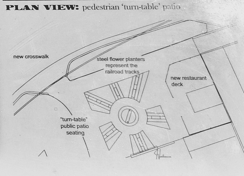
4. Marker detail: Pedestrian "Turn-Table" Patio
Photographed by Cosmos Mariner, July 27, 2025
5. The Minturn Turn-Table Marker
Looking north; Main Street crosses in the background.
Credits. This page was last revised on December 12, 2025. It was originally submitted on December 10, 2025, by Cosmos Mariner of Cape Canaveral, Florida. This page has been viewed 60 times since then and 34 times this year. Photos: 1, 2, 3, 4, 5. submitted on December 12, 2025, by Cosmos Mariner of Cape Canaveral, Florida.
