Page in Coconino County, Arizona — The American Mountains (Southwest)
American Placer Corporation Office

Photographed by Jeremy Snow, December 7, 2025
1. American Placer Corporation Office Marker
Headquarters of Charles H. Spencer's gold mining company
Built 1911
First of Spencer's eight stone buildings
Failing to recover gold, Spencer abandoned his mining outpost around 1912. Cowboys, miners, and travelers occasionally camped in the empty building. It briefly functioned as a post office in 1922, though almost no mail was sent or delivered.
Erected by National Park Service.
Topics. This historical marker is listed in this topic list: Industry & Commerce. A significant historical year for this entry is 1911.
Location. 36° 51.998′ N, 111° 35.13′ W. Marker is in Page, Arizona, in Coconino County. It is on Lees Ferry Road when traveling north. Located on the north side of the parking lot of the River Trail trailhead. Touch for map. Marker is at or near this postal address: Lees Ferry Rd, Marble Canyon AZ 86036, United States of America. Touch for directions.

Regionally, this marker is in Flagstaff & High Country, in the Navajo Nation, and in Hopi. It is also in the American Southwest, in the Mountain West, on the Colorado Plateau, and at the Four Corners. Globally, it is in North America, the
this page online
Other nearby markers. At least 8 other markers are within walking distance of this marker: Lees Ferry Fort (here, next to this marker); Lee's Ferry (a few steps from this marker); Historic District River Trail (within shouting distance of this marker); USGS Guesthouse/Spencer Bunkhouse (about 400 feet away, measured in a direct line); Mining the Chinle Shale 1910-11 (about 600 feet away); Water Intake (about 600 feet away); Spencer Boiler (about 700 feet away); a different marker also named Lees Ferry (about 700 feet away). Touch for a list and map of all markers in Page.
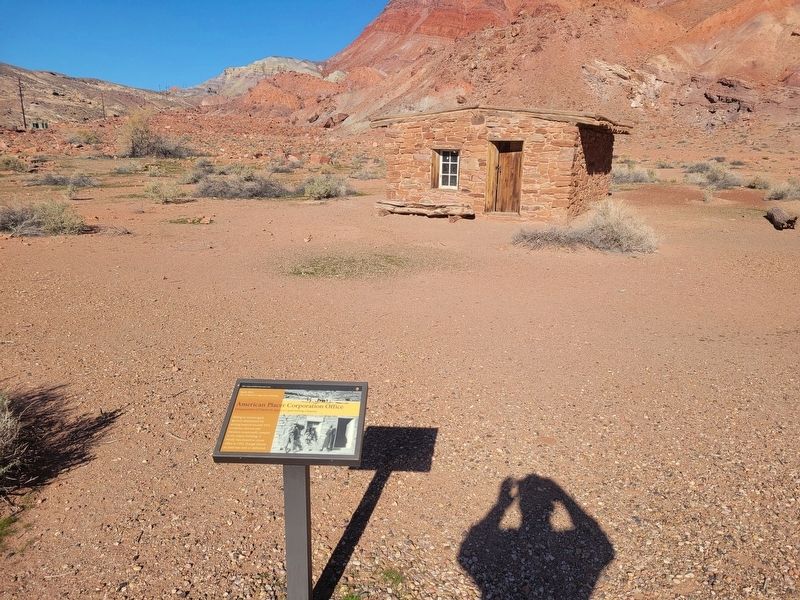
Photographed by Jeremy Snow, December 7, 2025
2. American Placer Corporation Office Marker
Credits. This page was last revised on December 15, 2025. It was originally submitted on December 11, 2025, by Jeremy Snow of Cedar City, Utah. This page has been viewed 54 times since then and 26 times this year. Photos: 1, 2. submitted on December 11, 2025, by Jeremy Snow of Cedar City, Utah. • Andrew Ruppenstein was the editor who published this page.
