Bynum in Hill County, Texas — The American South (West South Central)
Bynum School
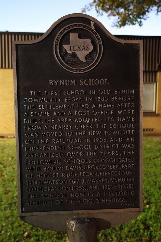
Photographed by Jeff Leichsenring, December 10, 2025
1. Bynum School Marker
Erected 1984 by Texas Historical Commission. (Marker Number 592.)
Topics. This historical marker is listed in this topic list: Education. A significant historical year for this entry is 1880.
Location. 31° 58.072′ N, 97° 0.005′ W. Marker is in Bynum, Texas, in Hill County. It is at the intersection of Tolivar Avenue (State Highway 171) and Brannon Street (Farm to Market Road 1242), on the left when traveling north on Tolivar Avenue. Touch for map. Marker is at or near this postal address: 704 SH 171, Bynum TX 76631, United States of America. Touch for directions.

Regionally, this marker is in the Prairies & Lakes Region. Globally, it is in North America, a Gulf of Mexico state, the Western Hemisphere, the Western World, and the Anglosphere. Historically, it finds itself in what was once New Spain, the Republic of Texas, and one of the Confederate States of America.
Other nearby markers. At least 8 other markers are within 7 miles of this marker, measured as the crow flies: Old Brandon Mill (approx. 5.8 miles away); Confederate Veterans and Old Settlers Reunion Grounds (approx. 5.9 miles away); Hill County, C.S.A. (approx. 6 miles away); Salem Lutheran Church (approx. 6.2 miles away); Ehre Sei Gott - Glory to God (approx. 6.2 miles away);
this page online
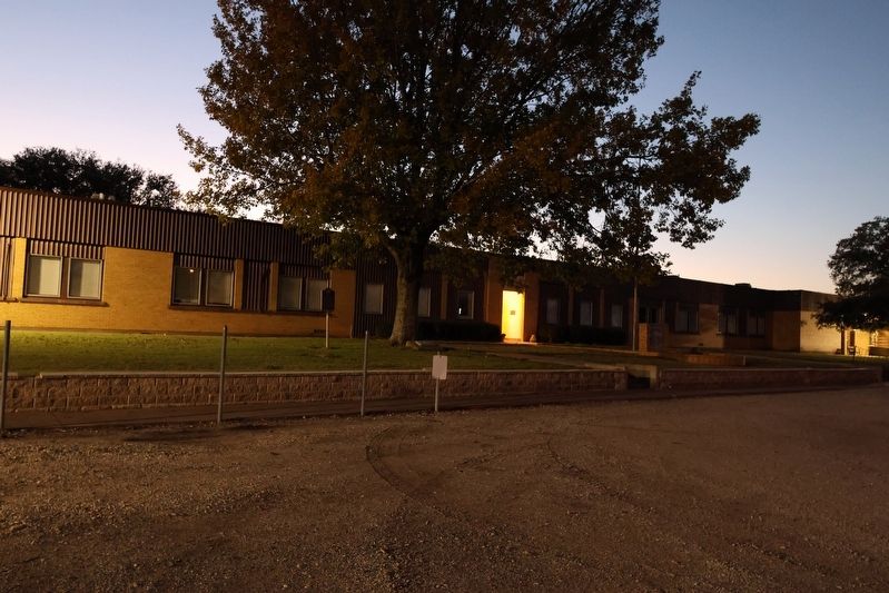
Photographed by Jeff Leichsenring, December 10, 2025
2. Bynum School and marker
Credits. This page was last revised on December 12, 2025. It was originally submitted on December 11, 2025, by Jeff Leichsenring of Garland, Texas. This page has been viewed 56 times since then and 26 times this year. Photos: 1, 2. submitted on December 11, 2025, by Jeff Leichsenring of Garland, Texas. • James Hulse was the editor who published this page.
