
Sainte-Mère-Église in Manche, Normandy, France — Western Europe
Sainte-Mère-Eglise

Photographed by James Hulse, June 3, 2025
1. Sainte-Mère-Eglise Marker

Sainte-Mère-Eglise est un objectif prioritaire pour son emplacement stratégique. En effet, la ville est traversée par la N13, mènant de Carentan à Cherbourg et par la D15 qui permet la liaison d'Utah Beach à Barneville. Les plans initiaux prévoyaient de couper le Cotentin en deux, afin de libérer, le plus rapidement possible, Cherbourg, seul port en eau profonde capable d'accueillir le ravitaillement nécessaire pour la Bataille de Normandie.
Légendes
(Photo #1) Juin 1946: Défilé de parachutistes de la 82 Division Aéroportée.
Sainte-Mère-Eglise is a priority target because of its strategic site. The town is a crossing of two main roads: N13 leads from Carentan to Cherbourg and D15 allows rallying Utah Beach to Barneville. Initial plans were to cut in two the Cotentin in order to liberate as soon as possible, Cherbourg, unique deep-water harbor able to welcome the supplies for the Battle of Normandy.
Captions
(Photo #1) Commemorative parade of 82nd Airborne on main street in 1946.
Reverse Side
L'armée allemande en 1944 utilisait encore largement les chevaux et les attelages hippomobiles pour ses déplacements, contrairement à l'image d'une armée motorisée et blindée que la propagande aimait à diffuser.
Le carrefour central à 9,7 km de la mer. (Utah Beach) Un parachutiste américain a récupéré un cheval pour se déplacer.
German army in 1944 still largely used horses to transport and move from place to place, in the contrary of the image of an armored and strong army largely spread by propaganda.
Notice the sign 9.7 km to the beach. (Utah Beach) An American paratrooper got a horse for his movements.
Erected by Sainte Mère Eglise, Baie du Cotentin and Airborne Museum Sainte-Mère-Eglise. (Marker Number 11.)
Topics. This historical
this page online
Location. 49° 24.535′ N, 1° 19.08′ W. Marker is in Sainte-Mère-Église, Normandie (Normandy), in Manche. It is at the intersection of Rue du Cap de Laine (State Road D974) and Rue de Verdun (State Road D15), on the left when traveling north on Rue du Cap de Laine. The marker is located at the intersection of the street with another marker. Touch for map. Marker is at or near this postal address: 2 Rue du Cap de Laine, Sainte-Mère-Église, Normandie 50480, France. Touch for directions.

Regionally, it is in the North Atlantic Region, Europe, the European Union, Atlantic Europe, the Schengen Area, Western Europe, a coastal Mediterranean country, and the Western World. Historically, it finds itself in what was once a French colony and also the Roman Empire.
Other nearby markers. At least 8 other markers are within walking distance of this marker: L'Auberge John Steele / John Steele Restaurant (here, next to this marker); La 2ᵉ Division Blindée (2ᵉ DB) / The 2nd Armored Division (within shouting distance of this marker);

Photographed by James Hulse, June 3, 2025
2. Sainte-Mère-Eglise Marker - Reverse Side
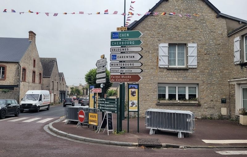
Photographed by James Hulse, June 3, 2025
3. The view of the marker along the street (right side)

Photographed by James Hulse, June 3, 2025
4. The view of the markers towards the street
Credits. This page was last revised on December 13, 2025. It was originally submitted on December 12, 2025, by James Hulse of Medina, Texas. This page has been viewed 58 times since then and 22 times this year. Photos: 1, 2, 3, 4. submitted on December 12, 2025, by James Hulse of Medina, Texas.
