
Sainte-Mère-Église in Manche, Normandy, France — Western Europe
Les Cimetières Provisoires
⎯⎯⎯
Temporary Cemeteries

Photographed by James Hulse, June 3, 2025
1. Les Cimetières Provisoires / Temporary Cemeteries Marker

Mme Simone Renaud au cimetière n°2. C'était la femme du maire. Grâce à sa connaissance de l'anglais, elle prendra soin des relations franco-américaines avec les familles des soldats enterrés dans les cimetières provisoires en fleurissant les tombes, prenant des photos pour les envoyer aux États-Unis.
Légendes
(Foto #1) Office religieux au cimetière n°1 en 1944.
(Foto #2) Le cimetière n°1 aménagé.
(Foto #3) Plus d'information dans les collections de Airborne Museum.
Mrs. Simone Renaud at the cemetery n°2. It was the mayor's wife. Thanks to her knowledge of English, she will take care of the Franco-American relations with the families of the soldiers buried in the temporary cemeteries by blooming the graves, taking pictures to send them to the United States.
Captions
(Photo #1) Religious Office at Cemetery No. 1 in 1944.
(Photo #2) The cemetery n°1 arranged.
(Photo #3) More Information in the collections of the Airborne Museum.
Reverse Side
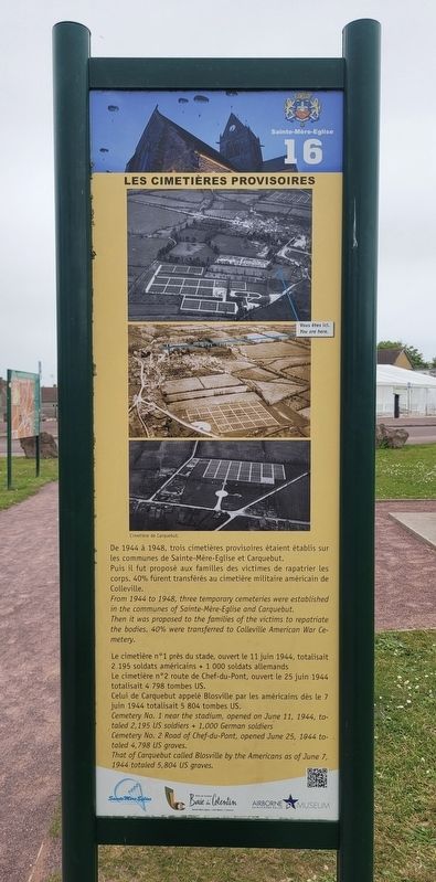
De 1944 à 1948, trois cimetières provisoires étaient établis sur les communes de Sainte-Mère-Eglise et Carquebut. Puis il fut proposé aux familles des victimes de rapatrier les corps. 40 % furent transférés au cimetière militaire américain de Colleville.
Le cimetière n°1 près du stade, ouvert le 11 juin 1944, totalisait 2 195 soldats américains + 1 000 soldats allemands. Le cimetière n°2 route de Chef-du-Pont, ouvert le 25 juin 1944 totalisait 4 798 tombes US. Celui de Carquebut appelé Blosville par les américains dès le 7 juin 1944 totalisait 5 804 tombes US.
Légendes
(Photo #1) Cimetière de Carquebut.
From 1944 to 1948, three temporary cemeteries were established in the communes of Sainte-Mère-Eglise and Carquebut. Then it was proposed to the families of the victims to repatriate the bodies. 40% were transferred to Colleville American War Cemetery.
Cemetery No. 1 near the stadium, opened on June 11, 1944, totaled 2,195 US soldiers + 1,000 German soldiers. Cemetery No. 2 Road of Chef-du-Pont, opened June 25, 1944 totaled 4,798 US graves. That of Carquebut called Blosville by the Americans as of June 7, 1944 totaled 5,804 US graves.
Captions
(Photo #1) Carquebut Cemetery
Erected by Sainte
this page online
Topics. This historical marker is listed in this topic list: War, World II. A significant historical year for this entry is 1944.
Location. 49° 24.537′ N, 1° 18.857′ W. Marker is in Sainte-Mère-Église, Normandie (Normandy), in Manche. It is at the intersection of Rue de la Liberté and Rue Eisenhower, on the left when traveling west on Rue de la Liberté. The marker is located along the sidewalk in the garden area. Touch for map. Marker is in this post office area: Sainte-Mère-Église, Normandie 50480, France. Touch for directions.

Regionally, it is in the North Atlantic Region, Europe, the European Union, Atlantic Europe, the Schengen Area, Western Europe, a coastal Mediterranean country, and the Western World. Historically, it finds itself in what was once a French colony and also the Roman Empire.
Other nearby markers. At least 8 other markers are within walking distance of this marker: Un bourg aux matériaux de construction contrastés (a few steps from this marker); Aux morts pour la Patrie / To the fallen for the Fatherland (within
Photographed by James Hulse, June 3, 2025
2. Les Cimetières Provisoires / Temporary Cemeteries Marker - Reverse Side
Photographed by James Hulse, June 3, 2025
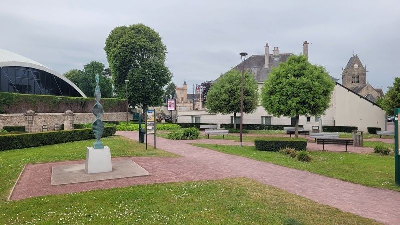
3. The view of the marker along the sidewalk
Credits. This page was last revised on December 13, 2025. It was originally submitted on December 12, 2025, by James Hulse of Medina, Texas. This page has been viewed 47 times since then and 11 times this year. Photos: 1, 2, 3. submitted on December 13, 2025, by James Hulse of Medina, Texas.
