
Sainte-Mère-Église in Manche, Normandy, France — Western Europe
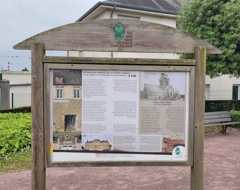
Un bourg aux matériaux de construction contrastés
A town center full of contrasting construction materials
Photographed by James Hulse, June 3, 2025
1. Un bourg aux matériaux de construction contrastés Marker

La commune de Sainte-Mère-Église compte encore nombre de maisons des 18ᵉ et 19ᵉ siècles. Le matériau de construction le plus visible est le calcaire. Il est majoritairement utilisé pour le gros œuvre sous forme de moellons d'extraction locale (pierres de petites dimensions, brutes, maçonnées avec du mortier). La pierre de taille, originaire du secteur de Valognes ou de Caen, est d'usage pour les encadrements des portes et des fenêtres.
Bien que souvent dissimulée derrière un enduit ou un rhabillage de pierre, la terre crue est l'autre matériau utilisé. Deux mises en œuvre possible, soit en matériau de complément pour faire les joints ou combler les vides intérieurs des murs en pierre soit sous forme de bauge, technique localement appelée mâsse. Cette dernière permet d'édifier de la maçonnerie porteuse en terre crue. On la retrouve essentiellement dans les constructions des hameaux périphériques et le plus souvent en usage d'appoint.
Le mariage d'une mise en œuvre soignée de moellons calcaires et de haut de mur en bauge est très caractéristique des constructions du Plain (région située au
this page online
L'église Notre-Dame
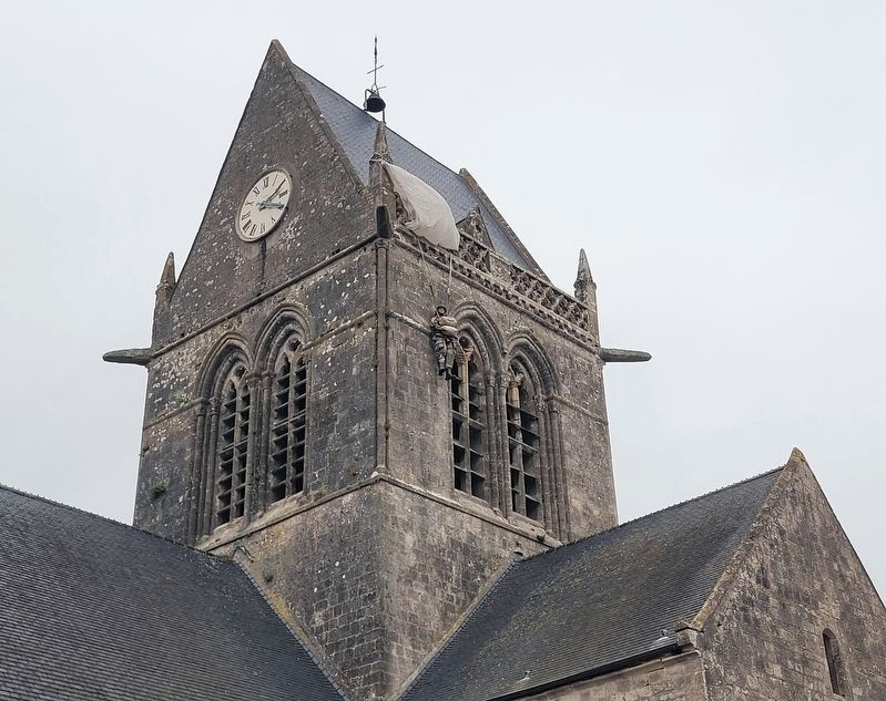
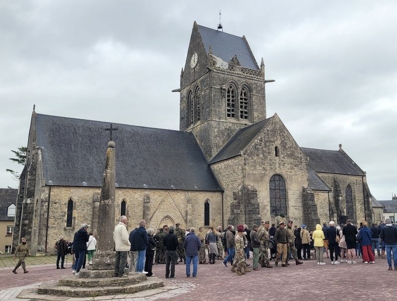
Elle doit sa renommée au célèbre parachutiste suspendu à son clocher en bâtière (deux pans de toit) et à son vitrail commémoratif dédié à Saint-Michel. L'église Notre-Dame est aussi connue par les spécialistes de l'art gothique comme l'un des prototypes du Cotentin d'église du 13ᵉ siècle à nef aveugle. En effet, les nefs des églises d'Auvers, Besneville, Marchésieux, Teurthéville-Bocage et Turqueville ont été édifiées sur le même principe. Il est également à souligner que comme les églises de paroisses proches (Sainte-Marie-du-Mont, Vierville, Neufville, Chef-du-Pont et Lieusaint), l'église Notre-Dame relevait de l'évêché de Bayeux.
En plus de l'ancien hospice datant de 1873, quelques édifices du bourg déclinent certains éléments caractéristiques de la fin du 19ᵉ siècle et du début du 20ᵉ siècle: encadrements en brique ou en pierre de taille sciée mécaniquement, toitures avec croupes.
L'hôtel de ville datant de 1912 se démarque particulièrement avec son avant-corps central, ces neuf travées de baies organisées symétriquement
Photographed by James Hulse, June 3, 2025
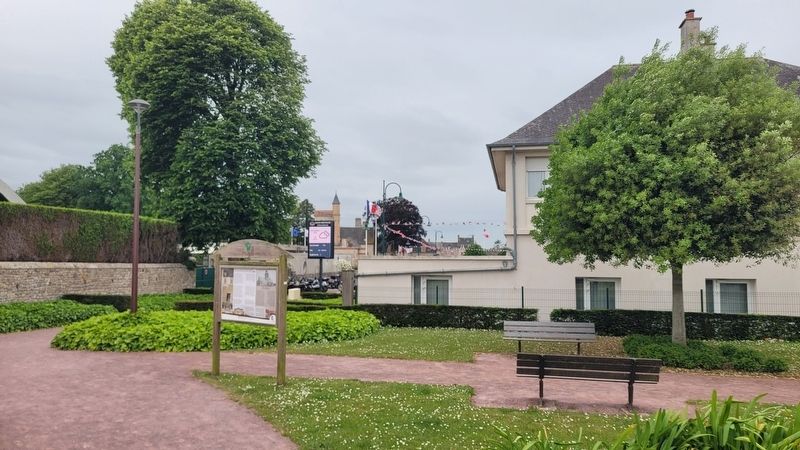
2. The view of the marker along the sidewalk
Légendes
(Photo #1) Maison en moellons et pierres de taille calcaires.
(Photo #2) Mur construit en bauge (terre crue) et en pierre calcaire.
(Photo #3) Encadrement en pierre de taille sciée mécaniquement.
(Photo #4) L'hôtel de ville.
(Photo #5) Encadrement en brique.
(Photo #6) Arrondissement de Valognes. Église de Sainte-Mère-Église.
© Pnr des Marais du Cotentin et du Bessin - mai 2014. Texte : Pnr des Marais du Cotentin et du Bessin. Photographies: M. de Rugy (DIGPC-Région Basse-Normandie); G. Aimard (Pnr des Marais du Cotentin et du Bessin), Iconographie: Archives Départementales de la Manche.
The town of Saint-Mère-Eglise, count a lot of houses of the 18th and 19th century. The most visible construction material is limestone, it is predominantly used for substantial work in the form of rubble, extracted locally (small brute stones, build with mortar). The stone from Valognes or Caen is used for the frames of windows and doors.
Frequently hidden behind render or stone, raw earth (sub soil) is the other building material. Two usages are possible,
Photographed by James Hulse, June 3, 2025
3. The view of the “dummy” American paratrooper on the top of the church steeple
The union of limestone rubble and top of walls made of cob are very characteristic of houses of the "Plain" (area, situated, to the north of Carentan and to the south of Valognes) dated of the 18th and 19th Century.
The church Notre-Dame
The church owes its reputation to the famous parachutist suspended to its bell tower and to its commemorative stained glass, dedicated to Saint-Michel. The Notre Dame church is also known by gothic art specialists as one of the prototypes of Cotentin's churches of the 13th Century to blind nave. Indeed, the naves of the churches of Auvers, Besneville, Marchésieux, Teurthéville-Bocage and Turqueville were built the same way. It is also important to underline that like the churches of nearby parishes (Saint-Marie-du-Mont, Vierville, Neufville, Chef-du-Pont et Lieusaint) the church of Notre
Photographed by James Hulse, June 3, 2025
4. The view of the Church of Sainte-Mère-Église (Notre-Dame Church)
Apart from the ancient hospice dated of 1873, some buildings in the center of town decline certain elements characteristic of the end of the 19th century and beginning of the 20th century: Frames made of brick or of mechanically cut stone, hipped roof structures.
Amongst these buildings, the city hall dated of 1912, particuly stand out due to its prominent central section, its nine bays symmetrically organized and the variety of shapes used for the roof.
Captions
(Photo #1) House built of limestone.
(Photo #2) Wall built of cob (raw earth) and limestone.
(Photo #3) Frames made of mechanically cut stone.
(Photo #4) The city hall.
(Photo #5) Frame made of brick.
(Photo #6) Arrondissement of Valognes. Church of Sainte-Mère-Église.
Erected 2014 by Parc naturel régional des Marais du Cotentin et du Bessin.
Topics. This historical marker is listed in these topic lists: Architecture • Religion & Religious Structures. A significant historical year for this entry is 1873.
Location. 49° 24.532′ N, 1° 18.864′ W. Marker is in Sainte-Mère-Église, Normandie (Normandy), in Manche. It is at the intersection of Rue de la Liberté and Rue Eisenhower, on the left when traveling west on Rue de la Liberté. The marker is located along the sidewalk in the garden area. Touch for map. Marker is in this post office area: Sainte-Mère-Église, Normandie 50480, France. Touch for directions.

Regionally, it is in the North Atlantic Region, Europe, the European Union, Atlantic Europe, the Schengen Area, Western Europe, a coastal Mediterranean country, and the Western World. Historically, it finds itself in what was once a French colony and also the Roman Empire.
Other nearby markers. At least 8 other markers are within walking distance of this marker: Les Cimetières Provisoires / Temporary Cemeteries (a few steps from this marker); Aux morts pour la Patrie / To the fallen for the Fatherland (within shouting distance of this marker); Truck Cargo 6×6 CCKW 353 (within shouting distance of this marker); Symbole du Jour J/ Symbol of D-Day (within shouting distance of this marker); House on Fire at Sainte-Mère-Église (within shouting distance of this marker); A Tous Les Français / To all French People (about 90 meters away, measured in a direct line); M4A4 Sherman (about 90 meters away); 88 mm FLAK 18-36-37-41 (about 90 meters away). Touch for a list and map of all markers in Sainte-Mère-Église.
Credits. This page was last revised on December 13, 2025. It was originally submitted on December 12, 2025, by James Hulse of Medina, Texas. This page has been viewed 48 times since then and 15 times this year. Photos: 1, 2, 3, 4. submitted on December 13, 2025, by James Hulse of Medina, Texas.
