Kula in Maui County, Hawaii — Hawaiian Island Archipelago (Pacific Ocean)
Behold, Hawai'i

Photographed by Darren Jefferson Clay, December 10, 2025
1. Behold Hawai'i Marker
For millennia, Polynesian navigators explored the Pacific in large double-hulled canoes using stars, tides, currents, the wind, and patterns of bird migration. They introduced the concept of kuleana to mālama 'aina (the responsibility to care for the land).
We all share this kuleana and can respect the land by staying on trails, taking nothing, and leaving nothing behind.
[photo caption:]
Polynesian explorers brought 'ilio (dogs), pua'a (pigs), moa (chickens), and more than 20 "canoe" plants, some of which are pictured here, to raise food in their new home.
Erected by National Park Service - U.S. Department of the Interior.
Topics. This historical marker is listed in these topic lists: Asian Americans • Exploration • Settlements & Settlers.
Location. 20° 45.562′ N, 156° 14.808′ W. Marker is in Kula, Hawaii, in Maui County. It can be reached from Haleakala Highway 11.3 miles west of Kekaulike Avenue (Hawaii Highway 377), on the left when traveling west. Located at Headquarters Visitor Center, Haleakalā National Park. Touch for map. Marker
this page online

Regionally, this marker is in Upcountry Maui. Globally, it is in North America, in Polynesia, in the Pacific Ocean, in North Pacific, on the Pacific Rim, in the Western Hemisphere, in the Western World, and in the Anglosphere.
Other nearby markers. At least 8 other markers are within 8 miles of this marker, measured as the crow flies: Stephen Tyng Mather (within shouting distance of this marker); Hawaiian Goose or Nene (Nay-Nay) (within shouting distance of this marker); Wind, Wave and Wings (within shouting distance of this marker); Ranch Wall (approx. 1½ miles away); Haleakalā National Park (approx. 3.1 miles away); Pa Ka‘oao (approx. 3.2 miles away); Holy Ghost Catholic Church (approx. 5.2 miles away); Tam Chow Store/USO/Club Rodeo (approx. 7.7 miles away). Touch for a list and map of all markers in Kula.
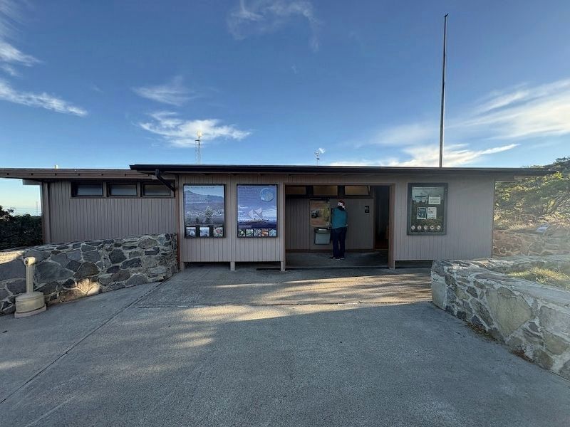
Photographed by Darren Jefferson Clay, December 10, 2025
2. Behold Hawai'i Marker
Credits. This page was last revised on April 15, 2026. It was originally submitted on December 14, 2025, by Darren Jefferson Clay of Duluth, Georgia. This page has been viewed 121 times since then and 91 times this year. Photos: 1, 2. submitted on December 14, 2025, by Darren Jefferson Clay of Duluth, Georgia. • Devry Becker Jones was the editor who published this page.
