
Sainte-Marie-du-Mont in Manche, Normandy, France — Western Europe
La carte
6 juin 1944
⎯⎯⎯
The Map
June 6th, 1944
Photographed by James Hulse, June 6, 2025
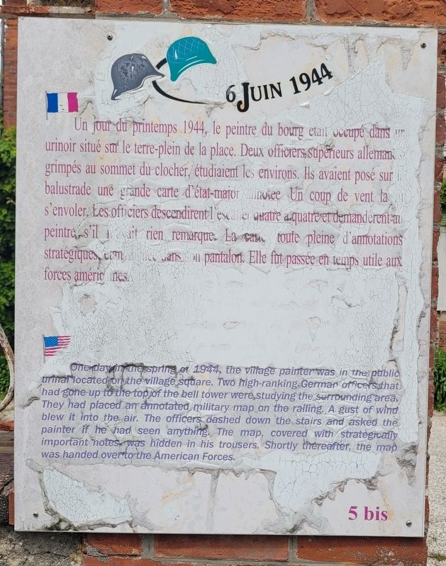
1. La carte / The Map Marker

Un jour du printemps 1944, le peintre du bourg était occupé dans un urinoir situé sur le terre-plein de la place. Deux officiers supérieurs allemands, grimpés au sommet du clocher, étudiaient les environs. Ils avaient posé sur la balustrade une grande carte d’état-major annotée. Un coup de vent la fit s’envoler. Les officiers descendirent l’escalier quatre à quatre et demandèrent au peintre s’il n’avait rien remarqué. La carte, toute pleine d’annotations stratégiques, était cachée dans son pantalon. Elle fut passée en temps utile aux forces américaines.
One day in the spring of 1944, the village painter was in the public urinal located on the village square. Two high-ranking German officers that had gone up to the top of the bell tower were studying the surrounding area. They had placed an annotated military map on the railing. A gust of wind blew it into the air. The officers dashed down the stairs and asked the painter if he had seen anything. The map, covered with strategically important notes, was hidden in his trousers. Shortly thereafter, the map was handed over to the American Forces.
this page online
Topics. This historical marker is listed in this topic list: War, World II. A significant historical year for this entry is 1944.
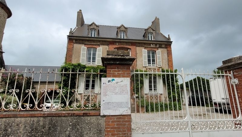
Location. 49° 22.743′ N, 1° 13.554′ W. Marker is in Sainte-Marie-du-Mont, Normandie (Normandy), in Manche. It is on Place de l'Église just east of Rue des Caux, on the left when traveling north. The marker is located along a fence in front of a house. Touch for map. Marker is at or near this postal address: 58 Pl de l'Église, Sainte-Marie-du-Mont, Normandie 50480, France. Touch for directions.

Regionally, it is in the North Atlantic Region, Europe, the European Union, Atlantic Europe, the Schengen Area, Western Europe, a coastal Mediterranean country, and the Western World. Historically, it finds itself in what was once a French colony and also the Roman Empire.
Other nearby markers. At least 8 other markers are within walking distance of this marker: La 101ᵉᵐᵉ division aéroportée américaine / The 101st American Airborne Division (a few steps from this marker); Un duel digne d'un western / A duel worthy of any Western (a few steps from this marker); Toutes les rencontres ne furent pas sanglantes / Not all encounters were bloody
Photographed by James Hulse, June 6, 2025
2. The view of the Map Marker along the street
Also see . . . D-Day, Drop Zone C And Remarkable Bravery At Sainte-Marie-Du-Mont. Normandy Then and Now
Tucked away in the marshy country of the Manche, just 3 ½ miles from an east facing beach, is the village of Saint-Marie-du-Mont. The Mont in question is the slightest hill, raising Notre-Dame church at the heart of the village above occasional floods. It was not a village anyone thought about very much, until June 1944. Now people visit from across the world. That eastern beach is now known as Utah and Saint-Marie-du-Mont was the first community to be liberated on D-Day. A liberation that did not go to plan.(Submitted on December 15, 2025, by James Hulse of Medina, Texas.)
Credits. This page was last revised on December 15, 2025. It was originally submitted on December 14, 2025, by James Hulse of Medina, Texas. This page has been viewed 49 times since then and 24 times this year. Photos: 1, 2. submitted on December 15, 2025, by James Hulse of Medina, Texas.
