
Sainte-Marie-du-Mont in Manche, Normandy, France — Western Europe
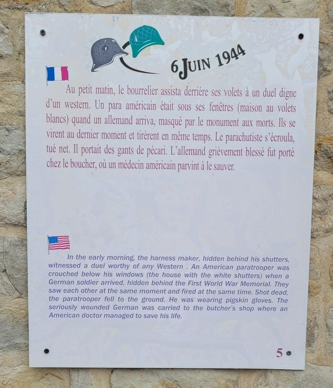
Un duel digne d'un western
6 juin 1944
⎯⎯⎯
A duel worthy of any Western
June 6th, 1944
Photographed by James Hulse, June 6, 2025
1. Un duel digne d'un western / A duel worthy of any Western Marker

Au petit matin, le bourrelier assista derrière ses volets à un duel digne d'un western. Un para américain était sous ses fenêtres (maison au volets blancs) quand un allemand arriva, masqué par le monument aux morts. Ils se virent au dernier moment et tirèrent en même temps. Le parachutiste s'écroula, tué net. Il portait des gants de pécari. L'allemand grièvement blessé fut porté chez le boucher, où un médecin américain parvint à le sauver.
In the early morning, the harness maker, hidden behind his shutters, witnessed a duel worthy of any Western. An American paratrooper was crouched below his windows (the house with the white shutters) when a German soldier arrived, hidden behind the First World War Memorial. They saw each other at the same moment and fired at the same time. Shot dead, the paratrooper fell to the ground. He was wearing pigskin gloves. The seriously wounded German was carried to the butcher's shop where an American doctor managed to save his life. (Marker Number 5.)
Topics. This historical marker is listed in this topic list: War, World II.
Location. 49° 22.74′ N,
this page online

Regionally, it is in the North Atlantic Region, Europe, the European Union, Atlantic Europe, the Schengen Area, Western Europe, a coastal Mediterranean country, and the Western World. Historically, it finds itself in what was once a French colony and also the Roman Empire.
Other nearby markers. At least 8 other markers are within walking distance of this marker: La 101ᵉᵐᵉ division aéroportée américaine / The 101st American Airborne Division (a few steps from this marker); La carte / The Map (a few steps from this marker); Déserteur allemand / German Deserter (within shouting distance of this marker); Un parachutiste américain / An American paratrooper (within shouting distance of this marker);
Photographed by James Hulse, June 6, 2025
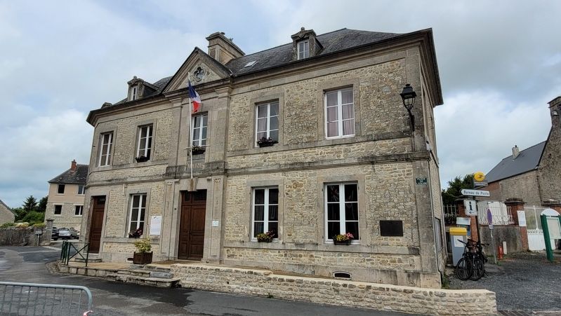
2. The marker is located on the left side of the building
Also see . . . D-Day, Drop Zone C And Remarkable Bravery At Sainte-Marie-Du-Mont. Normandy Then and Now
Tucked away in the marshy country of the Manche, just 3 ½ miles from an east facing beach, is the village of Saint-Marie-du-Mont. The Mont in question is the slightest hill, raising Notre-Dame church at the heart of the village above occasional floods. It was not a village anyone thought about very much, until June 1944. Now people visit from across the world. That eastern beach is now known as Utah and Saint-Marie-du-Mont was the first community to be liberated on D-Day. A liberation that did not go to plan.(Submitted on December 15, 2025, by James Hulse of Medina, Texas.)
Credits. This page was last revised on December 15, 2025. It was originally submitted on December 14, 2025, by James Hulse of Medina, Texas. This page has been viewed 46 times since then and 22 times this year. Photos: 1, 2. submitted on December 15, 2025, by James Hulse of Medina, Texas.
