Near Dunmor in Muhlenberg County, Kentucky — The American South (East South Central)
Hunt Settlement
Photographed by Duane and Tracy Marsteller, December 1, 2025
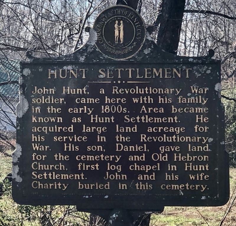
1. Hunt Settlement Marker
John Hunt, a Revolutionary War soldier, came here with his family in the early 1800s. Area became known as Hunt Settlement. He acquired large land acreage for his service in the Revolutionary War. His son, Daniel, gave land for the cemetery and Old Hebron Church, first log chapel in Hunt Settlement. John and his wife Charity buried in this cemetery.
Erected 1975 by Kentucky Historical Society and Kentucky Department of Transportation. (Marker Number 1521.)
Topics and series. This historical marker is listed in this topic list: Settlements & Settlers. In addition, it is included in the Kentucky Historical Society series list.
Location. 37° 6.907′ N, 86° 55.337′ W. Marker is near Dunmor, Kentucky, in Muhlenberg County. It is at the intersection of Kentucky Route 949 and Hunt Road, on the right when traveling east on Kentucky Route 949. Touch for map. Marker is at or near this postal address: 5311 KY-949, Dunmor KY 42339, United States of America. Touch for directions.

Regionally, this marker is in the Tri-State Region and specifically in the Pennyroyal Region.
this page online
Other nearby markers. At least 7 other markers are within 17 miles of this marker, measured as the crow flies: James Forgy – Pioneer (approx. 5.1 miles away); Suffolk (approx. 6.9 miles away); Capt. Henry Rhoads, Jr. (approx. 8.3 miles away); Airdrie Furnace Site / Iron Made in Kentucky (approx. 9.9 miles away); Mount Zion Presbyterian Church (approx. 15.4 miles away); John Prine (approx. 16.6 miles away); The Everly Brothers (approx. 16.6 miles away).

Photographed by Duane and Tracy Marsteller, December 1, 2025
2. Hunt Settlement Marker

Photographed by Duane and Tracy Marsteller, December 1, 2025
3. John and Charity Hunt Gravesites
Credits. This page was last revised on December 17, 2025. It was originally submitted on December 15, 2025, by Duane and Tracy Marsteller of Murfreesboro, Tennessee. This page has been viewed 100 times since then and 66 times this year. Photos: 1, 2, 3. submitted on December 15, 2025, by Duane and Tracy Marsteller of Murfreesboro, Tennessee. • J. Makali Bruton was the editor who published this page.
