Near Red Cliff in Eagle County, Colorado — The American Mountains (Southwest)
Rock Climbing at Camp Hale
10th Mountain Division
| — | U.S. Army | — |

Photographed by Cosmos Mariner, July 27, 2025
1. Rock Climbing at Camp Hale Marker
As mountain troops, soldiers of the 10th Mountain Division became accomplished rock climbers. They trained on the cliffs in front of you — summer and winter, regardless of weather. Safety, not “hot dogging”, was paramount. By today's standards, the equipment available then was primitive.
Engineering companies of “the 10th” became skilled at building monkey bridges and tramways in rugged mountain terrain. Why? To keep their troops supplied. Medics, likewise, let nothing stop them from treating and retrieving their wounded. Climbers like the man shown above weren’t hanging on for dear life, they were on a mission.
This project was partially funded by a State Historic Fund grant award from the Colorado Historical Society. Other partners who helped fund this project are: The 10th Mountain Division Foundation, Camp Jeep™, the National Forest Foundation and the Forest Service. Photos courtesy of the Denver Public Library, Western History Department. (Marker Number 7.)
Topics. This historical marker is listed in this topic list: War, World II.
Location. 39° 26.263′ N, 106° 19.006′ W.
this page online

Regionally, this marker is in the Colorado High Rockies. It is also in the American Mountain West. Globally, it is in North America, the Rocky Mountains, the Western Hemisphere, the Western World, and the Anglosphere.
Other nearby markers. At least 8 other markers are within walking distance of this marker: Entertainment Camp Hale (approx. 0.3 miles away); Construction of Camp Hale (approx. 0.3 miles away); Camp Hale (approx. half a mile away); Forces Converge in the Eagle River Valley (approx. half a mile away); Your Path Here Intersects with 10th Mountain Soldiers (approx. half a mile away); Camp Hale-Continental Divide National Monument (approx. half a mile away); Preparing for War in the Eagle River Valley
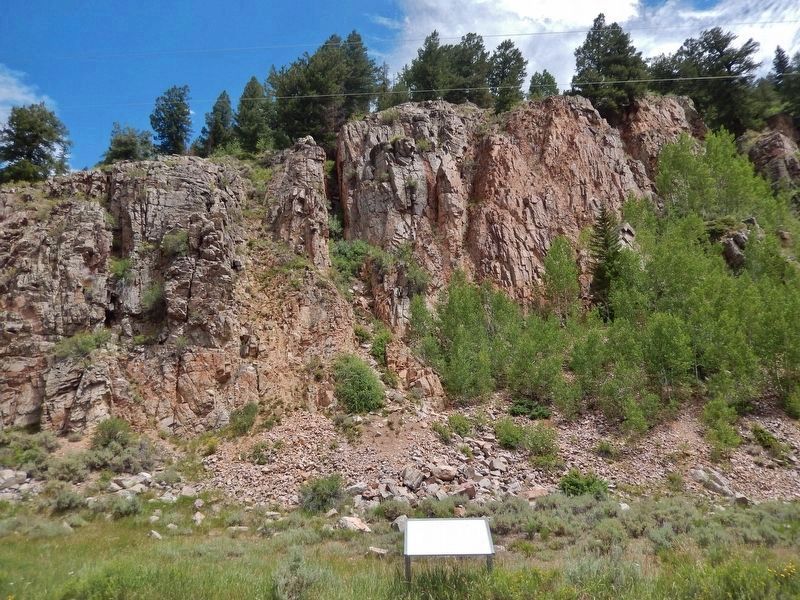
Photographed by Cosmos Mariner, July 27, 2025
2. Rock Climbing at Camp Hale Marker
Looking east from East Fork Eagle Road. There is extreme glare on the marker at this time of day.
Related markers. Click here for a list of markers that are related to this marker. Camp Hale
Also see . . . Camp Hale (Wikipedia).
Excerpt: Camp Hale was a U.S. Army training facility in the western United States, constructed in 1942 for what became the 10th Mountain Division. Located in central Colorado between Red Cliff and Leadville in the Eagle River Valley at an elevation of 9,238 feet, it was named for General Irving Hale. Onslow S. Rolfe, who had developed mountain warfare techniques as commander of the 87th Mountain Infantry Regiment, was selected to command Camp Hale.(Submitted on December 18, 2025, by Cosmos Mariner of Cape Canaveral, Florida.)Soldiers were trained in mountain climbing, Alpine and Nordic skiing, cold-weather survival, and various weapons and ordnance. When it was in full operation, approximately 15,000 soldiers were housed there.
Credits. This page was last revised on December 19, 2025. It was originally submitted on December 17, 2025, by Cosmos Mariner of Cape Canaveral, Florida. This page has been viewed 134 times since then and 96 times this year. Photos: 1, 2. submitted on December 18, 2025, by Cosmos Mariner of Cape Canaveral, Florida.
