Near Big Spring in Howard County, Texas — The American South (West South Central)
Moore School
Photographed by Bill Kirchner, July 11, 2015
1. Moore School Marker
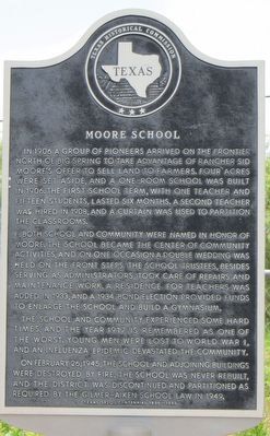
In 1906 a group of pioneers arrived on the frontier north of Big Spring to take advantage of rancher Sid Moore's offer to sell land to farmers. Four acres were set aside, and a one-room school was built in 1906. The first school term, with one teacher and fifteen students, lasted six months. A second teacher was hired in 1908, and a curtain was used to partition the classrooms.
Both school and community were named in honor of Moore. The school became the center of community activities, and on one occasion a double wedding was held on the front steps. The school trustees, besides serving as administrators, took care of repairs and maintenance work. A residence for teachers was added in 1933, and a 1934 bond election provided funds to enlarge the school and build a gymnasium.
The school and community experienced some hard times, and the year 1917 is remembered as one of the worst. Young men were lost to World War I, and an influenza epidemic devastated the community.
On February 26, 1945, the school and adjoining buildings were destroyed by fire. The school was never rebuilt, and the district was discontinued and partitioned as required by the Gilmer-Aiken School Law in 1949.
Erected 1986 by Texas Historical Commission. (Marker Number 3459.)
Topics. This historical marker is listed in this topic list: Education. A significant historical month for this entry is February 1793.
Location. 32° 18.544′ N, 101° 31.336′ W. Marker has been reported damaged. Marker is near Big Spring, Texas, in Howard County. It is at the intersection of Moore School Road and Fairview Road, on the left when traveling west on Moore School Road. Touch for map. Marker is at or near this postal address: 913 Moore School Rd, Big Spring TX 79720, United States of America. Touch for directions.

Regionally,
this page online
Other nearby markers. At least 8 other markers are within 5 miles of this location, measured as the crow flies: Masonic Cemetery (approx. 3.8 miles away); St. Thomas Catholic Church (approx. 4.2 miles away); The J. & W. Fisher Company (approx. 4.6 miles away); Big Spring Hardware Company (approx. 4.6 miles away); A Historical Big Spring Meat Market (approx. 4.6 miles away); Potton House (approx. 4.7 miles away); The Seventh Earl of Aylesford (approx. 4.7 miles away); Settles Hotel (approx. 4.8 miles away). Touch for a list and map of all markers in Big Spring.
Photographed by Jeff Leichsenring, December 15, 2025
2. Damaged Moore School Marker
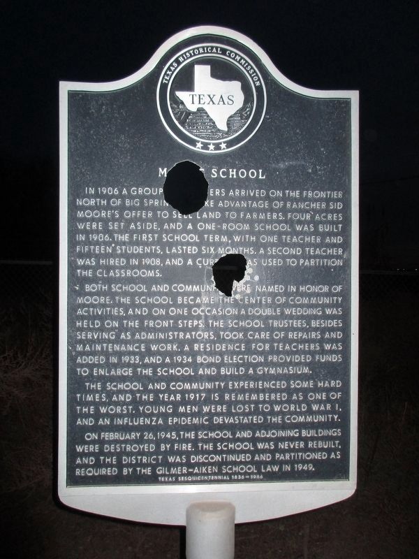
Unfortunately, the marker has weathered.
Photographed by Bill Kirchner, July 11, 2015
3. Moore School Marker
Photographed by Bill Kirchner, July 11, 2015
4. Moore School Marker
Credits. This page was last revised on December 19, 2025. It was originally submitted on August 2, 2015, by Bill Kirchner of Tucson, Arizona. This page has been viewed 1,573 times since then and 135 times this year. Last updated on December 18, 2025, by Jeff Leichsenring of Garland, Texas. Photos: 1. submitted on August 2, 2015, by Bill Kirchner of Tucson, Arizona. 2. submitted on December 18, 2025, by Jeff Leichsenring of Garland, Texas. 3, 4. submitted on August 2, 2015, by Bill Kirchner of Tucson, Arizona. • Devry Becker Jones was the editor who published this page.
