Marion in Marion County, Ohio — The American Midwest (Great Lakes)
Jacob's Well
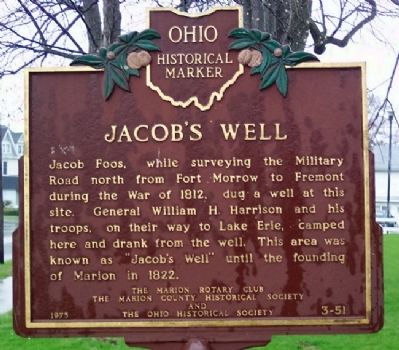
Jacob Foos, while surveying the Military Road north from Fort Morrow to Fremont during the War of 1812, dug a well at this site. General William H. Harrison and his troops, on their way to Lake Erie, camped here and drank from the well. This area was known as "Jacob's Well" until the founding of Marion in 1822.
Erected 1975 by The Marion Rotary Club, The Marion County Historical Society and The Ohio Historical Society. (Marker Number 3-51.)
Topics and series. This historical marker is listed in these topic lists: Patriots & Patriotism • Roads & Vehicles • Settlements & Settlers • War of 1812. In addition, it is included in the Ohio Historical Society / The Ohio History Connection, and the Rotary International series lists. A significant historical year for this entry is 1812.
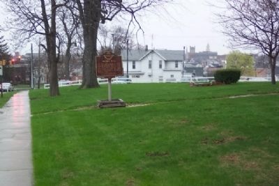
Location. 40° 34.923′ N, 83° 7.676′ W. Marker is in Marion, Ohio, in Marion County. Marker is at the intersection of Delaware Avenue (Ohio Route 423) and Main Street, on the right when traveling north on Delaware Avenue. Touch for map. Marker is at or near this postal address: 400 Delaware Avenue, Marion OH 43302, United States of America. Touch for directions.
Other nearby markers. At least 8 other markers are within walking distance of this marker. Marion Post Office (approx. 0.4 miles away); Ornamental Stone (approx. 0.4 miles away); First Bell Brought to Marion County (approx. 0.4 miles away); The Rooster Church (approx. 0.4 miles away); Marion County Courthouse (approx. half a mile away); The Marion County Trial of Bill Anderson (approx. half a mile away); Marion County Revolutionary Soldiers Memorial (approx. half a mile away); War Memorials (approx. half a mile away). Touch for a list and map of all markers in Marion.
Related markers. Click here for a list of markers that are related to this marker. To better understand the relationship, study each marker in the order shown.
Credits. This page was last revised on June 16, 2016. It was originally submitted on March 24, 2010, by William Fischer, Jr. of Scranton, Pennsylvania. This page has been viewed 2,537 times since then and 68 times this year. Photos: 1, 2. submitted on March 25, 2010, by William Fischer, Jr. of Scranton, Pennsylvania.

