Near Dolores in Montezuma County, Colorado — The American Mountains (Southwest)
Big Bend & McPhee
Photographed by Cosmos Mariner, July 17, 2025
1. Big Bend & McPhee Marker
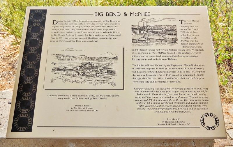
During the late 1870s, the ranching community of Big Bend was founded at the bend in the river valley to your right. Even in its heyday, only about 100 people lived in the community. Despite its meager population, Big Bend boasted a blacksmith shop, saloon, sawmill, hotel and two general merchandise stores. When the Denver & Rio Grande Railroad bypassed Big Bend on its way to Dolores and Rico in 1891, the town was doomed. Residents moved to the new town of Dolores and Big Bend was abandoned.
Colorado conducted a state census in 1885, but the census takers completely overlooked the Big Bend district.
—Duane A. Smith
in The River of Sorrows
National Park Service, Denver, CO
The New Mexico Lumber Company built the town of McPhee in 1924, about three miles downstream from Big Bend. McPhee was the largest community in Montezuma County and the largest lumber mill town in Colorado at the time. At the peak of its operation in 1927, McPhee boasted 1,400 residents. Over 40 miles of narrow gauge track connected McPhee to surrounding logging camps and to the town of Dolores.
The lumber mill was hit hard by the Depression. The mill shut
this page online
Company housing was available for workers at McPhee and [rent] was automatically deducted from wages. Anglo housing rented for $10 a month. These simple, five-room houses included running water and electricity, but no indoor bathrooms. Hispanic housing was located ¾ of a mile from the mill site. The three-room houses rented at $2 a month, rarely had electricity and had no running water. Kerosene lanterns were used and outdoor faucets were nearby. The company provided free firewood and an ice house was located near the mill pond.
—Lisa Mausolf
in The River of Sorrows
National Park Service, Denver, CO
Erected by The Colorado Historical Society, the Bureau of Land Management, the Family of Nellie Mulnix Joy and the Frankston Family.
Topics. This historical marker is listed in these topic lists: Industry & Commerce •
Photographed by Cosmos Mariner, July 17, 2025
2. Big Bend & McPhee Marker
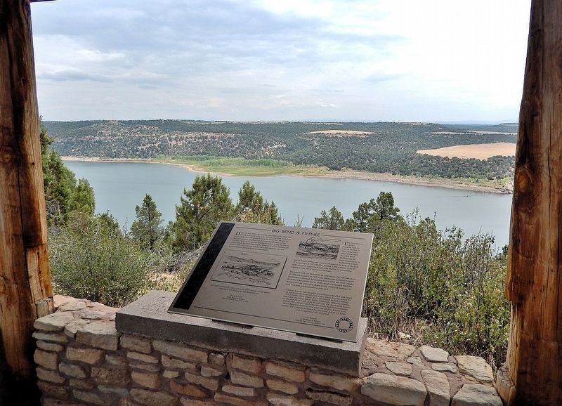
Looking east from the McPhee Reservoir Overlook.
Location. 37° 28.715′ N, 108° 32.771′ W. Marker is near Dolores, Colorado, in Montezuma County. It can be reached from State Highway 184 at milepost 7, on the right when traveling west. The marker is at the McPhee Reservoir Overlook on the Escalante Pueblo Trail, near the Canyons of the Ancients National Monument Visitor Center. Touch for map. Marker is at or near this postal address: 27501 Colorado Highway 184, Dolores CO 81323, United States of America. Touch for directions.

Regionally, this marker is in the American Mountain West, on the Colorado Plateau, and at the Four Corners. Globally, it is in North America, the Rocky Mountains, the Western Hemisphere, the Western World, and the Anglosphere. Historically, it finds itself in what was once the territory of the Ancestral Puebloans and also Mexico’s Alta California.
Other nearby markers. At least 8 other markers are within walking distance of this marker: Dolores / McPhee Reservoir (here, next to this marker); Wildlife or Relatives? (a few steps from this marker); Prickly Pear Cactus (within shouting distance of this marker); Big Sagebrush (within shouting distance of this marker); Juniper (within shouting distance of this marker); Piñon (within shouting distance of this marker); Farmland... Now & Then (within shouting distance of this marker); Great Sage Plain, Colorado and Utah (within shouting distance of this marker). Touch for a list and map of all markers in Dolores.
Also see . . .
1. McPhee, Colorado Ghost Town (United States Ghost Towns).
(By Jason Smith) Excerpt: McPhee was Colorado’s largest lumber town, established in 1924 by the New Mexico Lumber Company in Montezuma County. You’ll find its remarkable history marked by producing over half of Colorado’s lumber at its peak in 1927. The self-contained industrial community housed 600-1,000 residents before operations ceased in 1946. After a devastating fire in 1948, the town was ultimately submerged when McPhee Reservoir was completed in 1985.(Submitted on December 26, 2025, by Cosmos Mariner of Cape Canaveral, Florida.)
2. McPhee Reservoir (Wikipedia).
Excerpt: McPhee Reservoir is named for McPhee, Colorado, a company town founded by the New Mexico Lumber Company that is now submerged under the reservoir. In 1927, the McPhee sawmill produced over half of Colorado's lumber. The town housed up to 1,500 employees. The sawmill closed in 1946.(Submitted on December 26, 2025, by Cosmos Mariner of Cape Canaveral, Florida.)
Credits. This page was last revised on December 26, 2025. It was originally submitted on December 23, 2025, by Cosmos Mariner of Cape Canaveral, Florida. This page has been viewed 64 times since then and 24 times this year. Photos: 1, 2. submitted on December 26, 2025, by Cosmos Mariner of Cape Canaveral, Florida.
