
Whakarewarewa in Rotorua in Rotorua District, Bay of Plenty Region, New Zealand — Southwestern Pacific Ocean
New Zealand Centennial
1840-1940
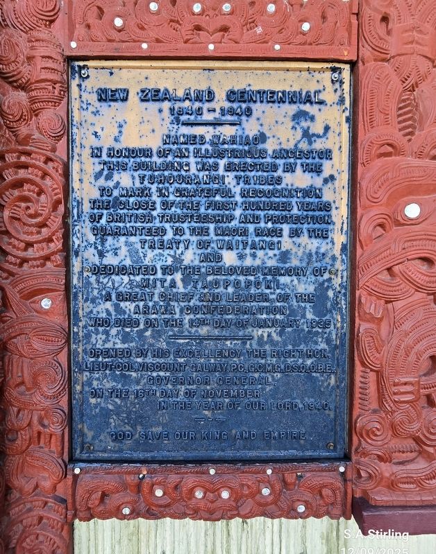
Photographed by Shirley A Stirling, December 9, 2025
1. New Zealand Centennial Marker
Named Wariaod in honour of an illustrious ancestor, this building was erected by the Tuhourangi tribes, to mark in grateful recognition The close of the first hundred years Of British trusteeship and protection. Guaranteed to the Maori race by the Treaty of Waitangi and dedicated to the beloved memory of Mita Taupopokl a great chief and leader of the Araba Confederation who died on the 14th day of January 1935.
Opened by his excellency the right Hon. Lieut-Col. Viscount Galway PC.C.C.M.G.Dso.OBE. Governor General On the 16th day of November in the year of our Lord, 1940. God save our King and Empire.
Erected 1940.
Topics. This historical marker is listed in these topic lists: Peace • Settlements & Settlers. A significant historical date for this entry is January 14, 1935.
Location. 38° 9.75′ S, 176° 15.406′ E. Marker is in Rotorua, Bay of Plenty Region, in Rotorua District. It is in Whakarewarewa. It is on Huarere Street near Hinganoa Drive, on the right when traveling east. This is at the Whakarewarewa Living Maori Village. Touch for map. Marker is at or near this postal address: 1 Hinganoa Dr, Rotorua, Bay of Plenty
this page online

Regionally, it is in Oceania, in Australasia, in Polynesia, in the Pacific Ocean, on the Ring of Fire, on the Pacific Rim, in the Western World, and in the Anglosphere. Historically, it finds itself in what was once a British colony.
Other nearby markers. At least 8 other markers are within 3 kilometers of this marker, measured as the crow flies: Te Arawa Hāhi Mihinare / Te Arawa Anglican Church (about 120 meters away, measured in a direct line); Roto Kanapanapa (approx. 0.3 kilometers away); Priest & Radium Hot Springs (approx. 2.7 kilometers away); Boer War 1899-1902 (approx. 3 kilometers away); Wylie Memorial (approx. 3 kilometers away); Government Gardens (approx. 3 kilometers away); Prince’s Gate Arches (approx. 3.1 kilometers away); Nga Whakairo Tupuna (Ancestral Carvings) at the Hinemoa and Arawa Street entrances to the gardens (approx. 3.1 kilometers away). Touch for a list and map of all markers in Rotorua.
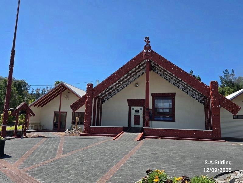
Photographed by Shirley A Stirling, December 9, 2025
2. Meeting house.
Te Pākira Marae and Wahiao meeting house, a meeting place of the Tūhourangi hapū of Ngāti Puta, Ngāti Uruhina, Ngāti Wāhiao, Tūhourangi and Ngāti Taoi.
The marker is to the right of the front door.
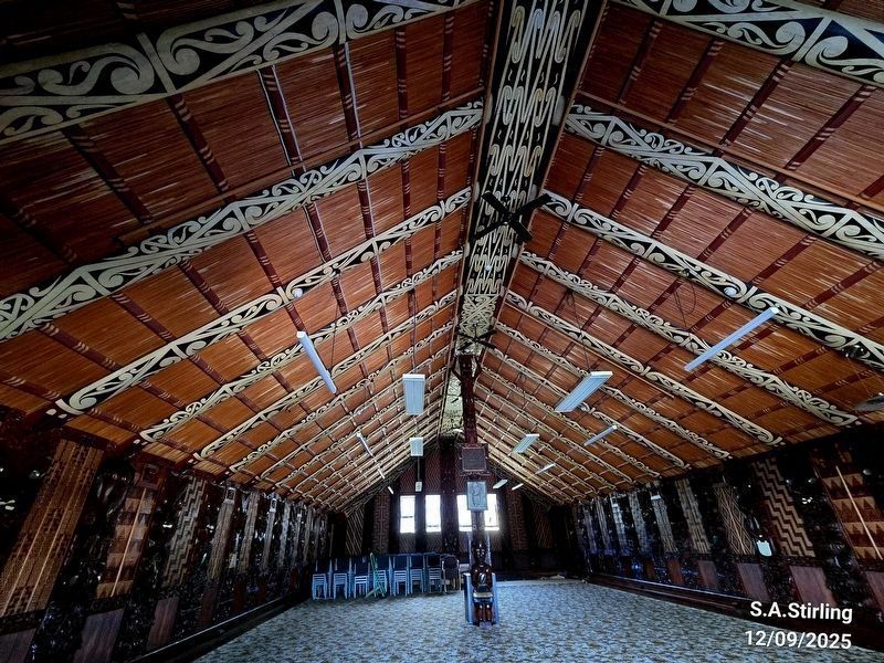
Photographed by Shirley A Stirling, December 9, 2025
3. Meeting house interior.
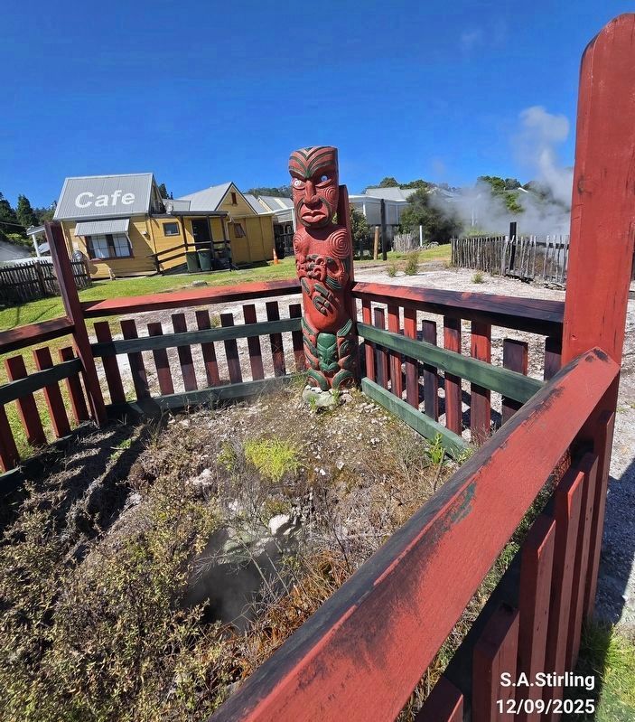
Photographed by Shirley A Stirling, December 9, 2025
4. Totem outside the building.
Note the steam pool in the background.
Credits. This page was last revised on December 29, 2025. It was originally submitted on December 8, 2025, by Shirley A Stirling of Lacey, Washington. This page has been viewed 63 times since then and 28 times this year. Last updated on December 23, 2025, by Shirley A Stirling of Lacey, Washington. Photos: 1. submitted on December 8, 2025, by Shirley A Stirling of Lacey, Washington. 2, 3, 4. submitted on December 23, 2025, by Shirley A Stirling of Lacey, Washington. • Devry Becker Jones was the editor who published this page.
