Near Mathis in Live Oak County, Texas — The American South (West South Central)
Town of Dinero
Photographed by Dave W, December 26, 2025
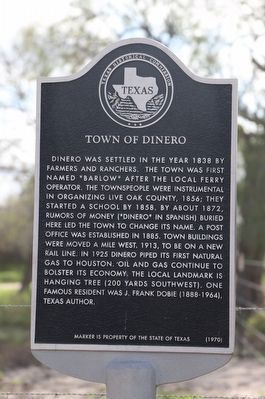
1. Town of Dinero Marker
Dinero was settled in the year 1838 by farmers and ranchers. The town was first named "Barlow" after the local ferry operator. The townspeople were instrumental in organizing Live Oak County, 1856; they started a school by 1858. By about 1872, rumors of money ("dinero" in Spanish) buried here led the town to change its name. A post office was established in 1885. Town buildings were moved a mile west, 1913, to be on a new rail line. In 1925 Dinero piped its first natural gas to Houston. Oil and gas continue to bolster its economy. The local landmark is hanging tree (200 yards southwest). One famous resident was J. Frank Dobie (1888-1964), Texas author.
Erected 1970 by Texas Historical Commission. (Marker Number 6290.)
Topics. This historical marker is listed in these topic lists: Industry & Commerce • Settlements & Settlers. A significant historical year for this entry is 1856.
Location. 28° 13.635′ N, 97° 57.675′ W. Marker is near Mathis, Texas, in Live Oak County. It is at the intersection of Farm to Market Road 534 and County Road 349, on the right when traveling east on Road 534. Touch for map. Marker is in this post office area: George West TX 78022, United States of America. Touch for directions.

Regionally, this marker is in South Texas. It is also in the American South. Globally, it is in North America, a Gulf of Mexico state, the Western Hemisphere, the Western World, and the Anglosphere. Historically, it finds itself in what was once New Spain, the Republic of Texas, and one of the Confederate States of America.
Other nearby markers. At least 8 other markers are within 12 miles of this marker, measured as the crow flies: Gussettville (approx. 6.9 miles away); Lagarto Cemetery (approx. 7 miles away); Charter Oak (approx. 7 miles away); Lagarto College (approx. 7.6 miles away);
this page online
Another marker is no longer nearby. Fort Ramirez (was approx. 7.8 miles away but has been confirmed missing).
Related markers. Click here for a list of markers that are related to this marker.
Also see . . . TSHA site with additional information about Dinero.
Dinero is on Farm Road 534 some ten miles southeast of George West in southeastern Live Oak County. The town was first named Barlow's Ferry, after E. Barlow, who in 1846 ran ferries across the Nueces River for local ranchers.(Submitted on January 1, 2026, by Dave W of Co, Colorado.)
Photographed by Dave W, December 26, 2025
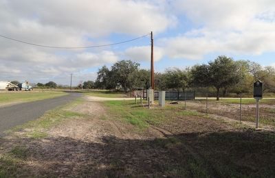
2. Town of Dinero Marker
Looking east at the curve on CR-534
Credits. This page was last revised on January 1, 2026. It was originally submitted on January 1, 2026, by Dave W of Co, Colorado. This page has been viewed 48 times since then. Photos: 1, 2. submitted on January 1, 2026, by Dave W of Co, Colorado. • James Hulse was the editor who published this page.
