Page in Coconino County, Arizona — The American Mountains (Southwest)
USGS Guesthouse/Spencer Bunkhouse

Photographed by Jeremy Snow, December 7, 2025
1. USGS Guesthouse Marker
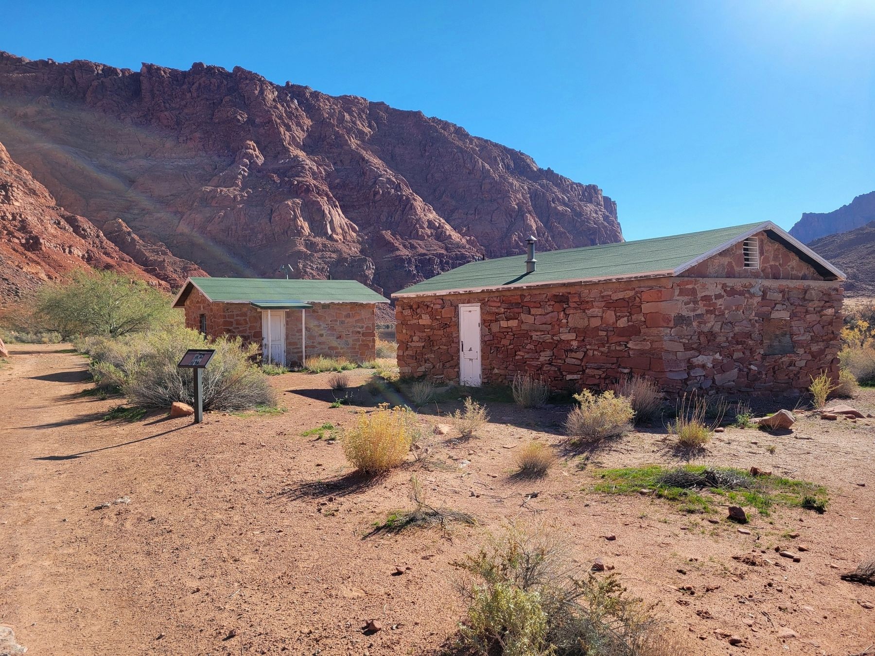
USGS Guesthouse
U.S. Geological Survey (USGS)
Built 1950
The USGS established a presence here as part of the Colorado River Compact, a 1922 water rights agreement. Using a cable car to measure the river's flow, they ensured proper water sharing between neighboring states. The USGS constructed this guesthouse using stones from demolished Spencer buildings.
Spencer Bunkhouse
Sleeping quarters for gold miners
Built 1911
Ferryman Jerry Johnson turned the last of Charles H. Spencer's crew bunkhouses into a school in 1921-25. In 1947, the USGS remodeled it as a residence, then a silt laboratory.
Erected by Glen Canyon National Recreation Area.
Topics. This historical marker is listed in these topic lists: Education • Industry & Commerce. A significant historical year for this entry is 1911.
Location. 36° 51.986′ N, 111° 35.04′ W. Marker is in Page, Arizona, in Coconino County. It can be reached from Spencer Trail. Marker located along the Historic District River Trail. Touch for map. Marker is at or near this postal address: Spencer Trail, Marble Canyon AZ 86036, United States of America. Touch for directions.

Regionally,
this page online
Other nearby markers. At least 8 other markers are within walking distance of this marker: Mining the Chinle Shale 1910-11 (within shouting distance of this marker); Water Intake (within shouting distance of this marker); Spencer Boiler (within shouting distance of this marker); Lees Ferry (within shouting distance of this marker); Historic District River Trail (about 400 feet away, measured in a direct line); a different marker also named Lee's Ferry (about 400 feet away); American Placer Corporation Office (about 400 feet away); Lees Ferry Fort (about 400 feet away). Touch for a list and map of all markers in Page.
Photographed by Jeremy Snow, December 7, 2025
2. USGS Guesthouse/Spencer Bunkhouse Marker
Credits. This page was last revised on January 2, 2026. It was originally submitted on January 1, 2026, by Jeremy Snow of Cedar City, Utah. This page has been viewed 46 times since then. Photos: 1, 2. submitted on January 1, 2026, by Jeremy Snow of Cedar City, Utah. • Andrew Ruppenstein was the editor who published this page.
