
Somerville in Somerset County, New Jersey — The American Northeast (Mid-Atlantic)
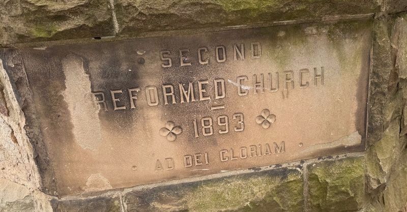
Second Reformed Church
100 West Main Street
| — | 1893 | — |

Topics. This historical marker is listed in these topic lists: Architecture • Religion & Religious Structures. A significant historical year for this entry is 1834.
Location. 40° 34.16′ N, 74° 36.893′ W. Marker is in Somerville, New Jersey, in Somerset County. It is at the intersection of West Main Street (New Jersey Route 28) and Union Street on West Main Street. Touch for map. Marker is at or near this postal address: 100 W Main St, Somerville NJ 08876, United States of America. Touch for directions.

Regionally, this marker is in New Jersey’s North Jersey, specifically in Central Jersey, in Greater Princeton, and in the New York City Metropolitan Area. It is also in the American Northeast and in the Mid-Atlantic. Globally, it is in the North Atlantic Region, North America, the Western Hemisphere, the Western World, and the Anglosphere. Historically,
this page online
Other nearby markers. At least 8 other markers are within walking distance of this marker: Ruth St. Denis (a few steps from this marker); 150 West Main Street (about 400 feet away, measured in a direct line); Thompson-Gaston Building (about 500 feet away); Former Public Library (about 500 feet away); Fireman's Museum (approx. 0.2 miles away); West End Building (approx. 0.2 miles away); Former Second National Bank (approx. 0.2 miles away); Somerset County 9/11 Memorial and Clock Tower (approx. 0.2 miles away). Touch for a list and map of all markers in Somerville.

Photographed by Devry Becker Jones (CC0), January 2, 2026
2. United Reformed Church, historically the Second Reformed Church
Credits. This page was last revised on January 3, 2026. It was originally submitted on January 3, 2026, by Devry Becker Jones of Washington, District of Columbia. This page has been viewed 45 times since then. Photos: 1, 2, 3. submitted on January 3, 2026, by Devry Becker Jones of Washington, District of Columbia.
