Downtown in Fresno in Fresno County, California — The American West (Pacific Coastal)
Green Bush Spring
Photographed by Lester J Letson
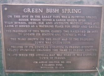
1. Green Bush Spring Marker
On this spot in the early days was a flowing spring beside which stood a large green bush. Wild horses, deer, elk and antelope watered here and it served as a watering place for sheep and cattle.
The presence of this water caused the railroad in 1872 to locate its station and townsite here.
The name shown on the first map proposed town was Green Bush.
Because of its central location in Fresno County, Leland Stanford changed the name to Fresno Station.
In 1873 when the official map was filed it was entitled Town of Fresno.
Erected 1964 by E Clampus Vitus. (Marker Number 6.)
Topics and series. This historical marker is listed in these topic lists: Natural Resources • Railroads & Streetcars • Settlements & Settlers. In addition, it is included in the E Clampus Vitus series list. A significant historical month for this entry is October 1878.
Location. 36° 44.088′ N, 119° 47.488′ W. Marker is in Fresno, California, in Fresno County. It is in Downtown. It can be reached from Mariposa Street just south of Fulton Street. Touch for map. Marker is at or near this postal address: 1111 Fulton St, Fresno CA 93721,
this page online

Regionally, this marker is in the San Joaquin Valley, specifically in the Central Valley, and in the Sierra Nevada. It is also on the American Pacific Coast. Globally, it is in North America, on the Ring of Fire, on the Pacific Rim, in the Western Hemisphere, in the Western World, and in the Anglosphere. Historically, it finds itself in what was once New Spain and also Mexico’s Alta California.
Other nearby markers. At least 8 other markers are within walking distance of this marker: Site of the Fresno Free Speech Fight (within shouting distance of this marker); Fresno County Courthouse (about 600 feet away, measured in a direct line); Lao Hmong American War Memorial (about 700 feet away); Dr. Martin Luther King, Jr. (about 700 feet away); William Saroyan (about 700 feet away); Honoring the Ex-Braceros and Their Contributions (approx. 0.2 miles away); Purple Heart Memorial (approx. 0.2 miles away); Fresno (approx. 0.2 miles away). Touch for a list and map of all markers in Fresno.
More about this marker. The Marker was relocated by the City of Fresno to a location
Photographed by Lester J Letson, circa 2007
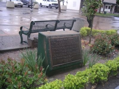
2. Green Bush Spring Marker
Regarding Green Bush Spring. The spring was capped off in the basement of the former J.C. Penney's building on the Fulton Mall in the 1960's. The Penney's building is just the other side of the Helm Building. When last checked in the 1980's, when the cap was removed, clear water flowed freely into the basement from the spring. It has remained capped off since then.
The discovery of the spring is what ultimately led to Fresno being located where it is today.
Photographed by Lester J Letson
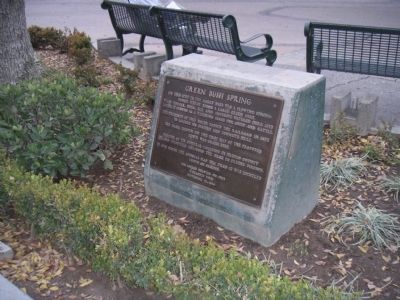
3. Green Bush Spring Marker
Credits. This page was last revised on January 5, 2026. It was originally submitted on February 27, 2010, by Lester J Letson of Fresno, California. This page has been viewed 4,562 times since then and 174 times this year. Last updated on January 3, 2026, by Rover Spotts of San Francisco, California. Photos: 1, 2, 3. submitted on February 27, 2010, by Lester J Letson of Fresno, California. • Devry Becker Jones was the editor who published this page.
Editor’s want-list for this marker. Photos of this plaque, if installed. Photos of other plaques nearby. • Can you help?
