Burnet in Burnet County, Texas — The American South (West South Central)
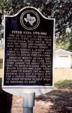
Peter Kerr 1795-1861
In 1851 bought a league and labor of Burnet County land, including site of Fort Croghan.
Amassed wealth as Army beef contractor, gave 100 acres and town square for Burnet County Seat. To build a college here he willed $23,500 and 6,359 acres of land to Burnet. The will was broken; city got a 2-acre site for a public school. It is said "He never refused to help when he observed its need."
Erected 1970 by Texas Historical Commission. (Marker Number 9723.)
Topics. This historical marker is listed in these topic lists: Education • Settlements & Settlers • War, Texas Independence. A significant historical year for this entry is 1836.
Location. 30° 45.045′ N, 98° 17.333′ W. Marker is in Burnet, Texas, in Burnet County. Marker can be reached from Hoovers Valley Road (County Road 116). Marker is on a private ranch road, southwest of Burnet. Touch for map. Marker is in this post office area: Burnet TX 78611, United States of America. Touch for directions.
Other nearby markers. At least 8 other markers are within 4 miles of this marker, measured as the crow flies. Site of Fort Croghan (approx. 3.1 miles away); Magill Family Cemetery (approx. 3.3 miles away); Rocky Rest (approx. 3˝ miles away); Old Cook Home (approx. 3.7 miles away); The Burnet Bulletin (approx. 3.7 miles away); Oldest Commercial Building in Burnet (approx. 3.7 miles away); Burnet County (approx. 3.7 miles away); General Adam R. Johnson (approx. 3.7 miles away). Touch for a list and map of all markers in Burnet.
Credits. This page was last revised on October 20, 2020. It was originally submitted on March 26, 2010, by JoAnn Myers of Burnet, Texas. This page has been viewed 976 times since then and 27 times this year. Photo 1. submitted on March 26, 2010, by JoAnn Myers of Burnet, Texas. • Kevin W. was the editor who published this page.
Editor’s want-list for this marker. A photo of the marker and the surrounding area in context. • An updated clear, close-up photo of the marker. • Can you help?
