Near Newark in New Castle County, Delaware — The American Northeast (Mid-Atlantic)
Arc Corner Monument Stone
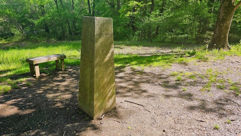
Photographed by Ian Lefkowitz, May 2, 2024
1. Arc Corner Monument Stone Marker
Field work executed by the United States Coast and Geodetic Survey
Pennsylvania
Wayne MacVeach • William H. Miller • R. Emmet Monaghan
Commissioners
Benj. H. Smith
Surveyor
Delaware
Thomas F. Bayard • John H. Hoffecker • B.L. Lewis M.D.
Commissioners
Daniel Farra
Surveyor
Erected 1892 by United States Coast and Geodetic Survey.
Topics. This historical marker is listed in this topic list: Political Subdivisions.
Location. 39° 43.331′ N, 75° 46.428′ W. Marker is near Newark, Delaware, in New Castle County. It can be reached from Hopkins Road 0.7 miles east of New London Road, on the right when traveling east. The marker is located off the highway, along the Tri-State Trail. Touch for map. Marker is at or near this postal address: 520 Hopkins Rd, Newark DE 19711, United States of America. Touch for directions.

Regionally, this marker is in Greater Wilmington and in Greater Philadelphia. It is also in the American Mid-Atlantic, on the Delmarva Peninsula, and on the Eastern Seaboard. Globally, it is in the North Atlantic Region, North America, the
this page online
Other nearby markers. At least 8 other markers are within 3 miles of this marker, measured as the crow flies: The Chambers House (approx. half a mile away); Dorothy P. Miller: Champion of Preservation (approx. half a mile away); a different marker also named The Wedge (approx. 0.7 miles away); Minguannan Indian Town (approx. 1.7 miles away in Pennsylvania); a different marker also named The Wedge (approx. 2.1 miles away); Revolutionary War Patriots in Head of Christiana Cemetery (approx. 2.2 miles away); Head of Christiana Presbyterian Church (approx. 2.2 miles away); Site of Post Mark'd West (approx. 2.2 miles away). Touch for a list and map of all markers in Newark.
Another marker is no longer nearby. The Wedge (was approx. 0.7 miles away but has been replaced with another marker now near it).
Photographed by Ian Lefkowitz, May 2, 2024
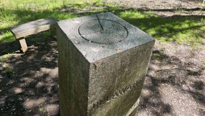
2. Arc Corner Monument Stone
The top of the survey marker includes a diagram of the Delaware wedge. Everything to the west and north of the line is located in Pennsylvania, everything to the east and south is in Delaware.

Photographed by Ian Lefkowitz, May 2, 2024
3. Arc Corner Monument Stone
The side of the monument stone that faces Delaware.

Photographed by Ian Lefkowitz, May 2, 2024
4. Mason - Dixon Trail
A trailblaze indicating the marker's presence on the Tri-State Connector Trail, as well as the Mason-Dixon Trail.

Photographed by Ian Lefkowitz, May 2, 2024
5. Arc Corner Monument Stone Marker
The marker is not directly visible from the road, however the approximate distance is visible in this photo.
Credits. This page was last revised on January 22, 2026. It was originally submitted on January 11, 2026, by Ian Lefkowitz of New York, New York. This page has been viewed 83 times since then. Photos: 1, 2, 3, 4, 5. submitted on January 11, 2026, by Ian Lefkowitz of New York, New York. • Bill Pfingsten was the editor who published this page.
