Paradise in Clark County, Nevada — The American Mountains (Southwest)
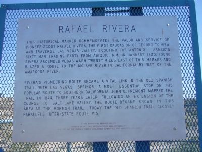
Rafael Rivera
Rivera's pioneering route became a vital link in the Old Spanish Trail, with Las Vegas Springs a most essential stop on this popular route to southern California. John C. Fremont mapped the trail in 1844. Three years later, following an extension of the course to Salt Lake Valley, the route became known in this area as the Mormon Trail. Today the Old Spanish Trail closely parallels inter-state route #15.
Erected by Rafael Rivera Monument Committee and Patriotic Citizens. (Marker Number 214.)
Topics and series. This historical marker is listed in these topic lists: Churches & Religion • Exploration • Roads & Vehicles • Settlements & Settlers. In addition, it is included in the Old Spanish National Trail series list. A significant historical month for this entry is January 1830.
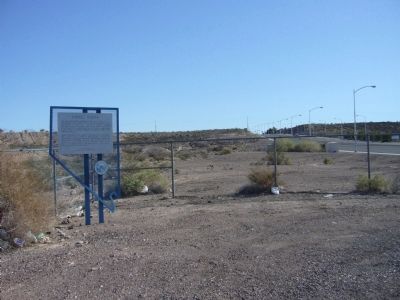
Location. 36° 5.014′ N, 115° 4.364′ W. Marker is in Paradise, Nevada, in Clark County. Marker is on Mountain Vista Street, 0.1 miles south of East Russell Road, on the left when traveling south. Touch for map. Marker is at or near this postal address: 5786 Mountain Vista Street, Las Vegas NV 89120, United States of America. Touch for directions.
Other nearby markers. At least 8 other markers are within 7 miles of this marker, measured as the crow flies. Siegfried & Roy Park (approx. 3.8 miles away); The Little Church of the West (approx. 5.6 miles away); The Welcome To Las Vegas Sign (approx. 5.6 miles away); Green Shack (approx. 5.7 miles away); The "Bugsy Building" (approx. 5.9 miles away); "Bugsy" (approx. 6 miles away); The Shrine of the Four-Faced Brahma (approx. 6.1 miles away); The Red Barn (approx. 6.2 miles away). Touch for a list and map of all markers in Paradise.
Also see . . . New Amended Text for Marker. The Nevada State Historic Preservation Office (SHPO) recently updated the text of the roughly 260 state historical markers in Nevada. The Nevada SHPO placed the amended text of each individual marker on its website and will change the actual markers in the field as funding allows. Minor changes have been made to this marker for grammar, readability, and content. The term Caucasian has been changed to European American. The link will take you to the Nevada SHPO page for the marker with the amended text. (Submitted on October 25, 2013, by Duane Hall of Abilene, Texas.)
Credits. This page was last revised on October 14, 2022. It was originally submitted on March 26, 2010, by Bill Kirchner of Tucson, Arizona. This page has been viewed 3,213 times since then and 63 times this year. Photos: 1, 2. submitted on March 26, 2010, by Bill Kirchner of Tucson, Arizona. • Syd Whittle was the editor who published this page.

