
Rotorua in Rotorua District, Bay of Plenty Region, New Zealand — Southwestern Pacific Ocean
The Croquet Pavilion and sports in the gardens
Photographed by Shaw Zavoshy, January 15, 2026
1. The Croquet Pavilion and sports in the gardens Marker
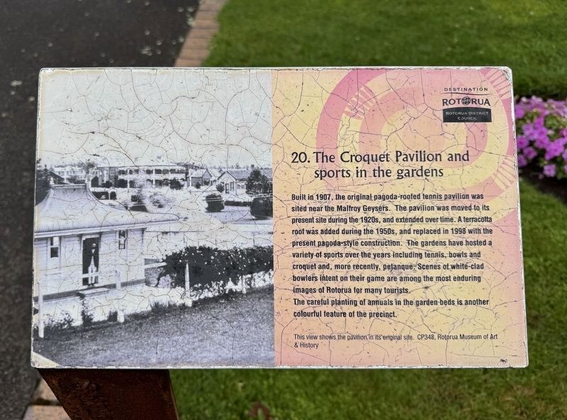
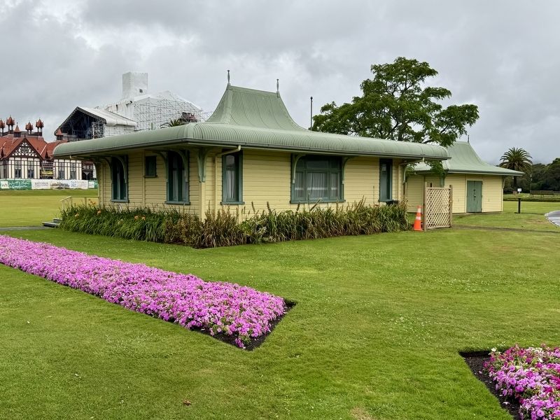
Built in 1907, the original pagoda-roofed tennis pavilion was sited near the Malfroy Geysers. The pavilion was moved to its present site during the 1920s, and extended over time. A terracotta roof was added during the 1950s, and replaced in 1998 with the present pagoda-style construction. The gardens have hosted a variety of sports over the years including tennis, bowls and croquet and, more recently, petanque. Scenes of white-clad bowlers intent on their game are among the most enduring images of Rotorua for many tourists. The careful planting of annuals in the garden beds is another colourful feature of the precinct.
Erected by Rotorua District Council. (Marker Number 20.)
Topics. This historical marker is listed in this topic list: Sports. A significant historical year for this entry is 1907.
Location. 38° 8.099′ S, 176° 15.459′ E. Marker is in Rotorua, Bay of Plenty Region, in Rotorua District. It is on Queens Drive, on the left when traveling west. The marker is next to the sidewalk on Queens Drive. Touch for map. Marker is at or near this postal address: 7 Queens Drive, Rotorua, Bay of Plenty Region
this page online

Regionally, it is in Oceania, in Australasia, in Polynesia, in the Pacific Ocean, on the Ring of Fire, on the Pacific Rim, in the Western World, and in the Anglosphere. Historically, it finds itself in what was once a British colony.
Other nearby markers. At least 8 other markers are within 3 kilometers of this marker, measured as the crow flies: Wylie Memorial (within shouting distance of this marker); Boer War 1899-1902 (within shouting distance of this marker); Prince’s Gate Arches (about 150 meters away, measured in a direct line); Government Gardens (about 150 meters away); Nga Whakairo Tupuna (Ancestral Carvings) at the Hinemoa and Arawa Street entrances to the gardens (about 180 meters away); This stone laid by Te Naera Te Houkotuku (approx. 0.3 kilometers away); Priest & Radium Hot Springs (approx. 0.4 kilometers away); Te Arawa Hāhi Mihinare / Te Arawa Anglican Church (approx. 3 kilometers away). Touch for a list and map of all markers in Rotorua.
Photographed by Shaw Zavoshy, January 15, 2026
2. The Croquet Pavilion
Credits. This page was last revised on January 15, 2026. It was originally submitted on January 15, 2026, by Andrew Ruppenstein of Lamorinda, California. This page has been viewed 49 times since then. Photos: 1, 2. submitted on January 15, 2026, by Andrew Ruppenstein of Lamorinda, California.
