Appomattox in Appomattox County, Virginia — The American South (Mid-Atlantic)
County Jail
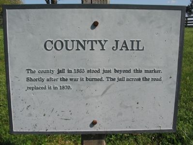
Photographed by Craig Swain, April 18, 2010
1. County Jail Marker
Topics. This historical marker is listed in this topic list: Government & Politics. A significant historical year for this entry is 1865.
Location. Marker is missing. It was located near 37° 22.655′ N, 78° 47.725′ W. Marker was in Appomattox, Virginia, in Appomattox County. It could be reached from Richmond Lynchburg Stage Lane west of Bocock Drive, on the right when traveling west. Marker is located in Appomattox Court House National Historical Park along the Richmond-Lynchburg Stage Road, which is now a walking path. Touch for map. Marker was at or near this postal address: 233 Richmond Lynchburg Stage Ln, Appomattox VA 24522, United States of America. Touch for directions.

Regionally, this marker was in the Piedmont and in Central Virginia. It was also in the American South and specifically in the Upper South. Globally, it was in North America, the Western Hemisphere, the Western World, and the Anglosphere. Historically, it found itself in what was once the territory of the
this page online
Other nearby markers. At least 8 other markers are within walking distance of this location: Clover Hill Tavern (within shouting distance of this marker); Clover Hill Tavern Slave Quarters (about 300 feet away, measured in a direct line); The Isbell House (about 400 feet away); a different marker also named The Isbell House (about 500 feet away); Anticipating Freedom (about 500 feet away); McLean House (about 500 feet away); Uncovering History (about 500 feet away); The Kelley Family (about 500 feet away). Touch for a list and map of all markers in Appomattox.
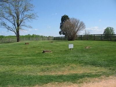
Photographed by Craig Swain, April 18, 2010
2. County Jail Marker and Foundation of Old Jail

Photographed by Evan Dwyer, December 20, 2025
3. County Jail Foundation Corners
With marker removed. The visible corners are reconstructed brick pillars to mark the location of the original jailhouse above ground.

Photographed by Tom Bosse, July 4, 2026
4. County Jail
This is the building that replaced the subject jail, which stood across the turnpike to the right of the frame.
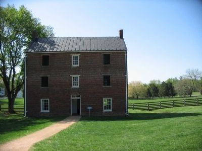
Photographed by Craig Swain, April 18, 2010
5. The 1870 Jail
Built to replace the original jail.
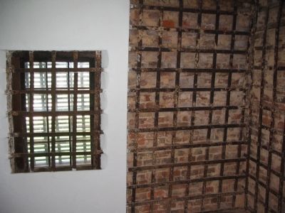
Photographed by Craig Swain, April 18, 2010
6. Interior of the 1870 Jail
The jail wall included a substantial amount of iron bars in the wall, between the bricks and plaster. This prevented prisoners from chiseling an escape hole.
Credits. This page was last revised on August 4, 2026. It was originally submitted on April 25, 2010, by Craig Swain of Leesburg, Virginia. This page has been viewed 1,162 times since then and 115 times this year. Last updated on January 16, 2026, by Evan Dwyer of Richmond, Virginia. Photos: 1, 2. submitted on April 25, 2010, by Craig Swain of Leesburg, Virginia. 3. submitted on January 16, 2026, by Evan Dwyer of Richmond, Virginia. 4. submitted on July 27, 2026, by Tom Bosse of Jefferson City, Tennessee. 5, 6. submitted on April 25, 2010, by Craig Swain of Leesburg, Virginia. • Bernard Fisher was the editor who published this page.
