San Mateo in San Mateo County, California — The American West (Pacific Coastal)
Central Park Veterans Memorial - Screaming Eagles Grove
Photographed by Syd Whittle, March 15, 2010
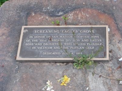
1. Central Park Veterans Memorial - Screaming Eagles Grove Marker
In honor of San Mateos adopted sons of the 101st. Airborne Division and native sons and daughters who served proudly in Vietnam and the Persian Gulf.
Erected 1991.
Topics. This memorial is listed in these topic lists: War, 1st Iraq & Desert Storm • War, Vietnam.
Location. 37° 33.687′ N, 122° 19.31′ W. Memorial is in San Mateo, California, in San Mateo County. It can be reached from South El Camino Real (State Highway 82). Marker is located at Central Park which is bordered by El Camino Real, East 5th Avenue, Laurel Avenue and 9th Avenue. Touch for map. Memorial is at or near this postal address: 3050 East 5th Avenue, San Mateo CA 94401, United States of America. Touch for directions.

Regionally, this memorial is in the San Francisco Bay Area and on the Coast Ranges. It is also on the American Pacific Coast. Globally, it is in North America, on the Ring of Fire, on the Pacific Rim, in the Western Hemisphere, in the Western World, and in the Anglosphere. Historically, it finds itself in what was once New Spain and also Mexico’s Alta California.
this page online
Other nearby markers. At least 8 other markers are within walking distance of this marker: Central Park Veterans Memorial (within shouting distance of this marker); Central Park Veterans Memorial – Japanese American Combat Team (within shouting distance of this marker); Central Park Veterans Memorial – World War I (within shouting distance of this marker); a different marker also named Central Park Veterans Memorial (within shouting distance of this marker); Central Park and The Kohl Pumphouse (about 300 feet away, measured in a direct line); First Business Structure (approx. 0.3 miles away); Morse’s Corners (approx. 0.4 miles away); Historic Camp Site (approx. 0.4 miles away). Touch for a list and map of all markers in San Mateo.
Photographed by Syd Whittle, March 15, 2010
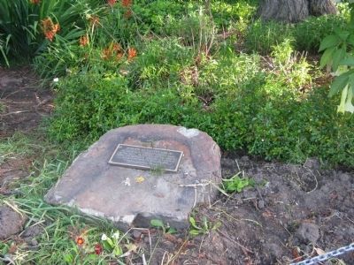
2. Screaming Eagles Grove Marker

Photographed by Syd Whittle, March 15, 2010
3. Screaming Eagles Grove
Credits. This page was last revised on June 16, 2016. It was originally submitted on March 27, 2010, by Syd Whittle of Mesa, Arizona. This page has been viewed 1,255 times since then and 18 times this year. Photos: 1, 2, 3. submitted on March 27, 2010, by Syd Whittle of Mesa, Arizona.
