
Toledo in Lewis County, Washington — The American West (Northwest)
Washington Territory Was Created August 29, 1851

Photographed by Shirley A Stirling, September 29, 2024
1. The creation of Washington Territory.
Erected 1922 by Washington State Historical Society.
Topics. This historical marker is listed in this topic list: Government & Politics. A significant historical date for this entry is August 29, 1853.
Location. 46° 26.324′ N, 122° 50.718′ W. Marker is in Toledo, Washington, in Lewis County. It is at the intersection of Cowlitz Street (State Road 505) and Front Street, on the left when traveling east on Cowlitz Street. Touch for map. Marker is at or near this postal address: 100 Front St, Toledo WA 98591, United States of America. Touch for directions.

Regionally, this marker is in Southwest Washington State. It is also on the American Pacific Coast, in the Pacific Northwest, and in the Lewis & Clark Corridor. Globally, it is in North America, in the Cascade Range, on the Ring of Fire, in the Pacific Rim, in the Western Hemisphere, in the Western World, and in the Anglosphere.
Other nearby markers. At least 8 other
this page online
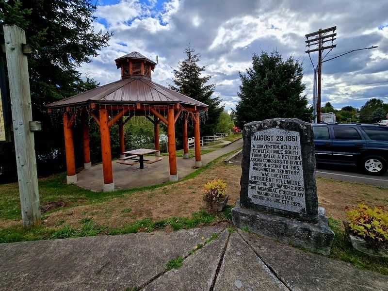
Photographed by Shirley A Stirling, September 29, 2024
2. The marker is near a gazebo.
Credits. This page was last revised on January 19, 2026. It was originally submitted on January 18, 2026, by Shirley A Stirling of Lacey, Washington. This page has been viewed 65 times since then. Photos: 1, 2. submitted on January 18, 2026, by Shirley A Stirling of Lacey, Washington. • James Hulse was the editor who published this page.
