
Terry Sanford in Fayetteville in Cumberland County, North Carolina — The American South (South Atlantic)
Liberty Row
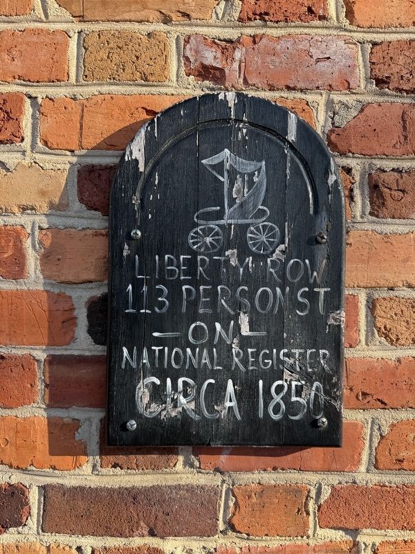
113 Person St
on
National Register
Circa 1850
Topics. This historical marker is listed in these topic lists: Architecture • Industry & Commerce. A significant historical year for this entry is 1850.
Location. 35° 3.145′ N, 78° 52.649′ W. Marker is in Fayetteville, North Carolina, in Cumberland County. It is in Terry Sanford. It is on Person Street. Touch for map. Marker is at or near this postal address: 115 Person St, Fayetteville NC 28301, United States of America. Touch for directions.

Regionally, this marker is in North Carolina’s Coastal Plain. It is also in the American South and specifically in the Upper South. Globally, it is in North America, the Western Hemisphere, the Western World, and the Anglosphere. Historically, it finds itself in what was once the territory of the Mississippian Culture, one of the original Thirteen Colonies, one of the Confederate States of America, and the Antebellum South.
Other nearby markers. At least 8 other markers are within walking distance of this marker: Fayetteville’s 250th Anniversary (within shouting distance of this marker); The Market House
this page online
Also see . . . National Register of Historic Places nomination form for Liberty Row.
This form was prepared on June 21, 1973 by the Survey and Planning Unit of the North Carolina Office of Archives and History. A statement of historical significance can be found on page 4:
Liberty Row, a reminder of Fayetteville's importance as an early trace center, is one of the most cohesive nineteenth century commercial rows in North Carolina, with examples of vernacular Federal, Italianate and Romanesque Revival styles. The earliest is Liberty Point Store, a handsome Federal period structure and a Fayetteville landmark. Of considerable historical significance is the point itself, a vestige of early street patternsand the site of the Liberty Point Resolves of June 20, 1775.Photographed by Devry Becker Jones (CC0), January 15, 20262. 113 Person Street, which houses the Archway Restaurant as of January 2026

In particular, the building at 113 Person Street is singled out a few times in the text. On page 2:
"...[B]uildings in the row share party walls, and... are two stories tall. Five of these buildings (...[including] 113-115... Person Street) appear to have been built in the mid-nineteenth century, and are similar in form to the Liberty Point Store with parapeted gable roofs and six-over-six sash rows.
Additionally on page 7:
A building, number 113-115 Person Street, was constructed in the neck of its alley in the mid-nineteenth century. An open passageway was left, however, through the first-story east half of the building. The remainder of the brick arch which spanned the rear half of the building, forming the rear entrance, is visible within the northeast rear bay. This passageway is now blocked off and used as commercial space. It appears that the passageway preserved the practical mid-row access from Person Street to Bow Street (for pedestrian traffic, although not for street traffic as was originally possible).(Submitted on January 19, 2026, by Devry Becker Jones of Washington, District of Columbia.)
Credits. This page was last revised on January 19, 2026. It was originally submitted on January 19, 2026, by Devry Becker Jones of Washington, District of Columbia. This page has been viewed 29 times since then. Photos: 1, 2. submitted on January 19, 2026, by Devry Becker Jones of Washington, District of Columbia.
